
Prognoza pogody na 5 dni Los Angeles 8 paź 2026

33°26° · Słonecznie

Prognoza pogody Los Angeles czwartek 8 paź 2026: słonecznie, temperatura od 26 °C do 33 °C.

Prawdopodobieństwo opadów 3%. Wiatr do 5.11 m/s (porywy 10 m/s). Wilgotność powietrza 28–56%, ciśnienie atmosferyczne 756–758 mm Hg, indeks UV do 7.2.

Ostrzeżenia pogodowe

Severe4 paź, 21:10 — 5 paź, 06:15Przetłumacz przez Google
Extreme Heat Warning issued October 4 at 9:10PM PDT until October 8 at 8:00PM PDT by NWS San Diego CA

Extreme Heat Warning

* WHAT...Dangerously hot conditions with high temperatures ranging from the mid 80s to mid 90s at the beaches to the upper 90s for the inland coastal areas and warm nights with lows in the 70s. * WHERE...Orange County Coastal Areas. * WHEN...Until 8 PM PDT Thursday. * IMPACTS...Heat related illnesses increase significantly during extreme heat events.
Drink plenty of fluids, stay in an air-conditioned room, stay out of the sun, and check up on relatives and neighbors. Do not leave young children and pets in unattended vehicles. Car interiors will reach lethal temperatures in a matter of minutes.
Severe4 paź, 21:10 — 5 paź, 06:15Przetłumacz przez Google
Extreme Heat Warning issued October 4 at 9:10PM PDT until October 8 at 8:00PM PDT by NWS San Diego CA

Extreme Heat Warning

* WHAT...Dangerously hot conditions with high temperatures 90 to 100 and warm nights with lows in the low to mid 70s. * WHERE...Santa Ana Mountains and Foothills. * WHEN...Until 8 PM PDT Thursday. * IMPACTS...Heat related illnesses increase significantly during extreme heat events.
Drink plenty of fluids, stay in an air-conditioned room, stay out of the sun, and check up on relatives and neighbors. Do not leave young children and pets in unattended vehicles. Car interiors will reach lethal temperatures in a matter of minutes.
Severe4 paź, 21:10 — 5 paź, 06:15Przetłumacz przez Google
Extreme Heat Warning issued October 4 at 9:10PM PDT until October 8 at 8:00PM PDT by NWS San Diego CA

Extreme Heat Warning

* WHAT...Dangerously hot conditions with high temperatures in the mid 90s to 103 and warm nights with low temperatures in the 70s. * WHERE...Orange County Inland Areas. * WHEN...Until 8 PM PDT Thursday. * IMPACTS...Heat related illnesses increase significantly during extreme heat events.
Drink plenty of fluids, stay in an air-conditioned room, stay out of the sun, and check up on relatives and neighbors. Do not leave young children and pets in unattended vehicles. Car interiors will reach lethal temperatures in a matter of minutes.
Severe5 paź, 03:19 — 5 paź, 15:45Przetłumacz przez Google
Extreme Heat Warning issued October 5 at 3:19AM PDT until October 8 at 8:00PM PDT by NWS San Diego CA

Extreme Heat Warning

* WHAT...Dangerously hot conditions with high temperatures in the upper 90s to 103. Nights will be very warm with low temperatures in the lower to mid 70s. * WHERE...Orange County Inland Areas. * WHEN...Until 8 PM PDT Thursday. * IMPACTS...Heat related illnesses increase significantly during extreme heat events.
Drink plenty of fluids, stay in an air-conditioned room, stay out of the sun, and check up on relatives and neighbors. Do not leave young children and pets in unattended vehicles. Car interiors will reach lethal temperatures in a matter of minutes.
Severe5 paź, 03:19 — 5 paź, 15:45Przetłumacz przez Google
Extreme Heat Warning issued October 5 at 3:19AM PDT until October 8 at 8:00PM PDT by NWS San Diego CA

Extreme Heat Warning

* WHAT...Dangerously hot conditions with high temperatures 90s. Nights will be very warm with low temperatures in the upper 60s to mid 70s. * WHERE...Santa Ana Mountains and Foothills. * WHEN...Until 8 PM PDT Thursday. * IMPACTS...Heat related illnesses increase significantly during extreme heat events.
Drink plenty of fluids, stay in an air-conditioned room, stay out of the sun, and check up on relatives and neighbors. Do not leave young children and pets in unattended vehicles. Car interiors will reach lethal temperatures in a matter of minutes.
5 dni w skrócie — dotknij dnia, aby go otworzyć
Wschód słońca 06:52
Zachód słońca 18:28
Ubywający sierp4% oświetlenia
Wschód księżyca 04:36 · Zachód księżyca 17:14
Wykres
Tabela

Prognoza od 26 °C do 33 °C i opady

Temperatura & Opady
Czas00:0001:0002:0003:0004:0005:0006:0007:0008:0009:0010:0011:0012:0013:0014:0015:0016:0017:0018:0019:0020:0021:0022:0023:00
Temperatura (°C)272727262626262626272930323333323030292827272626
Opady (mm/godz.)000000000000000000000000

Zachmurzenie i prawdopodobieństwo opadów

Zachmurzenie & Szansa na deszcz
Czas00:0001:0002:0003:0004:0005:0006:0007:0008:0009:0010:0011:0012:0013:0014:0015:0016:0017:0018:0019:0020:0021:0022:0023:00
Zachmurzenie (%)000000000000000000000010
Szansa na deszcz (%)222222232211000011111122

Prędkość i kierunek wiatru

Wiatr & Porywy wiatru
Czas00:0001:0002:0003:0004:0005:0006:0007:0008:0009:0010:0011:0012:0013:0014:0015:0016:0017:0018:0019:0020:0021:0022:0023:00
Wiatr (m/s)1.1910.811.111.111.111.311.311.1910.891.392.193.314.555.114.313.613.192.812.392.111.89
Porywy wiatru (m/s)1.2243.814.116.111.111.391.426.1943.894.397.196.317.5108.114.694.113.3936.396.116.89
Kierunek wiatru (°)S 191°SSW 204°SSW 198°SSW 213°SW 233°WSW 249°SW 232°SW 221°SW 217°SSW 208°SSW 203°SW 215°SW 223°SW 230°WSW 237°WSW 243°WSW 248°WSW 242°WSW 237°SW 228°SW 227°SW 226°SW 222°SW 226°

Wilgotność powietrza

Wilgotność
Czas00:0001:0002:0003:0004:0005:0006:0007:0008:0009:0010:0011:0012:0013:0014:0015:0016:0017:0018:0019:0020:0021:0022:0023:00
Wilgotność (%)515353535454555655504437312828313436384244474950

Ciśnienie atmosferyczne

Ciśnienie
Czas00:0001:0002:0003:0004:0005:0006:0007:0008:0009:0010:0011:0012:0013:0014:0015:0016:0017:0018:0019:0020:0021:0022:0023:00
Ciśnienie (mm Hg)757757757757757757757757758758758758758757756756756756756756757757758758

Indeks ultrafioletowy

Indeks UV
Czas00:0001:0002:0003:0004:0005:0006:0007:0008:0009:0010:0011:0012:0013:0014:0015:0016:0017:0018:0019:0020:0021:0022:0023:00
Indeks UV000000000.31.335.16.77.26.44.62.50.90.200000

Jakość powietrza i pyłki

Dane o jakości powietrza są dostępne tylko przez pierwsze trzy dni.

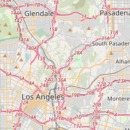
Los Angeles na mapie
Źródła danych i metodologia

Nasze prognozy pogody są zasilane przez profesjonalnego dostawcę danych pogodowych, który agreguje dane z krajowych służb meteorologicznych, obserwacji satelitarnych, sieci radarowych i ponad 80 000 stacji meteorologicznych na całym świecie. Dane prognostyczne są aktualizowane wielokrotnie w ciągu dnia. Przetwarzamy surowe dane na czytelne podsumowania — prędkość wiatru w m/s, ciśnienie w mm Hg — abyście Państwo mogli planować dzień z pewnością.