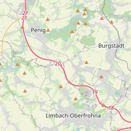
Prognoza pogody na 5 dni Limbach-Oberfrohna 19-08-2026

Prognoza pogody Limbach-Oberfrohna środa, 19 sierpnia 19.08.2026: zamieć śnieżna, temperatura od -2 °C do -1 °C.

Prawdopodobieństwo opadów 56%. Wiatr do 16 m/s (porywy 20.72 m/s). Wilgotność powietrza 64–98%, ciśnienie atmosferyczne 743–747 mm Hg, indeks UV do 3.9.

Ostrzeżenia pogodowe

Ukryj ostrzeżenia
Moderate16 sie, 11:0218 sie, 17:00Przetłumacz przez Google
Moderate Fire Impact
Risk of fires due to prolonged drought. Possible occurrence of severe fire with subsequent damage. Possible damage to ecosystems, property, forestry, agriculture, etc. Risk of human injury. Deterioration of air quality causing respiratory problems and other health issues.
Do not light fires outdoors, do not burn grass, do not smoke or discard cigarette butts on the ground. Do not use portable stoves or other open flame sources. Follow local bans issued due to drought and fire risk. Stay alert when using agricultural machinery and near railway tracks where sparks from wheels and brakes can ignite vegetation.
Moderate16 sie, 11:0218 sie, 17:00Przetłumacz przez Google
Moderate Fire Impact
Risk of fires due to prolonged drought. Possible occurrence of severe fire with subsequent damage. Possible damage to ecosystems, property, forestry, agriculture, etc. Risk of human injury. Deterioration of air quality causing respiratory problems and other health issues.
Do not light fires outdoors, do not burn grass, do not smoke or discard cigarette butts on the ground. Do not use portable stoves or other open flame sources. Follow local bans issued due to drought and fire risk. Stay alert when using agricultural machinery and near railway tracks where sparks from wheels and brakes can ignite vegetation.
Moderate16 sie, 11:0218 sie, 17:00Przetłumacz przez Google
Moderate Fire Impact
Risk of fires due to prolonged drought. Possible occurrence of severe fire with subsequent damage. Possible damage to ecosystems, property, forestry, agriculture, etc. Risk of human injury. Deterioration of air quality causing respiratory problems and other health issues.
Do not light fires outdoors, do not burn grass, do not smoke or discard cigarette butts on the ground. Do not use portable stoves or other open flame sources. Follow local bans issued due to drought and fire risk. Stay alert when using agricultural machinery and near railway tracks where sparks from wheels and brakes can ignite vegetation.
Moderate16 sie, 11:0217 sie, 20:59Przetłumacz przez Google
Moderate Thunderstorm Impact
Risk of severe thunderstorms. Possible local property damage and complications, especially in the energy industry and transport. Potential for local flooding, especially of low-lying areas. Local wind damage to roofs, fences, soft shelters and trees. Local power outages. Some travel delays. Driving conditions difficult. Possible crop damage from small hail. Risk of fire caused by lightning strike. Risk of injury from flying or falling objects, and lightning strikes.
Beware of lightning strikes and flying or falling objects (especially branches). Seek shelter in a building equipped with lightning protection. Outdoors, take cover in dense forest or low vegetation; avoid water bodies, hilltops, metal structures, isolated trees, and rock overhangs. When driving reduce speed. Observe weather warnings, weather radar (www.chmi.cz or mobile apps) and local flood risk https://produkty.chmi.cz/ffi.
Moderate16 sie, 11:0217 sie, 20:59Przetłumacz przez Google
Moderate Thunderstorm Impact
Risk of severe thunderstorms. Possible local property damage and complications, especially in the energy industry and transport. Potential for local flooding, especially of low-lying areas. Local wind damage to roofs, fences, soft shelters and trees. Local power outages. Some travel delays. Driving conditions difficult. Possible crop damage from small hail. Risk of fire caused by lightning strike. Risk of injury from flying or falling objects, and lightning strikes.
Beware of lightning strikes and flying or falling objects (especially branches). Seek shelter in a building equipped with lightning protection. Outdoors, take cover in dense forest or low vegetation; avoid water bodies, hilltops, metal structures, isolated trees, and rock overhangs. When driving reduce speed. Observe weather warnings, weather radar (www.chmi.cz or mobile apps) and local flood risk https://produkty.chmi.cz/ffi.
5 dni w skrócie — dotknij dnia, aby go otworzyć
Wschód słońca 06:02
Zachód słońca 20:22
Pierwsza kwadra48% oświetlenia
Wschód księżyca 14:44 · Zachód księżyca 22:31
Wykres
Tabela

Prognoza od -2 °C do -1 °C i opady

Temperatura & Opady
Czas00:0001:0002:0003:0004:0005:0006:0007:0008:0009:0010:0011:0012:0013:0014:0015:0016:0017:0018:0019:0020:0021:0022:0023:00
Temperatura (°C)-2-2-2-2-2-2-2-2-2-2-2-2-2-1-1-1-1-1-1-1-1-1-1-1
Opady (mm/godz.)00.08000.010.030.040.040.030.050.080.080.0500.050.040.010.040.10.060.120.150.110.14

Zachmurzenie i prawdopodobieństwo opadów

Zachmurzenie & Szansa na deszcz
Czas00:0001:0002:0003:0004:0005:0006:0007:0008:0009:0010:0011:0012:0013:0014:0015:0016:0017:0018:0019:0020:0021:0022:0023:00
Zachmurzenie (%)10010096100100100100100100100100100100100100100100100100100100100100100
Szansa na deszcz (%)182517172224242525263233292131313041534453565455

Prędkość i kierunek wiatru

Wiatr & Porywy wiatru
Czas00:0001:0002:0003:0004:0005:0006:0007:0008:0009:0010:0011:0012:0013:0014:0015:0016:0017:0018:0019:0020:0021:0022:0023:00
Wiatr (m/s)677.57.817.818.118.599.59.6110.511.1911.1910.8911.1111.6112.1912.1112.6113.3913.8115.1915.516
Porywy wiatru (m/s)7.617.928.58.899.039.6410.2210.8311.8112.3113.0313.8914.3314.6114.9215.3915.7215.6919.3918.1118.532020.7220.72
Kierunek wiatru (°)SW 232°SW 226°SW 221°SW 224°SW 223°SW 230°SW 234°WSW 240°WSW 244°WSW 252°W 260°W 264°W 268°W 274°W 281°WNW 285°WNW 291°WNW 302°NW 311°WNW 291°WNW 294°WNW 292°WNW 291°WNW 287°

Wilgotność powietrza

Wilgotność
Czas00:0001:0002:0003:0004:0005:0006:0007:0008:0009:0010:0011:0012:0013:0014:0015:0016:0017:0018:0019:0020:0021:0022:0023:00
Wilgotność (%)676466646564656568666870737475777992989496979797

Ciśnienie atmosferyczne

Ciśnienie
Czas00:0001:0002:0003:0004:0005:0006:0007:0008:0009:0010:0011:0012:0013:0014:0015:0016:0017:0018:0019:0020:0021:0022:0023:00
Ciśnienie (mm Hg)743743743744744744745746746746746747747747747747746746745745745745744744

Indeks ultrafioletowy

Indeks UV
Czas00:0001:0002:0003:0004:0005:0006:0007:0008:0009:0010:0011:0012:0013:0014:0015:0016:0017:0018:0019:0020:0021:0022:0023:00
Indeks UV00000000.20.61.11.93.92.30.40.50.91.20.10.10.10000

Jakość powietrza i pyłki

Jakość powietrza
Czas00:0001:0002:0003:0004:0005:0006:0007:0008:0009:0010:0011:0012:0013:0014:0015:0016:0017:0018:0019:0020:0021:0022:0023:00
PM2.5 (µg/m³)66.36.87.26.95.95.35.14.53.73.23.33.33.43.73.94.13.83.73.73.43.33.23.1
PM10 (µg/m³)7.98.68.88.68.17.77.35.85.75.44.74.24.14.24.34.74.84.74.74.84.44.64.95
Ozon (O₃) (µg/m³)757675736967636061595858596264676971696966636565
NO₂ (µg/m³)3.33.12.92.92.82.83.445.15.24.94.74.34.143.844.25.16.26.75.95.55.2
SO₂ (µg/m³)0.70.70.70.70.70.60.50.60.60.50.50.50.50.50.50.50.50.50.60.60.60.60.60.5
CO (µg/m³)154156158157156153151149151149148146145147149150153159160163163161160160

Limbach-Oberfrohna na mapie

Źródła danych i metodologia

Nasze prognozy pogody są zasilane przez profesjonalnego dostawcę danych pogodowych, który agreguje dane z krajowych służb meteorologicznych, obserwacji satelitarnych, sieci radarowych i ponad 80 000 stacji meteorologicznych na całym świecie. Dane prognostyczne są aktualizowane wielokrotnie w ciągu dnia. Przetwarzamy surowe dane na czytelne podsumowania — prędkość wiatru w m/s, ciśnienie w mm Hg — abyście Państwo mogli planować dzień z pewnością.