Prognoza pogody na 5 dni Grožnjan 26-07-2026

Prognoza pogody Grožnjan niedziela, 26 lipca 26.07.2026: słonecznie, temperatura od 19 °C do 28 °C.

Prawdopodobieństwo opadów 88%. Wiatr do 9.31 m/s (porywy 16.53 m/s). Wilgotność powietrza 62–88%, ciśnienie atmosferyczne 756–759 mm Hg, indeks UV do 7.

Ostrzeżenia pogodowe

Ukryj ostrzeżenia
Severe23 lip, 07:3127 lip, 00:59Przetłumacz przez Google
Severe Forestfire danger Warning (Degree 3/4) - Slovenia / South-West

Severe Forestfire danger Warning

There is a large risk of forest and bush fire.
Stay vigilant and be prepared there is a large risk of forest and bush fire. Immediately react to any developing fire. The public are asked to exercise extreme caution in the countryside, and immediately notify emergency services on any fire.
Moderate24 lip, 07:5025 lip, 10:00Przetłumacz przez Google
Yellow wind warning
Locally fresh NE wind. Maximum wind gusts 35-40 knots (65-75 km/h)
IMPACT: Although rather usual in this region, locally or potentially dangerous wind speeds are expected to produce dangerous wave conditions to small crafts. Inexperienced mariners, especially those operating smaller vessels, should avoid navigating in these conditions. Mariners should pay close attention to the marine forecast and consider wind and sea conditions in planning. It is possible that some ferry lines will not operate so follow traffic information if travelling.
Moderate24 lip, 07:5025 lip, 09:00Przetłumacz przez Google
Yellow wind warning
Locally fresh NE wind. Maximum wind gusts 35-40 knots (65-75 km/h)
IMPACT: Although rather usual in this region, locally or potentially dangerous wind speeds are expected to produce dangerous wave conditions to small crafts. Inexperienced mariners, especially those operating smaller vessels, should avoid navigating in these conditions. Mariners should pay close attention to the marine forecast and consider wind and sea conditions in planning. It is possible that some ferry lines will not operate so follow traffic information if travelling.
Moderate24 lip, 07:4924 lip, 23:59Przetłumacz przez Google
Yellow wind warning
Locally strong NE wind. Maximum wind gusts 35-50 knots (65-95 km/h)
IMPACT: Although rather usual in this region, locally or potentially dangerous wind speeds are expected to produce dangerous wave conditions to small crafts. Inexperienced mariners, especially those operating smaller vessels, should avoid navigating in these conditions. Mariners should pay close attention to the marine forecast and consider wind and sea conditions in planning. It is possible that some ferry lines will not operate so follow traffic information if travelling.
Moderate24 lip, 07:4924 lip, 23:59Przetłumacz przez Google
Yellow wind warning
Locally fresh and strong NE wind. Maximum wind gusts 35-50 knots (65-95 km/h)
IMPACT: Although rather usual in this region, locally or potentially dangerous wind speeds are expected to produce dangerous wave conditions to small crafts. Inexperienced mariners, especially those operating smaller vessels, should avoid navigating in these conditions. Mariners should pay close attention to the marine forecast and consider wind and sea conditions in planning. It is possible that some ferry lines will not operate so follow traffic information if travelling.
Wschód słońca 05:42
Zachód słońca 20:40
Przybywający garb95% oświetlenia
Wschód księżyca 19:20 · Zachód księżyca 02:24
Wykres
Tabela

Prognoza od 19 °C do 28 °C i opady

Temperatura & Opady
Czas00:0001:0002:0003:0004:0005:0006:0007:0008:0009:0010:0011:0012:0013:0014:0015:0016:0017:0018:0019:0020:0021:0022:0023:00
Temperatura (°C)202020192020202124262727272728272727272524222120
Opady (mm/godz.)000.02000000000000.070.10.140.140.3102.917.053.52.03

Zachmurzenie i prawdopodobieństwo opadów

Zachmurzenie & Szansa na deszcz
Czas00:0001:0002:0003:0004:0005:0006:0007:0008:0009:0010:0011:0012:0013:0014:0015:0016:0017:0018:0019:0020:0021:0022:0023:00
Zachmurzenie (%)6681667655981314689717673851668906680
Szansa na deszcz (%)54145556765455419182122361074887873

Prędkość i kierunek wiatru

Wiatr & Porywy wiatru
Czas00:0001:0002:0003:0004:0005:0006:0007:0008:0009:0010:0011:0012:0013:0014:0015:0016:0017:0018:0019:0020:0021:0022:0023:00
Wiatr (m/s)3.613.313.193.53.614.695.55.615.894.8156.8987.587.117.55.814.318.118.899.314.814.61
Porywy wiatru (m/s)7.316.536.447.116.978.9410.179.177.835.865.757.949.198.649.198.178.727.425.5311.2512.6916.539.228.86
Kierunek wiatru (°)ESE 108°E 97°E 90°E 95°ESE 104°E 96°ESE 104°ESE 122°SE 136°SSE 157°S 182°S 180°S 175°S 174°S 174°S 170°SSE 167°SSE 160°SSE 162°SSE 151°SSE 166°SSW 207°SE 144°ESE 107°

Wilgotność powietrza

Wilgotność
Czas00:0001:0002:0003:0004:0005:0006:0007:0008:0009:0010:0011:0012:0013:0014:0015:0016:0017:0018:0019:0020:0021:0022:0023:00
Wilgotność (%)666464656567707271676364636264656770677983888786

Ciśnienie atmosferyczne

Ciśnienie
Czas00:0001:0002:0003:0004:0005:0006:0007:0008:0009:0010:0011:0012:0013:0014:0015:0016:0017:0018:0019:0020:0021:0022:0023:00
Ciśnienie (mm Hg)758758758758758758758758758758758758758758758757757757756756758758758759

Indeks ultrafioletowy

Indeks UV
Czas00:0001:0002:0003:0004:0005:0006:0007:0008:0009:0010:0011:0012:0013:0014:0015:0016:0017:0018:0019:0020:0021:0022:0023:00
Indeks UV00000000.30.92.13.75.36.576.45.43.82.310.40000

Jakość powietrza i pyłki

Jakość powietrza
Czas00:0001:0002:0003:0004:0005:0006:0007:0008:0009:0010:0011:0012:0013:0014:0015:0016:0017:0018:0019:0020:0021:0022:0023:00
PM2.5 (µg/m³)4.54.34.44.24.14.13.844.34.14.24.44.74.74.44.95.14.84.43.944.24.54.3
PM10 (µg/m³)8.48.17.87.97.97.47.78.38.68.58.89.19910.41010.398.78.28.58.57.18.1
Ozon (O₃) (µg/m³)788081828281838785868990919293979898969796939087
NO₂ (µg/m³)2.21.91.81.71.61.51.51.41.31.110.90.90.70.70.70.70.70.81.11.41.61.81.9
SO₂ (µg/m³)0.20.20.20.20.20.20.20.20.20.20.20.20.20.20.20.20.10.10.10.10.10.10.10.1
CO (µg/m³)121121121121122122122123123122122122123120121122123123124123125128126128

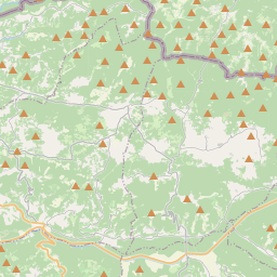
Grožnjan na mapie

Źródła danych i metodologia

Nasze prognozy pogody są zasilane przez profesjonalnego dostawcę danych pogodowych, który agreguje dane z krajowych służb meteorologicznych, obserwacji satelitarnych, sieci radarowych i ponad 80 000 stacji meteorologicznych na całym świecie. Dane prognostyczne są aktualizowane wielokrotnie w ciągu dnia. Przetwarzamy surowe dane na czytelne podsumowania — prędkość wiatru w m/s, ciśnienie w mm Hg — abyście Państwo mogli planować dzień z pewnością.