
Prognoza pogody na 5 dni Niagara Falls 13 paź 2026
 20°
20°Prognoza pogody Niagara Falls dziś 13 paź 2026: słonecznie, temperatura od 18 °C do 25 °C.
Prawdopodobieństwo opadów 54%. Wiatr do 8.81 m/s (porywy 16.33 m/s). Wilgotność powietrza 54–86%, ciśnienie atmosferyczne 755–758 mm Hg, indeks UV do 4.4.
Ostrzeżenia pogodowe
squall warning in effect
squall
Squalls with wind gusts up to 35 knots, frequent lightning and hail of 1 to 2 centimetres are expected or occurring in the area.
###
Please continue to monitor alerts and forecasts issued by Environment Canada. For more information monitor Canadian Coast Guard radio or Weatheradio stations.
5 dni w skrócie — dotknij dnia, aby go otworzyć
Wschód słońca 07:27
Zachód słońca 18:37
Zachód słońca 18:37
Przybywający sierp11% oświetlenia
Wschód księżyca 11:06 · Zachód księżyca 19:55
Wschód księżyca 11:06 · Zachód księżyca 19:55
Wykres
Tabela
wt., 13 paź 2026
| Czas | Pogoda | Temperatura | Szansa na deszcz | Zachmurzenie | Wilgotność | Ciśnienie | Wiatr | Indeks UV |
|---|---|---|---|---|---|---|---|---|
| 00:00 | Bezchmurnie | 19 °C | 8% | 3% | 76% | 758 mm Hg | SW 220° 5.39 (14.81) m/s | 0 |
| 01:00 | Bezchmurnie | 19 °C | 8% | 5% | 78% | 758 mm Hg | SW 220° 5.39 (14.61) m/s | 0 |
| 02:00 |  Całkowite zachmurzenie | 19 °C | 22% | 100% | 78% | 758 mm Hg | SW 217° 5.19 (14.33) m/s | 0 |
| 03:00 |  Możliwy przelotny deszcz | 19 °C | 26% (0.05 mm/godz.) | 98% | 78% | 757 mm Hg | SW 219° 5.19 (14.19) m/s | 0 |
| 04:00 |  Lekki przelotny deszcz | 18 °C | 36% (0.16 mm/godz.) | 96% | 81% | 757 mm Hg | SW 216° 5.11 (13.92) m/s | 0 |
| 05:00 | Możliwy przelotny deszcz | 18 °C | 39% (0.14 mm/godz.) | 100% | 86% | 757 mm Hg | SW 222° 4.11 (13.81) m/s | 0 |
| 06:00 | Możliwy przelotny deszcz | 18 °C | 38% (0.14 mm/godz.) | 100% | 83% | 757 mm Hg | SW 221° 4 (11.92) m/s | 0 |
| 07:00 | Lekki przelotny deszcz | 18 °C | 36% (0.18 mm/godz.) | 82% | 85% | 757 mm Hg | SW 214° 4.31 (12) m/s | 0 |
| 08:00 |  Całkowite zachmurzenie | 18 °C | 23% | 94% | 81% | 756 mm Hg | S 190° 4.19 (12.42) m/s | 0 |
| 09:00 |  Częściowe zachmurzenie | 19 °C | 12% | 56% | 74% | 756 mm Hg | S 190° 5.31 (14.03) m/s | 0.3 |
| 10:00 |  Przelotna lekka mżawka | 21 °C | 29% (0.3 mm/godz.) | 73% | 66% | 756 mm Hg | SSW 212° 6.11 (15.22) m/s | 0.9 |
| 11:00 |  Lekka mżawka | 23 °C | 32% (0.27 mm/godz.) | 85% | 62% | 755 mm Hg | SW 221° 7.11 (15.22) m/s | 1.6 |
| 12:00 |  Możliwe burze | 24 °C | 17% (0.08 mm/godz.) | 83% | 58% | 755 mm Hg | SW 231° 8.39 (15.83) m/s | 3.5 |
| 13:00 |  Słonecznie | 25 °C | 2% | 0% | 54% | 755 mm Hg | SW 232° 8.81 (15.81) m/s | 4.4 |
| 14:00 |  Umiarkowany deszcz okresami | 24 °C | 48% (0.96 mm/godz.) | 77% | 62% | 755 mm Hg | WSW 240° 8.19 (16.22) m/s | 4.3 |
| 15:00 |  Przelotny lekki deszcz z burzą | 23 °C | 48% (0.93 mm/godz.) | 71% | 66% | 755 mm Hg | WSW 245° 7.69 (16.33) m/s | 3.3 |
| 16:00 | Umiarkowany deszcz okresami | 23 °C | 47% (0.71 mm/godz.) | 84% | 68% | 755 mm Hg | WSW 246° 7.31 (15.61) m/s | 2 |
| 17:00 | Umiarkowany deszcz okresami | 22 °C | 54% (0.91 mm/godz.) | 78% | 74% | 755 mm Hg | WSW 240° 6.19 (15.33) m/s | 0.9 |
| 18:00 | Słonecznie | 21 °C | 8% | 0% | 76% | 755 mm Hg | SW 228° 5.5 (15.39) m/s | 0.2 |
| 19:00 | Bezchmurnie | 20 °C | 9% | 0% | 79% | 755 mm Hg | SW 227° 5.19 (15.31) m/s | 0 |
| 20:00 | Bezchmurnie | 20 °C | 9% | 0% | 80% | 755 mm Hg | WSW 238° 5.31 (14.81) m/s | 0 |
| 21:00 | Bezchmurnie | 20 °C | 10% | 0% | 82% | 756 mm Hg | WSW 246° 4.39 (14.11) m/s | 0 |
| 22:00 | Bezchmurnie | 20 °C | 9% | 0% | 80% | 757 mm Hg | W 273° 4.19 (11.61) m/s | 0 |
| 23:00 | Bezchmurnie | 20 °C | 9% | 0% | 80% | 758 mm Hg | WNW 285° 4.81 (12.61) m/s | 0 |
wt., 13 paź 2026
Najczęstsze pytania o pogodę na 5 dni w Niagara Falls
Jaka będzie pogoda w Niagara Falls w ciągu najbliższych 5 dni?
W ciągu najbliższych 5 dni w Niagara Falls temperatura wyniesie około od 4 do 25 °C. Szczegółową prognozę godzinową dla każdego z 5 dni znajdziesz na wykresach powyżej.
W które z najbliższych 5 dni będzie padać w Niagara Falls?
Prawdopodobieństwo opadów w Niagara Falls w ciągu najbliższych 5 dni sięga 90%. Na wykresie opadów na 5 dni powyżej zobaczysz, w które dni i godziny będzie padać.
Jak dokładna jest prognoza pogody na 5 dni dla Niagara Falls?
Prognoza na 5 dni jest dość wiarygodna: pierwsze 2–3 dni są zwykle bardzo dokładne, a dni 4–5 mogą zostać skorygowane. Dane są aktualizowane kilka razy dziennie, więc zajrzyj ponownie przed ważnymi planami.
Który z najbliższych 5 dni w Niagara Falls będzie najcieplejszy, a który najchłodniejszy?
W ciągu najbliższych 5 dni temperatura w Niagara Falls waha się od około 4 do 25 °C. Najcieplejszy i najchłodniejszy dzień porównasz na wykresie temperatury powyżej.
Czy w Niagara Falls w ciągu najbliższych 5 dni będzie wietrznie?
W ciągu najbliższych 5 dni wiatr w Niagara Falls wzmaga się do 9 m/s. Najbardziej wietrzne dni łatwo dostrzec na wykresie wiatru powyżej.
Który dzień tygodnia w Niagara Falls najlepiej nadaje się na spacer lub wyjazd?
Na spacer lub wyjazd wybierz dni z najmniejszym prawdopodobieństwem opadów (do 90%) i słabym wiatrem — łatwo je porównać na wykresach na 5 dni powyżej.
Jak najlepiej korzystać z prognozy na 5 dni dla Niagara Falls?
Pierwsze 2–3 dni są wystarczająco wiarygodne do konkretnych decyzji, a dni 4–5 są wskazówką, która uściśla się w miarę zbliżania. Prognoza jest aktualizowana kilka razy dziennie, więc sprawdź ją ponownie przed ważnymi planami.
Czy w tym tygodniu w Niagara Falls przyda się parasol lub krem z filtrem?
Prawdopodobieństwo deszczu w najbliższych 5 dniach sięga 90%, więc na najbardziej mokre z nich weź coś nieprzemakalnego — pasek dni powyżej pokazuje które. Dzisiejszy indeks UV sięga 4.4; krem ma sens mniej więcej od 3 w górę.
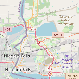
Niagara Falls na mapie
Źródła danych i metodologia
Nasze prognozy pogody są zasilane przez profesjonalnego dostawcę danych pogodowych, który agreguje dane z krajowych służb meteorologicznych, obserwacji satelitarnych, sieci radarowych i ponad 80 000 stacji meteorologicznych na całym świecie. Dane prognostyczne są aktualizowane wielokrotnie w ciągu dnia. Przetwarzamy surowe dane na czytelne podsumowania — prędkość wiatru w m/s, ciśnienie w mm Hg — abyście Państwo mogli planować dzień z pewnością.