
Prognoza pogody na 5 dni Grožnjan 21 lis 2026
 12°
Prognoza pogody — Grožnjan, dziś, 21 lis 2026: częściowe zachmurzenie, temperatura od 9 °C do 13 °C.
Prawdopodobieństwo opadów 27%. Wiatr do 3.31 m/s (porywy 5.61 m/s). Wilgotność powietrza 74–95%, ciśnienie atmosferyczne 759–764 mm Hg, indeks UV do 1.3.
Ostrzeżenia pogodowe
Yellow wind warning
SE wind increasing to strong or near gale force, veering to southwesterly by the end of the day. Maximum wind gusts 35-40 knots (65-75 km/h)
IMPACT: Although rather usual in this region, locally or potentially dangerous wind speeds are expected to produce dangerous wave conditions to small crafts. Inexperienced mariners, especially those operating smaller vessels, should avoid navigating in these conditions.
Mariners should pay close attention to the marine forecast and consider wind and sea conditions in planning. It is possible that some ferry lines will not operate so follow traffic information if travelling.
Yellow wind warning
SE wind increasing to strong or near gale force, veering to southwesterly and northwesterly by the end of the day. Maximum wind gusts 35-40 knots (65-75 km/h)
IMPACT: Although rather usual in this region, locally or potentially dangerous wind speeds are expected to produce dangerous wave conditions to small crafts. Inexperienced mariners, especially those operating smaller vessels, should avoid navigating in these conditions.
Mariners should pay close attention to the marine forecast and consider wind and sea conditions in planning. It is possible that some ferry lines will not operate so follow traffic information if travelling.
Yellow wind warning
SE wind increasing to strong or near gale force, veering to southwesterly and northwesterly by the end of the day. Maximum wind gusts 35-40 knots (65-75 km/h)
IMPACT: Although rather usual in this region, locally or potentially dangerous wind speeds are expected to produce dangerous wave conditions to small crafts. Inexperienced mariners, especially those operating smaller vessels, should avoid navigating in these conditions.
Mariners should pay close attention to the marine forecast and consider wind and sea conditions in planning. It is possible that some ferry lines will not operate so follow traffic information if travelling.
Yellow wind warning
SE wind increasing to strong or near gale force, veering to southwesterly by the end of the day. Maximum wind gusts 35-40 knots (65-75 km/h)
IMPACT: Although rather usual in this region, locally or potentially dangerous wind speeds are expected to produce dangerous wave conditions to small crafts. Inexperienced mariners, especially those operating smaller vessels, should avoid navigating in these conditions.
Mariners should pay close attention to the marine forecast and consider wind and sea conditions in planning. It is possible that some ferry lines will not operate so follow traffic information if travelling.
Yellow wind warning
SE wind increasing to strong or near gale force, veering to southwesterly and northwesterly by the end of the day. Maximum wind gusts 35-40 knots (65-75 km/h)
IMPACT: Although rather usual in this region, locally or potentially dangerous wind speeds are expected to produce dangerous wave conditions to small crafts. Inexperienced mariners, especially those operating smaller vessels, should avoid navigating in these conditions.
Mariners should pay close attention to the marine forecast and consider wind and sea conditions in planning. It is possible that some ferry lines will not operate so follow traffic information if travelling.
5 dni w skrócie — dotknij dnia, aby go otworzyć
Wschód słońca 07:11
Zachód słońca 16:29
Zachód słońca 16:29
Przybywający garb95% oświetlenia
Wschód księżyca 14:21 · Zachód księżyca 03:23
Wschód księżyca 14:21 · Zachód księżyca 03:23
Wykres
Tabela
sob., 21 lis 2026
| Czas | Pogoda | Temperatura | Szansa na deszcz | Zachmurzenie | Wilgotność | Ciśnienie | Wiatr | Indeks UV |
|---|---|---|---|---|---|---|---|---|
| 00:00 |  Zamglenie | 10 °C | 22% | 26% | 95% | 759 mm Hg | ESE 108° 3.11 (4.97) m/s | 0 |
| 01:00 | Zamglenie | 9 °C | 23% | 26% | 95% | 759 mm Hg | ESE 111° 3.31 (5.36) m/s | 0 |
| 02:00 | Zamglenie | 10 °C | 26% | 49% | 95% | 759 mm Hg | ESE 123° 2.69 (5.61) m/s | 0 |
| 03:00 | Zamglenie | 10 °C | 27% | 54% | 95% | 759 mm Hg | SE 130° 2.19 (5.53) m/s | 0 |
| 04:00 | Zamglenie | 10 °C | 27% | 54% | 95% | 759 mm Hg | SE 138° 2.11 (5.42) m/s | 0 |
| 05:00 |  Częściowe zachmurzenie | 10 °C | 21% | 53% | 93% | 760 mm Hg | SSE 165° 1.5 (4.89) m/s | 0 |
| 06:00 | Częściowe zachmurzenie | 10 °C | 17% | 32% | 91% | 760 mm Hg | SSW 195° 1.61 (4.42) m/s | 0 |
| 07:00 | Częściowe zachmurzenie | 10 °C | 19% | 52% | 90% | 761 mm Hg | SW 215° 1.89 (3.92) m/s | 0 |
| 08:00 | Częściowe zachmurzenie | 11 °C | 18% | 44% | 88% | 761 mm Hg | SSW 209° 1.69 (4.25) m/s | 0 |
| 09:00 | Częściowe zachmurzenie | 12 °C | 17% | 50% | 86% | 761 mm Hg | SW 217° 1.5 (4.39) m/s | 0.3 |
| 10:00 | Częściowe zachmurzenie | 12 °C | 13% | 34% | 82% | 762 mm Hg | SW 217° 1.69 (4.69) m/s | 0.7 |
| 11:00 |  Słonecznie | 13 °C | 10% | 20% | 78% | 762 mm Hg | SSW 212° 2 (4.72) m/s | 1.1 |
| 12:00 | Słonecznie | 13 °C | 9% | 15% | 76% | 762 mm Hg | SSW 205° 2 (4.39) m/s | 1.3 |
| 13:00 | Słonecznie | 13 °C | 8% | 10% | 74% | 762 mm Hg | SSW 198° 2 (4.42) m/s | 1.2 |
| 14:00 | Słonecznie | 13 °C | 8% | 6% | 75% | 762 mm Hg | S 185° 1.89 (4.42) m/s | 0.8 |
| 15:00 | Słonecznie | 13 °C | 8% | 3% | 77% | 762 mm Hg | SSE 166° 2 (4.61) m/s | 0.4 |
| 16:00 | Słonecznie | 12 °C | 9% | 1% | 80% | 762 mm Hg | SSE 153° 2.11 (4.61) m/s | 0.1 |
| 17:00 |  Bezchmurnie | 11 °C | 11% | 1% | 84% | 763 mm Hg | SE 138° 2.19 (4.14) m/s | 0 |
| 18:00 | Bezchmurnie | 10 °C | 13% | 6% | 88% | 763 mm Hg | ESE 119° 2.31 (3.86) m/s | 0 |
| 19:00 | Częściowe zachmurzenie | 9 °C | 17% | 32% | 91% | 764 mm Hg | ESE 107° 2.61 (3.92) m/s | 0 |
| 20:00 | Częściowe zachmurzenie | 10 °C | 20% | 54% | 90% | 764 mm Hg | ESE 109° 2.5 (4) m/s | 0 |
| 21:00 |  Pochmurno | 10 °C | 22% | 70% | 89% | 764 mm Hg | ESE 108° 2.5 (3.94) m/s | 0 |
| 22:00 | Częściowe zachmurzenie | 10 °C | 20% | 59% | 88% | 764 mm Hg | ESE 111° 2.5 (4.03) m/s | 0 |
| 23:00 | Częściowe zachmurzenie | 10 °C | 19% | 49% | 90% | 763 mm Hg | ESE 105° 2.69 (4.25) m/s | 0 |
sob., 21 lis 2026
Grožnjan: najczęstsze pytania o pogodę na 5 dni
Grožnjan: jaka będzie pogoda w ciągu najbliższych 5 dni?
W ciągu najbliższych 5 dni temperatura wyniesie od około 4 do 14 °C. Szczegółową prognozę godzinową dla każdego z 5 dni znajdziesz na wykresach powyżej.
Grožnjan: w które z najbliższych 5 dni będzie padać?
Prawdopodobieństwo opadów w ciągu najbliższych 5 dni sięga 85%. Na wykresie opadów na 5 dni powyżej zobaczysz, w które dni i godziny będzie padać.
Grožnjan: jak dokładna jest prognoza pogody na 5 dni?
Prognoza na 5 dni jest dość wiarygodna: pierwsze 2–3 dni są zwykle bardzo dokładne, a dni 4–5 mogą zostać skorygowane. Dane są aktualizowane kilka razy dziennie, więc zajrzyj ponownie przed ważnymi planami.
Grožnjan: który z najbliższych 5 dni będzie najcieplejszy, a który najchłodniejszy?
W ciągu najbliższych 5 dni temperatura waha się od około 4 do 14 °C. Najcieplejszy i najchłodniejszy dzień porównasz na wykresie temperatury powyżej.
Grožnjan: czy w ciągu najbliższych 5 dni będzie wietrznie?
W ciągu najbliższych 5 dni wiatr wzmaga się do 8 m/s. Najbardziej wietrzne dni łatwo dostrzec na wykresie wiatru powyżej.
Grožnjan: który dzień tygodnia najlepiej nadaje się na spacer lub wyjazd?
Na spacer lub wyjazd wybierz dni z najmniejszym prawdopodobieństwem opadów (do 85%) i słabym wiatrem — łatwo je porównać na wykresach na 5 dni powyżej.
Grožnjan: jak najlepiej korzystać z prognozy na 5 dni?
Pierwsze 2–3 dni są wystarczająco wiarygodne do konkretnych decyzji, a dni 4–5 są wskazówką, która uściśla się w miarę zbliżania. Prognoza jest aktualizowana kilka razy dziennie, więc sprawdź ją ponownie przed ważnymi planami.
Grožnjan: czy w tym tygodniu przyda się parasol lub krem z filtrem?
Prawdopodobieństwo deszczu w najbliższych 5 dniach sięga 85%, więc na najbardziej mokre z nich weź coś nieprzemakalnego — pasek dni powyżej pokazuje które. Dzisiejszy indeks UV sięga 1.3; krem ma sens mniej więcej od 3 w górę.
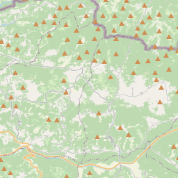
Grožnjan na mapie
Źródła danych i metodologia
Nasze prognozy pogody są zasilane przez profesjonalnego dostawcę danych pogodowych, który agreguje dane z krajowych służb meteorologicznych, obserwacji satelitarnych, sieci radarowych i ponad 80 000 stacji meteorologicznych na całym świecie. Dane prognostyczne są aktualizowane wielokrotnie w ciągu dnia. Przetwarzamy surowe dane na czytelne podsumowania — prędkość wiatru w m/s, ciśnienie w mm Hg — abyście Państwo mogli planować dzień z pewnością.