
Laika prognoze 5 dienām Auerbaha 2026. g. 25. okt.
 8°
8°Laika prognoze Auerbaha Svētdiena 2026. g. 25. okt.: apmācies, temperatūra no 1 °C līdz 8 °C.
Nokrišņu varbūtība 85%. Vējš līdz 8.69 m/s (brāzmas 18.42 m/s). Gaisa mitrums 60–95%, atmosfēras spiediens 755–766 mm Hg, UV indekss līdz 2.
Laika brīdinājumi
Moderate Wind Related Impact
SE wind with gusts between 15 and 20 m/s (55 to 70 km/h).
Possible complications in the energy industry, forestry, and transport. Possible damage to trees and forests. Minor damage to energy infrastructure, property (especially older buildings). Risk of injury from flying or falling objects, especially broken branches. Minor travel delays due to debris and outages.
Secure windows, doors, remove or anchor loosely stored objects, tents, greenhouses, etc. Watch out for falling objects such as branches or roof tiles. When driving, watch out for strong crosswinds at exposed points such as bridges, drive slowly. In the mountains, limit hikes and avoid ridge areas in particular.
Moderate Wind Related Impact
SE wind with gusts between 15 and 20 m/s (55 to 70 km/h).
Possible complications in the energy industry, forestry, and transport. Possible damage to trees and forests. Minor damage to energy infrastructure, property (especially older buildings). Risk of injury from flying or falling objects, especially broken branches. Minor travel delays due to debris and outages.
Secure windows, doors, remove or anchor loosely stored objects, tents, greenhouses, etc. Watch out for falling objects such as branches or roof tiles. When driving, watch out for strong crosswinds at exposed points such as bridges, drive slowly. In the mountains, limit hikes and avoid ridge areas in particular.
Moderate Wind Related Impact
SE wind with gusts between 15 and 20 m/s (55 to 70 km/h).
Possible complications in the energy industry, forestry, and transport. Possible damage to trees and forests. Minor damage to energy infrastructure, property (especially older buildings). Risk of injury from flying or falling objects, especially broken branches. Minor travel delays due to debris and outages.
Secure windows, doors, remove or anchor loosely stored objects, tents, greenhouses, etc. Watch out for falling objects such as branches or roof tiles. When driving, watch out for strong crosswinds at exposed points such as bridges, drive slowly. In the mountains, limit hikes and avoid ridge areas in particular.
Moderate Wind Related Impact
SE wind with gusts between 15 and 20 m/s (55 to 70 km/h).
Possible complications in the energy industry, forestry, and transport. Possible damage to trees and forests. Minor damage to energy infrastructure, property (especially older buildings). Risk of injury from flying or falling objects, especially broken branches. Minor travel delays due to debris and outages.
Secure windows, doors, remove or anchor loosely stored objects, tents, greenhouses, etc. Watch out for falling objects such as branches or roof tiles. When driving, watch out for strong crosswinds at exposed points such as bridges, drive slowly. In the mountains, limit hikes and avoid ridge areas in particular.
5 dienas īsumā — pieskarieties dienai, lai to atvērtu
Lec 06:49
Riet 16:59
Riet 16:59
Pilnmēness100% apgaismots
Mēness lec 16:12 · Mēness riet 05:56
Mēness lec 16:12 · Mēness riet 05:56
Grafiks
Tabulasvētd., 2026. g. 25. okt.
Temperatūra no 1 °C līdz 8 °C un nokrišņi
Mākoņainums un nokrišņu varbūtība
Vēja ātrums un virziens
Gaisa mitrums
Atmosfēras spiediens
Ultravioletās radiācijas indekss
Gaisa kvalitāte un putekšņi
Gaisa kvalitātes dati pieejami tikai pirmajām trim dienām.
svētd., 2026. g. 25. okt.
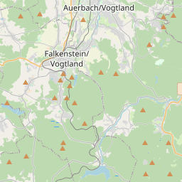
Auerbaha kartē
Datu avoti un metodoloģija
Mūsu laika prognozes tiek nodrošinātas ar profesionāla laika datu pakalpojumu sniedzēja palīdzību, kas apkopo datus no valsts meteoroloģiskajiem dienestiem, satelītu novērojumiem, radaru tīkliem un vairāk nekā 80 000 meteoroloģisko staciju visā pasaulē. Prognožu dati tiek atjaunināti vairākas reizes dienā. Mēs pārveidojam neapstrādātus datus skaidros kopsavilkumos — vēja ātrums m/s, spiediens mmHg — lai jūs varētu plānot savu dienu ar pārliecību.