Laika prognoze 5 dienām Auerbaha 23-08-2026

Laika prognoze Auerbaha svētdiena, 23. augusts 23.08.2026: saulains laiks, temperatūra no 7 °C līdz 15 °C.

Nokrišņu varbūtība 29%. Vējš līdz 4.31 m/s (brāzmas 7.19 m/s). Gaisa mitrums 41–94%, atmosfēras spiediens 767–768 mm Hg, UV indekss līdz 4.8.

Laika brīdinājumi

Slēpt brīdinājumus
Severe20. aug. 18:1022. aug. 01:59Tulkot ar Google
Major Thunderstorm Impact
Risk of very severe thunderstorms with torrential rain (around 40 mm in a short time), in combination with rain around 70 mm, wind gusts 20 to 25 m/s (70 to 90 km/h) and hail around 2 cm. Local property damage and complications, especially in the energy industry, transport, and agriculture. Potential for dangerous flooding, flash floods. Increased runoff from slopes, rapid flooding of low-lying areas, dry gullies, small streams, undercutting of roads. Significant wind damage to trees, parks, buildings, property, energy infrastructure etc. Power outages. Travel delays and disruptions. Driving conditions difficult due to wind gusts, reduced visibility, fallen trees/branches, high risk of hydroplaning. Extensive damage to vegetation, buildings, and property from hail. Risk of fire caused by lightning strike. Risk of serious injury from flying or falling objects and lightning strikes.
Beware of lightning strikes, hail, and falling or windblown objects. Seek shelter in a building with lightning protection. Outdoors, take cover in dense forest or low vegetation; avoid water, hilltops, metal structures, isolated trees, and rock overhangs. Avoid stream courses in the mountains, as water and debris flows may occur there suddenly. Secure windows, doors, greenhouses, and loose objects. Be prepared for possible power outages. When driving, reduce speed, do not enter or drive into flowing water or flooded areas. Stay informed of the driving conditions. Observe weather warnings, weather radar (www.chmi.cz or mobile apps) and flash flood risk https://produkty.chmi.cz/ffi.
Moderate20. aug. 18:1022. aug. 01:59Tulkot ar Google
Moderate Thunderstorm Impact
Risk of severe thunderstorms with torrential rain (around 40 mm in a short time), wind gusts up to 20 m/s (70 km/h) and hail up to 2 cm. Possible local property damage and complications, especially in the energy industry and transport. Potential for local flooding, especially of low-lying areas. Local wind damage to roofs, fences, soft shelters and trees. Local power outages. Some travel delays. Driving conditions difficult. Possible crop damage from small hail. Risk of fire caused by lightning strike. Risk of injury from flying or falling objects, and lightning strikes.
Beware of lightning strikes and flying or falling objects (especially branches). Seek shelter in a building equipped with lightning protection. Outdoors, take cover in dense forest or low vegetation; avoid water bodies, hilltops, metal structures, isolated trees, and rock overhangs. When driving reduce speed. Observe weather warnings, weather radar (www.chmi.cz or mobile apps) and local flood risk https://produkty.chmi.cz/ffi.
Severe20. aug. 18:1022. aug. 01:59Tulkot ar Google
Major Thunderstorm Impact
Risk of very severe thunderstorms with torrential rain (around 40 mm in a short time), in combination with rain around 70 mm, wind gusts 20 to 25 m/s (70 to 90 km/h) and hail around 2 cm. Local property damage and complications, especially in the energy industry, transport, and agriculture. Potential for dangerous flooding, flash floods. Increased runoff from slopes, rapid flooding of low-lying areas, dry gullies, small streams, undercutting of roads. Significant wind damage to trees, parks, buildings, property, energy infrastructure etc. Power outages. Travel delays and disruptions. Driving conditions difficult due to wind gusts, reduced visibility, fallen trees/branches, high risk of hydroplaning. Extensive damage to vegetation, buildings, and property from hail. Risk of fire caused by lightning strike. Risk of serious injury from flying or falling objects and lightning strikes.
Beware of lightning strikes, hail, and falling or windblown objects. Seek shelter in a building with lightning protection. Outdoors, take cover in dense forest or low vegetation; avoid water, hilltops, metal structures, isolated trees, and rock overhangs. Avoid stream courses in the mountains, as water and debris flows may occur there suddenly. Secure windows, doors, greenhouses, and loose objects. Be prepared for possible power outages. When driving, reduce speed, do not enter or drive into flowing water or flooded areas. Stay informed of the driving conditions. Observe weather warnings, weather radar (www.chmi.cz or mobile apps) and flash flood risk https://produkty.chmi.cz/ffi.
Moderate20. aug. 18:1022. aug. 01:59Tulkot ar Google
Moderate Thunderstorm Impact
Risk of severe thunderstorms with torrential rain (around 40 mm in a short time), wind gusts up to 20 m/s (70 km/h) and hail up to 2 cm. Possible local property damage and complications, especially in the energy industry and transport. Potential for local flooding, especially of low-lying areas. Local wind damage to roofs, fences, soft shelters and trees. Local power outages. Some travel delays. Driving conditions difficult. Possible crop damage from small hail. Risk of fire caused by lightning strike. Risk of injury from flying or falling objects, and lightning strikes.
Beware of lightning strikes and flying or falling objects (especially branches). Seek shelter in a building equipped with lightning protection. Outdoors, take cover in dense forest or low vegetation; avoid water bodies, hilltops, metal structures, isolated trees, and rock overhangs. When driving reduce speed. Observe weather warnings, weather radar (www.chmi.cz or mobile apps) and local flood risk https://produkty.chmi.cz/ffi.
Severe20. aug. 18:1022. aug. 01:59Tulkot ar Google
Major Thunderstorm Impact
Risk of very severe thunderstorms with torrential rain (around 40 mm in a short time), in combination with rain around 70 mm, wind gusts 20 to 25 m/s (70 to 90 km/h) and hail around 2 cm. Local property damage and complications, especially in the energy industry, transport, and agriculture. Potential for dangerous flooding, flash floods. Increased runoff from slopes, rapid flooding of low-lying areas, dry gullies, small streams, undercutting of roads. Significant wind damage to trees, parks, buildings, property, energy infrastructure etc. Power outages. Travel delays and disruptions. Driving conditions difficult due to wind gusts, reduced visibility, fallen trees/branches, high risk of hydroplaning. Extensive damage to vegetation, buildings, and property from hail. Risk of fire caused by lightning strike. Risk of serious injury from flying or falling objects and lightning strikes.
Beware of lightning strikes, hail, and falling or windblown objects. Seek shelter in a building with lightning protection. Outdoors, take cover in dense forest or low vegetation; avoid water, hilltops, metal structures, isolated trees, and rock overhangs. Avoid stream courses in the mountains, as water and debris flows may occur there suddenly. Secure windows, doors, greenhouses, and loose objects. Be prepared for possible power outages. When driving, reduce speed, do not enter or drive into flowing water or flooded areas. Stay informed of the driving conditions. Observe weather warnings, weather radar (www.chmi.cz or mobile apps) and flash flood risk https://produkty.chmi.cz/ffi.
Lec 06:11
Riet 20:14
Augošs mēness86% apgaismots
Mēness lec 18:34 · Mēness riet 00:49
Grafiks
Tabula
svētd., 2026. g. 23. aug.

Temperatūra no 7 °C līdz 15 °C un nokrišņi

Temperatūra & Nokrišņi
Laiks00:0001:0002:0003:0004:0005:0006:0007:0008:0009:0010:0011:0012:0013:0014:0015:0016:0017:0018:0019:0020:0021:0022:0023:00
Temperatūra (°C)1312121111101011791012131414151515141415131212
Nokrišņi (mm/st)0.0200.01000000000.01000000000000

Mākoņainums un nokrišņu varbūtība

Mākoņainība & Nokrišņu varbūtība
Laiks00:0001:0002:0003:0004:0005:0006:0007:0008:0009:0010:0011:0012:0013:0014:0015:0016:0017:0018:0019:0020:0021:0022:0023:00
Mākoņainība (%)825783514245492528674905511182484105
Nokrišņu varbūtība (%)2915271515161515182212139101112225778

Vēja ātrums un virziens

Vēja & Vēja brāzmas
Laiks00:0001:0002:0003:0004:0005:0006:0007:0008:0009:0010:0011:0012:0013:0014:0015:0016:0017:0018:0019:0020:0021:0022:0023:00
Vēja (m/s)1.8121.811.811.611.51.51.391.311.892.893.393.89444.314.314.11432.50.690.691.11
Vēja brāzmas (m/s)22.424.812.111.691.531.535.392.924.394.925.335.425.645.816.116.396.56.536.897.1910.891.22
Vēja virziens (°)DDR 212°DDR 206°DR 226°DR 225°DR 228°DR 225°DDR 213°DDR 203°RDR 239°R 275°RZR 289°RZR 291°RZR 294°RZR 295°RZR 298°ZR 306°ZR 308°ZR 314°ZR 319°ZR 315°ZZR 342°ZZR 327°DR 217°DR 217°

Gaisa mitrums

Mitrums
Laiks00:0001:0002:0003:0004:0005:0006:0007:0008:0009:0010:0011:0012:0013:0014:0015:0016:0017:0018:0019:0020:0021:0022:0023:00
Mitrums (%)929392939394949387807360524743424141455167757575

Atmosfēras spiediens

Spiediens
Laiks00:0001:0002:0003:0004:0005:0006:0007:0008:0009:0010:0011:0012:0013:0014:0015:0016:0017:0018:0019:0020:0021:0022:0023:00
Spiediens (mm Hg)767767767767767767767768768767767767767767767767767767767767767768768768

Ultravioletās radiācijas indekss

UV indekss
Laiks00:0001:0002:0003:0004:0005:0006:0007:0008:0009:0010:0011:0012:0013:0014:0015:0016:0017:0018:0019:0020:0021:0022:0023:00
UV indekss00000000.10.51.42.644.74.84.64.231.70.80.20000

Gaisa kvalitāte un putekšņi

Gaisa kvalitāte
Laiks00:0001:0002:0003:0004:0005:0006:0007:0008:0009:0010:0011:0012:0013:0014:0015:0016:0017:0018:0019:0020:0021:0022:0023:00
PM2.5 (µg/m³)4.655.25.65.96.86.76.15.75.254.74.343.83.74.34.23.83.94.24.655.1
PM10 (µg/m³)6.97.177.78.29.39.18.27.87.66.86.96.96.46.265.86.16.66.77.28.28.48.6
Ozons (O₃) (µg/m³)605856535150495254606364707172757777777674716461
NO₂ (µg/m³)3.13.43.43.63.53.43.73.52.61.81.30.90.80.70.60.60.50.60.81.11.722.53
SO₂ (µg/m³)0.20.30.30.30.30.30.30.30.30.40.30.30.20.10.10.10.10.10.20.20.30.30.30.4
CO (µg/m³)146147149151150150149147147149152151151150149148150151152153154160159165
svētd., 2026. g. 23. aug.

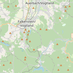
Auerbaha kartē

Datu avoti un metodoloģija

Mūsu laika prognozes tiek nodrošinātas ar profesionāla laika datu pakalpojumu sniedzēja palīdzību, kas apkopo datus no valsts meteoroloģiskajiem dienestiem, satelītu novērojumiem, radaru tīkliem un vairāk nekā 80 000 meteoroloģisko staciju visā pasaulē. Prognožu dati tiek atjaunināti vairākas reizes dienā. Mēs pārveidojam neapstrādātus datus skaidros kopsavilkumos — vēja ātrums m/s, spiediens mmHg — lai jūs varētu plānot savu dienu ar pārliecību.