
Orų prognozė 5 dienoms Auerbach 2026-10-25
 8°
8°Orų prognozė Auerbach sekmadienis 2026-10-25: apsiniaukę, temperatūra nuo 1 °C iki 8 °C.
Kritulių tikimybė 85%. Vėjas iki 8.69 m/s (gūsiai 18.42 m/s). Oro drėgmė 60–95%, atmosferos slėgis 755–766 mm Hg, UV indeksas iki 2.
Oro perspėjimai
Moderate Wind Related Impact
SE wind with gusts between 15 and 20 m/s (55 to 70 km/h).
Possible complications in the energy industry, forestry, and transport. Possible damage to trees and forests. Minor damage to energy infrastructure, property (especially older buildings). Risk of injury from flying or falling objects, especially broken branches. Minor travel delays due to debris and outages.
Secure windows, doors, remove or anchor loosely stored objects, tents, greenhouses, etc. Watch out for falling objects such as branches or roof tiles. When driving, watch out for strong crosswinds at exposed points such as bridges, drive slowly. In the mountains, limit hikes and avoid ridge areas in particular.
Moderate Wind Related Impact
SE wind with gusts between 15 and 20 m/s (55 to 70 km/h).
Possible complications in the energy industry, forestry, and transport. Possible damage to trees and forests. Minor damage to energy infrastructure, property (especially older buildings). Risk of injury from flying or falling objects, especially broken branches. Minor travel delays due to debris and outages.
Secure windows, doors, remove or anchor loosely stored objects, tents, greenhouses, etc. Watch out for falling objects such as branches or roof tiles. When driving, watch out for strong crosswinds at exposed points such as bridges, drive slowly. In the mountains, limit hikes and avoid ridge areas in particular.
Moderate Wind Related Impact
SE wind with gusts between 15 and 20 m/s (55 to 70 km/h).
Possible complications in the energy industry, forestry, and transport. Possible damage to trees and forests. Minor damage to energy infrastructure, property (especially older buildings). Risk of injury from flying or falling objects, especially broken branches. Minor travel delays due to debris and outages.
Secure windows, doors, remove or anchor loosely stored objects, tents, greenhouses, etc. Watch out for falling objects such as branches or roof tiles. When driving, watch out for strong crosswinds at exposed points such as bridges, drive slowly. In the mountains, limit hikes and avoid ridge areas in particular.
Moderate Wind Related Impact
SE wind with gusts between 15 and 20 m/s (55 to 70 km/h).
Possible complications in the energy industry, forestry, and transport. Possible damage to trees and forests. Minor damage to energy infrastructure, property (especially older buildings). Risk of injury from flying or falling objects, especially broken branches. Minor travel delays due to debris and outages.
Secure windows, doors, remove or anchor loosely stored objects, tents, greenhouses, etc. Watch out for falling objects such as branches or roof tiles. When driving, watch out for strong crosswinds at exposed points such as bridges, drive slowly. In the mountains, limit hikes and avoid ridge areas in particular.
5 dienų glaustai — spustelėkite dieną, kad ją atidarytumėte
Saulėtekis 06:49
Saulėlydis 16:59
Saulėlydis 16:59
Pilnatis100% apšvietimo
Mėnulio patekėjimas 16:12 · Mėnulio nusileidimas 05:56
Mėnulio patekėjimas 16:12 · Mėnulio nusileidimas 05:56
Diagrama
Lentelė
2026-10-25, sk
| Laikas | Orai | Temperatūra | Lietaus tikimybė | Debesuotumas | Drėgmė | Slėgis | Vėjas | UV indeksas |
|---|---|---|---|---|---|---|---|---|
| 00:00 |  Mažai debesuota | 4 °C | 18% | 51% | 87% | 766 mm Hg | PV 218° 4.5 (10.92) m/s | 0 |
| 01:00 | Mažai debesuota | 4 °C | 17% | 50% | 86% | 766 mm Hg | PV 219° 4.19 (10.72) m/s | 0 |
| 02:00 |  Giedra | 3 °C | 14% | 10% | 90% | 766 mm Hg | PPV 200° 3.61 (10.61) m/s | 0 |
| 03:00 | Giedra | 2 °C | 15% | 7% | 93% | 765 mm Hg | P 191° 3.5 (10.81) m/s | 0 |
| 04:00 | Giedra | 2 °C | 15% | 4% | 92% | 765 mm Hg | P 187° 3.61 (11.22) m/s | 0 |
| 05:00 | Giedra | 2 °C | 15% | 6% | 92% | 765 mm Hg | P 183° 3.61 (11.61) m/s | 0 |
| 06:00 | Giedra | 1 °C | 16% | 16% | 92% | 764 mm Hg | P 180° 3.69 (11.92) m/s | 0 |
| 07:00 |  Debesuota | 1 °C | 27% | 82% | 93% | 764 mm Hg | P 173° 3.69 (12.42) m/s | 0 |
| 08:00 | Apsiniaukę | 2 °C | 29% | 100% | 88% | 764 mm Hg | P 179° 4.11 (12.92) m/s | 1 |
| 09:00 | Apsiniaukę | 4 °C | 22% | 100% | 76% | 763 mm Hg | P 180° 4.89 (13.11) m/s | 1 |
| 10:00 | Apsiniaukę | 5 °C | 17% | 89% | 70% | 761 mm Hg | P 182° 5.5 (13.89) m/s | 2 |
| 11:00 | Apsiniaukę | 7 °C | 16% | 100% | 64% | 760 mm Hg | P 184° 6.81 (14.72) m/s | 2 |
| 12:00 | Apsiniaukę | 7 °C | 16% | 100% | 62% | 759 mm Hg | P 184° 7 (15.31) m/s | 2 |
| 13:00 | Apsiniaukę | 8 °C | 14% | 98% | 60% | 758 mm Hg | P 183° 7.61 (15.92) m/s | 2 |
| 14:00 |  Silpnas lietus | 7 °C | 40% (0.4 mm/val.) | 99% | 65% | 757 mm Hg | P 184° 8 (16.69) m/s | 2 |
| 15:00 | Apsiniaukę | 7 °C | 54% (0.7 mm/val.) | 99% | 71% | 756 mm Hg | P 185° 8.31 (17.61) m/s | 2 |
| 16:00 | Silpnas lietus | 6 °C | 67% (1.12 mm/val.) | 100% | 77% | 755 mm Hg | P 185° 8.69 (18.42) m/s | 2 |
| 17:00 |  Vidutinis lietus | 6 °C | 73% (1.6 mm/val.) | 100% | 82% | 755 mm Hg | P 190° 8.5 (18.19) m/s | 2 |
| 18:00 |  Silpnas lietus | 6 °C | 79% (2.1 mm/val.) | 100% | 87% | 755 mm Hg | PPV 194° 8.19 (17.89) m/s | 0 |
| 19:00 |  Vidutinis lietus | 6 °C | 85% (2.65 mm/val.) | 100% | 92% | 755 mm Hg | PPV 199° 8 (17.72) m/s | 0 |
| 20:00 |  Silpna dulksna | 6 °C | 82% (1.9 mm/val.) | 100% | 93% | 755 mm Hg | PV 227° 7.5 (15.69) m/s | 0 |
| 21:00 | Vidutinis lietus | 7 °C | 80% (1.2 mm/val.) | 100% | 94% | 756 mm Hg | VPV 255° 7.11 (13.81) m/s | 0 |
| 22:00 | Silpna dulksna | 7 °C | 69% (0.48 mm/val.) | 100% | 95% | 757 mm Hg | VŠV 283° 6.61 (11.81) m/s | 0 |
| 23:00 |  Silpnas lietus su pertraukomis | 7 °C | 59% (0.4 mm/val.) | 91% | 93% | 758 mm Hg | V 281° 6.31 (12) m/s | 0 |
2026-10-25, sk
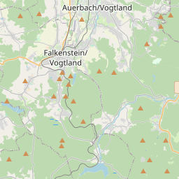
Auerbach žemėlapyje
Duomenų šaltiniai ir metodologija
Mūsų orų prognozės yra paremtos profesionaliu orų duomenų tiekėju, kuris apibendrina duomenis iš nacionalinių meteorologijos tarnybų, palydovinių stebėjimų, radarų tinklų ir daugiau nei 80 000 meteorologinių stočių visame pasaulyje. Prognozių duomenys atnaujinami kelis kartus per dieną. Neapdorotus duomenis paverčiame aiškiomis santraukomis – vėjo greitis m/s, slėgis mm Hg – kad galėtumėte planuoti savo dieną su pasitikėjimu.