
Orų prognozė 5 dienoms Auerbach 2026-10-21
 6°
6°Orų prognozė Auerbach šiandien 2026-10-21: apsiniaukę, temperatūra nuo 5 °C iki 12 °C.
Kritulių tikimybė 78%. Vėjas iki 5.69 m/s (gūsiai 11 m/s). Oro drėgmė 70–95%, atmosferos slėgis 756–761 mm Hg, UV indeksas iki 2.
Oro perspėjimai
Moderate Wind Related Impact
SE wind with gusts between 15 and 20 m/s (55 to 70 km/h).
Possible complications in the energy industry, forestry, and transport. Possible damage to trees and forests. Minor damage to energy infrastructure, property (especially older buildings). Risk of injury from flying or falling objects, especially broken branches. Minor travel delays due to debris and outages.
Secure windows, doors, remove or anchor loosely stored objects, tents, greenhouses, etc. Watch out for falling objects such as branches or roof tiles. When driving, watch out for strong crosswinds at exposed points such as bridges, drive slowly. In the mountains, limit hikes and avoid ridge areas in particular.
Moderate Wind Related Impact
SE wind with gusts between 15 and 20 m/s (55 to 70 km/h).
Possible complications in the energy industry, forestry, and transport. Possible damage to trees and forests. Minor damage to energy infrastructure, property (especially older buildings). Risk of injury from flying or falling objects, especially broken branches. Minor travel delays due to debris and outages.
Secure windows, doors, remove or anchor loosely stored objects, tents, greenhouses, etc. Watch out for falling objects such as branches or roof tiles. When driving, watch out for strong crosswinds at exposed points such as bridges, drive slowly. In the mountains, limit hikes and avoid ridge areas in particular.
Moderate Wind Related Impact
SE wind with gusts between 15 and 20 m/s (55 to 70 km/h).
Possible complications in the energy industry, forestry, and transport. Possible damage to trees and forests. Minor damage to energy infrastructure, property (especially older buildings). Risk of injury from flying or falling objects, especially broken branches. Minor travel delays due to debris and outages.
Secure windows, doors, remove or anchor loosely stored objects, tents, greenhouses, etc. Watch out for falling objects such as branches or roof tiles. When driving, watch out for strong crosswinds at exposed points such as bridges, drive slowly. In the mountains, limit hikes and avoid ridge areas in particular.
Moderate Wind Related Impact
SE wind with gusts between 15 and 20 m/s (55 to 70 km/h).
Possible complications in the energy industry, forestry, and transport. Possible damage to trees and forests. Minor damage to energy infrastructure, property (especially older buildings). Risk of injury from flying or falling objects, especially broken branches. Minor travel delays due to debris and outages.
Secure windows, doors, remove or anchor loosely stored objects, tents, greenhouses, etc. Watch out for falling objects such as branches or roof tiles. When driving, watch out for strong crosswinds at exposed points such as bridges, drive slowly. In the mountains, limit hikes and avoid ridge areas in particular.
5 dienų glaustai — spustelėkite dieną, kad ją atidarytumėte
Saulėtekis 07:42
Saulėlydis 18:06
Saulėlydis 18:06
Priešpilnis86% apšvietimo
Mėnulio patekėjimas 16:22 · Mėnulio nusileidimas 02:10
Mėnulio patekėjimas 16:22 · Mėnulio nusileidimas 02:10
Diagrama
Lentelė
2026-10-21, tr
| Laikas | Orai | Temperatūra | Lietaus tikimybė | Debesuotumas | Drėgmė | Slėgis | Vėjas | UV indeksas |
|---|---|---|---|---|---|---|---|---|
| 00:00 |  Mažai debesuota | 5 °C | 17% | 33% | 90% | 759 mm Hg | PPR 149° 2.69 (3.53) m/s | 0 |
| 01:00 | Mažai debesuota | 6 °C | 16% | 28% | 90% | 759 mm Hg | PPR 152° 2.61 (3.61) m/s | 0 |
| 02:00 | Apsiniaukę | 6 °C | 31% | 100% | 91% | 758 mm Hg | PR 136° 2.11 (2.19) m/s | 0 |
| 03:00 | Apsiniaukę | 6 °C | 31% | 100% | 91% | 758 mm Hg | PR 136° 1.81 (1.81) m/s | 0 |
| 04:00 | Apsiniaukę | 6 °C | 30% | 97% | 91% | 758 mm Hg | PPR 150° 2.11 (2.11) m/s | 0 |
| 05:00 | Apsiniaukę | 6 °C | 31% | 100% | 92% | 758 mm Hg | PR 146° 2.11 (2.22) m/s | 0 |
| 06:00 | Apsiniaukę | 6 °C | 31% | 100% | 92% | 758 mm Hg | PPR 147° 2.19 (2.5) m/s | 0 |
| 07:00 | Apsiniaukę | 6 °C | 31% | 100% | 91% | 757 mm Hg | PPR 148° 1.89 (2.22) m/s | 0 |
| 08:00 |  Apsiniaukę | 6 °C | 31% | 100% | 92% | 757 mm Hg | PPR 161° 2.11 (2.5) m/s | 0 |
| 09:00 | Apsiniaukę | 8 °C | 27% | 100% | 85% | 757 mm Hg | PPR 150° 1 (1.72) m/s | 0.2 |
| 10:00 | Apsiniaukę | 9 °C | 25% | 100% | 82% | 758 mm Hg | P 190° 1.31 (2.42) m/s | 0.6 |
| 11:00 | Apsiniaukę | 11 °C | 22% | 100% | 76% | 757 mm Hg | PR 127° 1 (1.83) m/s | 1.2 |
| 12:00 | Apsiniaukę | 11 °C | 21% | 100% | 75% | 757 mm Hg | PPV 192° 1.61 (2.81) m/s | 1.5 |
| 13:00 | Apsiniaukę | 12 °C | 18% | 100% | 70% | 756 mm Hg | PPV 196° 1.31 (2.39) m/s | 2 |
| 14:00 | Apsiniaukę | 12 °C | 19% | 100% | 70% | 756 mm Hg | PPV 211° 2.11 (3.31) m/s | 1.7 |
| 15:00 | Apsiniaukę | 12 °C | 19% | 100% | 71% | 756 mm Hg | PV 214° 2.11 (3.14) m/s | 1.1 |
| 16:00 | Apsiniaukę | 12 °C | 18% | 94% | 71% | 756 mm Hg | PV 218° 2.39 (3.97) m/s | 0.5 |
| 17:00 | Apsiniaukę | 12 °C | 22% | 100% | 77% | 757 mm Hg | VPV 243° 2.39 (5.14) m/s | 0.1 |
| 18:00 | Apsiniaukę | 10 °C | 27% | 100% | 84% | 758 mm Hg | VPV 254° 4.31 (7.64) m/s | 0 |
| 19:00 |  Galimas trumpalaikis lietus | 8 °C | 38% (0.07 mm/val.) | 100% | 92% | 758 mm Hg | VPV 250° 4.5 (9.64) m/s | 0 |
| 20:00 | Galimas trumpalaikis lietus | 8 °C | 40% (0.1 mm/val.) | 100% | 89% | 760 mm Hg | V 260° 5.69 (10.61) m/s | 0 |
| 21:00 |  Silpna dulksna | 7 °C | 72% (0.65 mm/val.) | 100% | 92% | 760 mm Hg | VPV 258° 4.61 (11) m/s | 0 |
| 22:00 |  Silpnas lietus | 6 °C | 78% (1.28 mm/val.) | 100% | 95% | 761 mm Hg | VPV 239° 3.19 (10.22) m/s | 0 |
| 23:00 | Silpnas lietus | 7 °C | 74% (0.88 mm/val.) | 100% | 95% | 761 mm Hg | PV 234° 4.39 (10.31) m/s | 0 |
2026-10-21, tr
Dažni klausimai apie 5 dienų orų prognozę Auerbach
Koks oras bus Auerbach artimiausias 5 dienas?
Artimiausias 5 dienas Auerbach temperatūra svyruos maždaug nuo 1 iki 12 °C. Išsamią kiekvienos iš 5 dienų valandinę prognozę rasite grafikuose viršuje.
Kuriomis iš artimiausių 5 dienų Auerbach lis?
Kritulių tikimybė Auerbach artimiausias 5 dienas siekia 85%. Viršuje esančiame 5 dienų kritulių grafike matysite, kuriomis dienomis ir valandomis lis.
Kiek tiksli 5 dienų orų prognozė Auerbach?
5 dienų prognozė gana patikima: pirmos 2–3 dienos paprastai labai tikslios, 4–5 dienos gali būti tikslinamos. Duomenys atnaujinami kelis kartus per dieną, todėl prieš svarbius planus užsukite dar kartą.
Kuri iš artimiausių 5 dienų Auerbach bus šilčiausia, o kuri vėsiausia?
Artimiausias 5 dienas temperatūra Auerbach svyruoja maždaug nuo 1 iki 12 °C. Šilčiausią ir vėsiausią dieną patogu palyginti temperatūros grafike viršuje.
Ar Auerbach artimiausias 5 dienas bus vėjuota?
Artimiausias 5 dienas vėjas Auerbach sustiprėja iki 9 m/s. Vėjuočiausios dienos gerai matomos vėjo grafike viršuje.
Kuri savaitės diena Auerbach geriausiai tinka pasivaikščiojimui ar kelionei?
Pasivaikščiojimui ar kelionei rinkitės dienas su mažiausia kritulių tikimybe (iki 85%) ir silpnu vėju – jas lengva palyginti 5 dienų grafikuose viršuje.
Kaip geriausiai naudotis Auerbach 5 dienų prognoze?
Pirmos 2–3 dienos pakankamai patikimos tvirtiems sprendimams, o 4–5 dienos yra orientyras, kuris tikslėja artėjant. Prognozė atnaujinama kelis kartus per dieną, todėl prieš svarbius planus patikrinkite dar kartą.
Ar šią savaitę Auerbach prireiks skėčio ar kremo nuo saulės?
Lietaus tikimybė artimiausias 5 dienas siekia 85%, tad drėgniausioms iš jų pasiimkite ką nors neperšlampamo — kurios tai dienos, matyti dienų juostoje aukščiau. Šiandienos UV indeksas siekia 2; kremas prasmingas maždaug nuo 3.
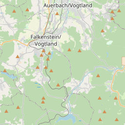
Auerbach žemėlapyje
Duomenų šaltiniai ir metodologija
Mūsų orų prognozės yra paremtos profesionaliu orų duomenų tiekėju, kuris apibendrina duomenis iš nacionalinių meteorologijos tarnybų, palydovinių stebėjimų, radarų tinklų ir daugiau nei 80 000 meteorologinių stočių visame pasaulyje. Prognozių duomenys atnaujinami kelis kartus per dieną. Neapdorotus duomenis paverčiame aiškiomis santraukomis – vėjo greitis m/s, slėgis mm Hg – kad galėtumėte planuoti savo dieną su pasitikėjimu.