Prévisions météo à 5 jours Grožnjan 5 nov. 2026

14°9° · Ensoleillé

Prévisions météo Grožnjan jeudi 5 nov. 2026 : ensoleillé, température de 9 °C à 14 °C.

Probabilité de précipitations 13%. Vent jusqu'à 4 m/s (rafales 8.19 m/s). Humidité de l'air 57–81%, pression atmosphérique 770–771 mm Hg, indice UV jusqu'à 1.6.

Alertes météo

Moderate2 nov., 18:27 — 3 nov., 23:59Traduire avec Google
Yellow wind warning
Locally strong NE breeze. Maximum wind gusts 35-50 knots (65-95 km/h)
IMPACT: Although rather usual in this region, locally or potentially dangerous wind speeds are expected to produce dangerous wave conditions to small crafts. Inexperienced mariners, especially those operating smaller vessels, should avoid navigating in these conditions. Mariners should pay close attention to the marine forecast and consider wind and sea conditions in planning. It is possible that some ferry lines will not operate so follow traffic information if travelling.
Moderate2 nov., 18:27 — 3 nov., 23:59Traduire avec Google
Yellow wind warning
Locally strong NE breeze. Maximum wind gusts 35-45 knots (65-85 km/h)
IMPACT: Although rather usual in this region, locally or potentially dangerous wind speeds are expected to produce dangerous wave conditions to small crafts. Inexperienced mariners, especially those operating smaller vessels, should avoid navigating in these conditions. Mariners should pay close attention to the marine forecast and consider wind and sea conditions in planning. It is possible that some ferry lines will not operate so follow traffic information if travelling.
Moderate2 nov., 18:27 — 3 nov., 23:59Traduire avec Google
Yellow wind warning
Locally near gale force NE wind. Maximum wind gusts 35-60 knots (65-110 km/h)
IMPACT: Although rather usual in this region, locally or potentially dangerous wind speeds are expected to produce dangerous wave conditions to small crafts. Inexperienced mariners, especially those operating smaller vessels, should avoid navigating in these conditions. Mariners should pay close attention to the marine forecast and consider wind and sea conditions in planning. It is possible that some ferry lines will not operate so follow traffic information if travelling.
Moderate2 nov., 18:27 — 3 nov., 23:59Traduire avec Google
Yellow wind warning
Locally strong NE breeze. Maximum wind gusts 35-50 knots (65-95 km/h)
IMPACT: Although rather usual in this region, locally or potentially dangerous wind speeds are expected to produce dangerous wave conditions to small crafts. Inexperienced mariners, especially those operating smaller vessels, should avoid navigating in these conditions. Mariners should pay close attention to the marine forecast and consider wind and sea conditions in planning. It is possible that some ferry lines will not operate so follow traffic information if travelling.
Severe2 nov., 18:27 — 3 nov., 23:59Traduire avec Google
Orange wind warning
Locally near gale, before noon also gale force NE wind. Maximum wind gusts 35-80 knots (65-150 km/h)
IMPACT: Be prepared for gale and strong gale wind speeds combined with locally high waves that are imminent or occurring. Operating a vessel in these conditions requires experience and properly equipped vessels. It is highly recommended that mariners without the proper experience seek safe harbor prior to onset of potentially dangerous wind and wave conditions. It is likely that many ferries will not operate so follow traffic information if travelling.
Les 5 jours en un coup d'œil — appuyez sur un jour pour l'ouvrir
Lever du soleil 06:50
Coucher du soleil 16:47
Dernier Croissant13% illuminé
Lever de la lune 02:14 · Coucher de la lune 14:44
Graphique
Tableau

Prévisions de 9 °C à 14 °C et précipitations

Température & Précipitations
Heure00:0001:0002:0003:0004:0005:0006:0007:0008:0009:0010:0011:0012:0013:0014:0015:0016:0017:0018:0019:0020:0021:0022:0023:00
Température (°C)1110101091010910111212121413131414131213131113
Précipitations (mm/h)000000000000000000000000

Couverture nuageuse et probabilité de précipitations

Couverture nuageuse & Risque de pluie
Heure00:0001:0002:0003:0004:0005:0006:0007:0008:0009:0010:0011:0012:0013:0014:0015:0016:0017:0018:0019:0020:0021:0022:0023:00
Couverture nuageuse (%)5554401645224101259140775112
Risque de pluie (%)787797710764443444413812586

Vitesse et direction du vent

Vent & Rafale de vent
Heure00:0001:0002:0003:0004:0005:0006:0007:0008:0009:0010:0011:0012:0013:0014:0015:0016:0017:0018:0019:0020:0021:0022:0023:00
Vent (m/s)3.1942.892.693.532.6932.392.191.810.390.611.311.612.311.811.811.111.191.812.52.312.39
Rafale de vent (m/s)8.195.567.896.695.0867.694.425.395.193.720.50.612.975.615.313.192.221.112.564.812.814.087.39
Direction du vent (°)ENE 78°ENE 78°ENE 75°E 80°ENE 74°ENE 76°ENE 68°ENE 65°ENE 69°ENE 63°ENE 66°N 357°NO 325°NNO 332°NO 309°ONO 287°ONO 302°NNO 329°NE 48°ESE 123°SE 126°SSE 164°ESE 111°SE 126°

Humidité de l'air

Humidité
Heure00:0001:0002:0003:0004:0005:0006:0007:0008:0009:0010:0011:0012:0013:0014:0015:0016:0017:0018:0019:0020:0021:0022:0023:00
Humidité (%)747673737972728172696361605760616160606563657669

Pression atmosphérique

Pression
Heure00:0001:0002:0003:0004:0005:0006:0007:0008:0009:0010:0011:0012:0013:0014:0015:0016:0017:0018:0019:0020:0021:0022:0023:00
Pression (mm Hg)770770770770770770770770770770771771770770770770770770770770770770770770

Indice ultraviolet

Indice UV
Heure00:0001:0002:0003:0004:0005:0006:0007:0008:0009:0010:0011:0012:0013:0014:0015:0016:0017:0018:0019:0020:0021:0022:0023:00
Indice UV000000000.10.40.91.31.61.51.10.60.20000000

Qualité de l'air et pollen

Qualité de l'air
Heure00:0001:0002:0003:0004:0005:0006:0007:0008:0009:0010:0011:0012:0013:0014:0015:0016:0017:0018:0019:0020:0021:0022:0023:00
PM2.5 (µg/m³)121110.810.710.510.51111.711.29.78.58.28.38.48.38.48.38.810.612.914.314.714.713.1
PM10 (µg/m³)16.816.516.415.514.413.513.213.613.711.810.310.810.29.69.4101111.513.615.618.418.617.614.8
Ozone (O₃) (µg/m³)393939394139383737515559636769686862534542404141.3
NO₂ (µg/m³)5.754.53.93.53.33.34.24.93.72.51.71.41.21.11.31.52.54.47.87.476.56.5
SO₂ (µg/m³)0.50.40.40.30.30.30.30.30.30.30.30.30.30.40.40.40.40.50.50.60.70.60.50.8
CO (µg/m³)211207204202201199196195200185183174168164162165172178184198208212211201.3

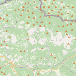
Grožnjan sur la carte

Sources de données et méthodologie

Nos prévisions météo sont alimentées par un fournisseur professionnel de données météorologiques qui agrège les données des services météorologiques nationaux, des observations satellites, des réseaux radar et de plus de 80 000 stations météorologiques dans le monde. Les données de prévision sont mises à jour plusieurs fois par jour. Nous convertissons les données brutes en résumés clairs — vitesse du vent en m/s, pression en mm Hg — afin que vous puissiez planifier votre journée en toute confiance.