Prévisions météo à 5 jours Grožnjan 25-07-2026

Prévisions météo Grožnjan demain 25.07.2026 : ensoleillé, température de 19 °C à 26 °C.

Probabilité de précipitations 15%. Vent jusqu'à 4.11 m/s (rafales 7.56 m/s). Humidité de l'air 43–65%, pression atmosphérique 758–762 mm Hg, indice UV jusqu'à 7.8.

Alertes météo

Masquer les alertes
Severe23 juil., 07:3127 juil., 00:59Traduire avec Google
Severe Forestfire danger Warning (Degree 3/4) - Slovenia / South-West

Severe Forestfire danger Warning

There is a large risk of forest and bush fire.
Stay vigilant and be prepared there is a large risk of forest and bush fire. Immediately react to any developing fire. The public are asked to exercise extreme caution in the countryside, and immediately notify emergency services on any fire.
Moderate24 juil., 07:5025 juil., 10:00Traduire avec Google
Yellow wind warning
Locally fresh NE wind. Maximum wind gusts 35-40 knots (65-75 km/h)
IMPACT: Although rather usual in this region, locally or potentially dangerous wind speeds are expected to produce dangerous wave conditions to small crafts. Inexperienced mariners, especially those operating smaller vessels, should avoid navigating in these conditions. Mariners should pay close attention to the marine forecast and consider wind and sea conditions in planning. It is possible that some ferry lines will not operate so follow traffic information if travelling.
Moderate24 juil., 07:5025 juil., 09:00Traduire avec Google
Yellow wind warning
Locally fresh NE wind. Maximum wind gusts 35-40 knots (65-75 km/h)
IMPACT: Although rather usual in this region, locally or potentially dangerous wind speeds are expected to produce dangerous wave conditions to small crafts. Inexperienced mariners, especially those operating smaller vessels, should avoid navigating in these conditions. Mariners should pay close attention to the marine forecast and consider wind and sea conditions in planning. It is possible that some ferry lines will not operate so follow traffic information if travelling.
Moderate24 juil., 07:4924 juil., 23:59Traduire avec Google
Yellow wind warning
Locally strong NE wind. Maximum wind gusts 35-50 knots (65-95 km/h)
IMPACT: Although rather usual in this region, locally or potentially dangerous wind speeds are expected to produce dangerous wave conditions to small crafts. Inexperienced mariners, especially those operating smaller vessels, should avoid navigating in these conditions. Mariners should pay close attention to the marine forecast and consider wind and sea conditions in planning. It is possible that some ferry lines will not operate so follow traffic information if travelling.
Moderate24 juil., 07:4924 juil., 23:59Traduire avec Google
Yellow wind warning
Locally fresh and strong NE wind. Maximum wind gusts 35-50 knots (65-95 km/h)
IMPACT: Although rather usual in this region, locally or potentially dangerous wind speeds are expected to produce dangerous wave conditions to small crafts. Inexperienced mariners, especially those operating smaller vessels, should avoid navigating in these conditions. Mariners should pay close attention to the marine forecast and consider wind and sea conditions in planning. It is possible that some ferry lines will not operate so follow traffic information if travelling.
Les 5 jours en un coup d'œil — appuyez sur un jour pour l'ouvrir
Lever du soleil 05:41
Coucher du soleil 20:41
Gibbeuse Croissante90% illuminé
Lever de la lune 18:31 · Coucher de la lune 01:35
Graphique
Tableau

Prévisions de 19 °C à 26 °C et précipitations

Température & Précipitations
Heure00:0001:0002:0003:0004:0005:0006:0007:0008:0009:0010:0011:0012:0013:0014:0015:0016:0017:0018:0019:0020:0021:0022:0023:00
Température (°C)201919191919192022232425252526262626262524222221
Précipitations (mm/h)000000000000000000000000.01

Couverture nuageuse et probabilité de précipitations

Couverture nuageuse & Risque de pluie
Heure00:0001:0002:0003:0004:0005:0006:0007:0008:0009:0010:0011:0012:0013:0014:0015:0016:0017:0018:0019:0020:0021:0022:0023:00
Couverture nuageuse (%)44456789107655566653334587
Risque de pluie (%)3444444432111111111234415

Vitesse et direction du vent

Vent & Rafale de vent
Heure00:0001:0002:0003:0004:0005:0006:0007:0008:0009:0010:0011:0012:0013:0014:0015:0016:0017:0018:0019:0020:0021:0022:0023:00
Vent (m/s)2.532.892.892.3922.112.111.50.810.611.1922.613.113.112.812.892.52.533.814.113.69
Rafale de vent (m/s)5.176.316.086.085.034.174.193.6420.920.691.392.3133.583.583.223.333.083.224.897.037.567.25
Direction du vent (°)E 84°E 80°E 79°E 86°E 88°E 100°ESE 117°ESE 104°E 101°ESE 114°SSO 200°SO 232°SO 230°SO 224°SO 219°SSO 213°SSO 209°SSO 208°SSO 202°S 185°S 172°SSE 155°SE 135°ESE 118°

Humidité de l'air

Humidité
Heure00:0001:0002:0003:0004:0005:0006:0007:0008:0009:0010:0011:0012:0013:0014:0015:0016:0017:0018:0019:0020:0021:0022:0023:00
Humidité (%)576161616160605953484443444545454545465158626465

Pression atmosphérique

Pression
Heure00:0001:0002:0003:0004:0005:0006:0007:0008:0009:0010:0011:0012:0013:0014:0015:0016:0017:0018:0019:0020:0021:0022:0023:00
Pression (mm Hg)762762762762762761761761761761761761761761760760759759758758758758759759

Indice ultraviolet

Indice UV
Heure00:0001:0002:0003:0004:0005:0006:0007:0008:0009:0010:0011:0012:0013:0014:0015:0016:0017:0018:0019:0020:0021:0022:0023:00
Indice UV00000000.31.12.44.15.97.37.87.46.14.32.61.20.40000

Qualité de l'air et pollen

Qualité de l'air
Heure00:0001:0002:0003:0004:0005:0006:0007:0008:0009:0010:0011:0012:0013:0014:0015:0016:0017:0018:0019:0020:0021:0022:0023:00
PM2.5 (µg/m³)444.14.64.64.44.34.24.13.73.73.83.84.143.93.944.14.14.24.34.44.2
PM10 (µg/m³)7.16.977.17.177.687.46.56.46.66.15.95.65.866.36.66.66.87.48.18.5
Ozone (O₃) (µg/m³)827970656160616564768791951021041051061051019594898580
NO₂ (µg/m³)2.42.52.93.53.53.12.82.21.810.90.70.60.50.50.50.50.60.711.322.32.5
SO₂ (µg/m³)0.20.20.20.20.30.50.50.40.30.30.20.20.20.20.20.20.20.20.20.20.20.30.30.2
CO (µg/m³)124124124126126127126126125124123123122121120120119119120121121121122122

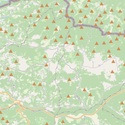
Grožnjan sur la carte

Sources de données et méthodologie

Nos prévisions météo sont alimentées par un fournisseur professionnel de données météorologiques qui agrège les données des services météorologiques nationaux, des observations satellites, des réseaux radar et de plus de 80 000 stations météorologiques dans le monde. Les données de prévision sont mises à jour plusieurs fois par jour. Nous convertissons les données brutes en résumés clairs — vitesse du vent en m/s, pression en mm Hg — afin que vous puissiez planifier votre journée en toute confiance.