Prévisions météo à 5 jours Toronto 17-06-2026

Prévisions météo Toronto mercredi 17 juin 17.06.2026 : pluie éparse possible, température de 15 °C à 19 °C.

Probabilité de précipitations 11%. Vent jusqu'à 5.39 m/s (rafales 8.69 m/s). Humidité de l'air 69–97%, pression atmosphérique 752–755 mm Hg, indice UV jusqu'à 6.7.

Alertes météo

Masquer les alertes
ModerateJun 13, 04:15 PMJun 14, 04:00 AMTraduire avec Google
yellow watch - severe thunderstorm - in effect

thunderstorm — Service Notice – April 2026: The Environment and Climate Change Canada (ECCC) CAP Service undergoes changes from time to time as the business of alerting evolves. For Spring 2026, changes are expected to include... 1) ECCC's initiative to introduce free-form polygons to represent the true threat area of a weather hazard is tentatively set for June 2026 deployment. Data changes will appear in CAP following this deployment, 2) marine alerts will now be issued for smaller zone splits in certain areas of Atlantic and Pacific waters and 3) other minor improvements and corrections. For more information on these changes: https://comm.collab.science.gc.ca/mailman3/hyperkitty/list/dd_info@comm.collab.science.gc.ca/ | Notification de service – avril 2026: Le service du PAC d’Environnement et Changement climatique Canada (ECCC) subit périodiquement des changements à mesure que le système d’alerte évolue. Pour le printemps 2026, il y aura des changements incluant... 1) l’initiative d’ECCC visant à introduire des polygones libres pour représenter la véritable zone de menace d’un danger météorologique devrait être déployée provisoirement en juin 2026. Des changements de données apparaîtront dans le PAC à la suite de ce déploiement, 2) les alertes marines seront désormais émises pour des subdivisions de zones plus petites dans certaines régions des eaux de l’Atlantique et du Pacifique et 3) d’autres améliorations et corrections mineures. Pour plus d’informations sur ces changements: https://comm.collab.science.gc.ca/mailman3/hyperkitty/list/dd_info@comm.collab.science.gc.ca/

Conditions are favourable for the development of severe thunderstorms that may be capable of producing strong wind gusts and large hail. What: Wind gusts up to 90 km/h. Hail up to toonie-sized. When: This afternoon into this evening. ### Local utility outages are possible. Damage to roofs, fences, branches or soft shelters is possible. There is a risk of injury. Severe thunderstorm watches are issued when conditions are favourable for the development of thunderstorms capable of producing damaging hail, wind or rain. Please continue to monitor alerts and forecasts issued by Environment Canada. To report severe weather, send an email to ONstorm@ec.gc.ca or post reports on X using #ONStorm. For more information: https://www.ontario.ca/page/be-prepared-emergency.
When thunder roars, go indoors! Lightning kills and injures Canadians every year. Secure loose objects. Emergency Management Ontario recommends that you take cover immediately if threatening weather approaches.
ModerateJun 13, 11:14 PMJun 14, 02:12 AMTraduire avec Google
yellow warning - severe thunderstorm - in effect

thunderstorm — Service Notice – April 2026: The Environment and Climate Change Canada (ECCC) CAP Service undergoes changes from time to time as the business of alerting evolves. For Spring 2026, changes are expected to include... 1) ECCC's initiative to introduce free-form polygons to represent the true threat area of a weather hazard is tentatively set for June 2026 deployment. Data changes will appear in CAP following this deployment, 2) marine alerts will now be issued for smaller zone splits in certain areas of Atlantic and Pacific waters and 3) other minor improvements and corrections. For more information on these changes: https://comm.collab.science.gc.ca/mailman3/hyperkitty/list/dd_info@comm.collab.science.gc.ca/ | Notification de service – avril 2026: Le service du PAC d’Environnement et Changement climatique Canada (ECCC) subit périodiquement des changements à mesure que le système d’alerte évolue. Pour le printemps 2026, il y aura des changements incluant... 1) l’initiative d’ECCC visant à introduire des polygones libres pour représenter la véritable zone de menace d’un danger météorologique devrait être déployée provisoirement en juin 2026. Des changements de données apparaîtront dans le PAC à la suite de ce déploiement, 2) les alertes marines seront désormais émises pour des subdivisions de zones plus petites dans certaines régions des eaux de l’Atlantique et du Pacifique et 3) d’autres améliorations et corrections mineures. Pour plus d’informations sur ces changements: https://comm.collab.science.gc.ca/mailman3/hyperkitty/list/dd_info@comm.collab.science.gc.ca/

At 7:13 p.m. EDT, Environment Canada meteorologists are tracking a line of severe thunderstorms capable of producing damaging wind gusts, up to quarter size hail and heavy rain. Thunderstorm Location: Steenburg Lake to Norwood to Janetville Motion: Moving east at 50 km/h Hazards: Wind: damaging (90 - 110 km/h) Hail: up to quarter size (up to 2.5 cm) Rain: heavy (15 - 50 mm) Locations in the Path: Lakefield Omemee Peterborough Marmora Campbellford ### Local utility outages are likely. Damage to roofs, fences, soft shelters or trees is likely. Large hail may cause significant damage and injury. Severe thunderstorm warnings are issued when imminent or occurring thunderstorms are expected to produce damaging hail, wind or rain.
Take immediate cover if a thunderstorm approaches. If outside, protect yourself from flying debris and hail. Emergency Management Ontario recommends that you take cover immediately if threatening weather approaches.
ModerateJun 13, 11:14 PMJun 14, 02:12 AMTraduire avec Google
yellow warning - severe thunderstorm - in effect

thunderstorm — Service Notice – April 2026: The Environment and Climate Change Canada (ECCC) CAP Service undergoes changes from time to time as the business of alerting evolves. For Spring 2026, changes are expected to include... 1) ECCC's initiative to introduce free-form polygons to represent the true threat area of a weather hazard is tentatively set for June 2026 deployment. Data changes will appear in CAP following this deployment, 2) marine alerts will now be issued for smaller zone splits in certain areas of Atlantic and Pacific waters and 3) other minor improvements and corrections. For more information on these changes: https://comm.collab.science.gc.ca/mailman3/hyperkitty/list/dd_info@comm.collab.science.gc.ca/ | Notification de service – avril 2026: Le service du PAC d’Environnement et Changement climatique Canada (ECCC) subit périodiquement des changements à mesure que le système d’alerte évolue. Pour le printemps 2026, il y aura des changements incluant... 1) l’initiative d’ECCC visant à introduire des polygones libres pour représenter la véritable zone de menace d’un danger météorologique devrait être déployée provisoirement en juin 2026. Des changements de données apparaîtront dans le PAC à la suite de ce déploiement, 2) les alertes marines seront désormais émises pour des subdivisions de zones plus petites dans certaines régions des eaux de l’Atlantique et du Pacifique et 3) d’autres améliorations et corrections mineures. Pour plus d’informations sur ces changements: https://comm.collab.science.gc.ca/mailman3/hyperkitty/list/dd_info@comm.collab.science.gc.ca/

At 7:13 p.m. EDT, Environment Canada meteorologists are tracking a line of severe thunderstorms capable of producing damaging wind gusts, up to quarter size hail and heavy rain. ### Local utility outages are likely. Damage to roofs, fences, soft shelters or trees is likely. Large hail may cause significant damage and injury. Severe thunderstorm warnings are issued when imminent or occurring thunderstorms are expected to produce damaging hail, wind or rain.
Take immediate cover if a thunderstorm approaches. If outside, protect yourself from flying debris and hail. Emergency Management Ontario recommends that you take cover immediately if threatening weather approaches.
ModerateJun 13, 11:00 PMJun 14, 01:58 AMTraduire avec Google
yellow warning - severe thunderstorm - in effect

thunderstorm — Service Notice – April 2026: The Environment and Climate Change Canada (ECCC) CAP Service undergoes changes from time to time as the business of alerting evolves. For Spring 2026, changes are expected to include... 1) ECCC's initiative to introduce free-form polygons to represent the true threat area of a weather hazard is tentatively set for June 2026 deployment. Data changes will appear in CAP following this deployment, 2) marine alerts will now be issued for smaller zone splits in certain areas of Atlantic and Pacific waters and 3) other minor improvements and corrections. For more information on these changes: https://comm.collab.science.gc.ca/mailman3/hyperkitty/list/dd_info@comm.collab.science.gc.ca/ | Notification de service – avril 2026: Le service du PAC d’Environnement et Changement climatique Canada (ECCC) subit périodiquement des changements à mesure que le système d’alerte évolue. Pour le printemps 2026, il y aura des changements incluant... 1) l’initiative d’ECCC visant à introduire des polygones libres pour représenter la véritable zone de menace d’un danger météorologique devrait être déployée provisoirement en juin 2026. Des changements de données apparaîtront dans le PAC à la suite de ce déploiement, 2) les alertes marines seront désormais émises pour des subdivisions de zones plus petites dans certaines régions des eaux de l’Atlantique et du Pacifique et 3) d’autres améliorations et corrections mineures. Pour plus d’informations sur ces changements: https://comm.collab.science.gc.ca/mailman3/hyperkitty/list/dd_info@comm.collab.science.gc.ca/

At 6:59 p.m. EDT, Environment Canada meteorologists are tracking a line of severe thunderstorms capable of producing damaging wind gusts, up to quarter size hail and heavy rain. Thunderstorm Location: Denbigh to 15 km (16 km) west of Millbridge to Greenbank Motion: Moving east at 50 km/h Hazards: Wind: damaging (90 - 110 km/h) Hail: up to quarter size (up to 2.5 cm) Rain: heavy (15 - 50 mm) Locations in the Path: Lindsay Curve Lake Lakefield Omemee Peterborough Northbrook Marmora Campbellford ### Local utility outages are likely. Damage to roofs, fences, soft shelters or trees is likely. Large hail may cause significant damage and injury. Severe thunderstorm warnings are issued when imminent or occurring thunderstorms are expected to produce damaging hail, wind or rain.
Take immediate cover if a thunderstorm approaches. If outside, protect yourself from flying debris and hail. Emergency Management Ontario recommends that you take cover immediately if threatening weather approaches.
ModerateJun 13, 11:00 PMJun 14, 01:58 AMTraduire avec Google
yellow warning - severe thunderstorm - in effect

thunderstorm — Service Notice – April 2026: The Environment and Climate Change Canada (ECCC) CAP Service undergoes changes from time to time as the business of alerting evolves. For Spring 2026, changes are expected to include... 1) ECCC's initiative to introduce free-form polygons to represent the true threat area of a weather hazard is tentatively set for June 2026 deployment. Data changes will appear in CAP following this deployment, 2) marine alerts will now be issued for smaller zone splits in certain areas of Atlantic and Pacific waters and 3) other minor improvements and corrections. For more information on these changes: https://comm.collab.science.gc.ca/mailman3/hyperkitty/list/dd_info@comm.collab.science.gc.ca/ | Notification de service – avril 2026: Le service du PAC d’Environnement et Changement climatique Canada (ECCC) subit périodiquement des changements à mesure que le système d’alerte évolue. Pour le printemps 2026, il y aura des changements incluant... 1) l’initiative d’ECCC visant à introduire des polygones libres pour représenter la véritable zone de menace d’un danger météorologique devrait être déployée provisoirement en juin 2026. Des changements de données apparaîtront dans le PAC à la suite de ce déploiement, 2) les alertes marines seront désormais émises pour des subdivisions de zones plus petites dans certaines régions des eaux de l’Atlantique et du Pacifique et 3) d’autres améliorations et corrections mineures. Pour plus d’informations sur ces changements: https://comm.collab.science.gc.ca/mailman3/hyperkitty/list/dd_info@comm.collab.science.gc.ca/

At 6:59 p.m. EDT, Environment Canada meteorologists are tracking a line of severe thunderstorms capable of producing damaging wind gusts, up to quarter size hail and heavy rain. ### Local utility outages are likely. Damage to roofs, fences, soft shelters or trees is likely. Large hail may cause significant damage and injury. Severe thunderstorm warnings are issued when imminent or occurring thunderstorms are expected to produce damaging hail, wind or rain.
Take immediate cover if a thunderstorm approaches. If outside, protect yourself from flying debris and hail. Emergency Management Ontario recommends that you take cover immediately if threatening weather approaches.
Lever du soleil 05:35
Coucher du soleil 21:01
Premier Croissant11% illuminé
Lever de la lune 07:49 · Coucher de la lune 23:31
Graphique
Tableau
TempératureRisque de pluieCouverture nuageuseHumiditéPressionVentIndice UV
00:00Météo
Partiellement nuageux
17 °C11% 47%74%754 mm HgSO 222° 3 (5) m/s0
01:00Météo
Pluie éparse possible
16 °C22% (0.07 mm/h)69%77%754 mm HgOSO 238° 3 (4.64) m/s0
02:00Météo
Pluie légère
15 °C79% (1.98 mm/h)94%91%753 mm HgSO 216° 3.11 (4.61) m/s0
03:00Météo
Pluie légère
15 °C75% (0.96 mm/h)99%95%753 mm HgSSE 152° 2.31 (3.33) m/s0
04:00Météo
Brume
15 °C44% (0.11 mm/h)81%96%752 mm HgSE 131° 3.39 (5) m/s0
05:00Météo
Pluie légère
15 °C77% (1.07 mm/h)99%96%752 mm HgSE 143° 3.5 (5.22) m/s0
06:00Météo
Pluie légère
15 °C83% (2.08 mm/h)100%97%752 mm HgSE 144° 3.39 (4.94) m/s0
07:00Météo
Averse de pluie légère
15 °C74% (0.89 mm/h)100%97%752 mm HgSSE 148° 3.81 (5.56) m/s0.1
08:00Météo
Averse de pluie légère
15 °C75% (0.98 mm/h)98%96%752 mm HgSSE 166° 3.81 (5.64) m/s0.3
09:00Météo
Pluie éparse possible
17 °C55% (0.52 mm/h)71%93%752 mm HgSSO 195° 4.19 (6.31) m/s2.1
10:00Météo
Pluie éparse possible
18 °C56% (0.58 mm/h)84%84%752 mm HgSO 218° 5.19 (7.31) m/s3.8
11:00Météo
Pluie éparse possible
18 °C56% (0.67 mm/h)80%82%752 mm HgSO 224° 5.39 (8.28) m/s5.3
12:00Météo
Averse de pluie légère
18 °C48% (0.53 mm/h)72%78%752 mm HgSO 232° 5.11 (8.25) m/s6.7
13:00Météo
Averse de pluie légère
19 °C35% (0.3 mm/h)66%81%752 mm HgOSO 248° 5.19 (8.69) m/s6.4
14:00Météo
Pluie éparse possible
19 °C14% (0.03 mm/h)56%72%752 mm HgOSO 247° 4.89 (8.25) m/s4.3
15:00Météo
Pluie éparse possible
19 °C16% (0.02 mm/h)78%69%752 mm HgOSO 245° 5.31 (6.72) m/s5.8
16:00Météo
Pluie éparse possible
19 °C16% (0.01 mm/h)86%71%752 mm HgOSO 248° 5.19 (6.86) m/s4.5
17:00Météo
Pluie éparse possible
19 °C20% (0.04 mm/h)94%69%753 mm HgOSO 247° 4.69 (6.58) m/s3.1
18:00Météo
Pluie éparse possible
19 °C13% (0.01 mm/h)71%69%752 mm HgOSO 245° 3.81 (5.56) m/s1.6
19:00Météo
Partiellement nuageux
19 °C8% 28%71%753 mm HgOSO 247° 3.81 (5.75) m/s0.6
20:00Météo
Ensoleillé
18 °C8% 21%73%754 mm HgOSO 248° 3.81 (6.03) m/s0.2
21:00Météo
Ensoleillé
17 °C9% 15%78%754 mm HgO 262° 2.61 (4.44) m/s0
22:00Météo
Dégagé
17 °C11% 24%81%755 mm HgO 270° 1.69 (3.03) m/s0
23:00Météo
Partiellement nuageux
17 °C16% 57%82%754 mm HgNNO 328° 0.69 (1.25) m/s0

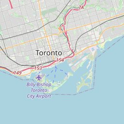
Toronto sur la carte

Sources de données et méthodologie

Nos prévisions météo sont alimentées par un fournisseur professionnel de données météorologiques qui agrège les données des services météorologiques nationaux, des observations satellites, des réseaux radar et de plus de 80 000 stations météorologiques dans le monde. Les données de prévision sont mises à jour plusieurs fois par jour. Nous convertissons les données brutes en résumés clairs — vitesse du vent en m/s, pression en mm Hg — afin que vous puissiez planifier votre journée en toute confiance.