
5 päeva ilmaprognoos Bangkok 15. sept 2026
Ilmaprognoos Bangkok teisipäev 15. sept 2026: nõrk vihmahoog, temperatuur 24 °C kuni 28 °C.
Sademete tõenäosus 87%. Tuul kuni 3.5 m/s (iilid 7.5 m/s). Õhuniiskus 76–97%, õhurõhk 756–759 mm Hg, UV-indeks kuni 4.2.
Ilmahoiatused
Heavy Rain Risk Area
Heavy Rain
The high-pressure system from China cover the upper North and the upper Northeast of Thailand with the monsoon trough lies across the lower Central, the upper South, the upper Gulf and the East into an active low-pressure cell over the coast of middle Vietnam. Meanwhile, the moderate southwest monsoon prevails over the Andaman Sea, the South and the Gulf. Isolated heavy to very heavy rains are likely in the East and the South while isolated heavy rains are possible in the lower Northeast, the lower Central including Bangkok and vicinity. The moderate winds and waves in the upper Andaman Sea are expected about 2 meters high and above 2 meters high in thundershowers.
I
People should beware of heavy to very heavy rains and accumulation that may cause flash floods, overflows and landslides especially along the waterways near foothills and lowlands.
All ships should proceed with caution and keep off thundershowers.
n addition, an active low-pressure cell over the coast of middle Vietnam is expected to intensify to tropical storm and will move near the coast of upper Vietnam during 13-14 September 2026. Please stay tuned for the weather update.
พื้นที่เสี่ยงภัยฝนตกหนักบริเวณประเทศไทย
Heavy Rain
ภาคตะวันออกและภาคใต้มีฝนตกหนักถึงหนักมากบางพื้นที่ ส่วนภาคตะวันออกเฉียงเหนือ ภาคกลาง รวมทั้งกรุงเทพมหานครและปริมณฑลมีฝนตกหนักบางแห่ง
ทั้งนี้เนื่องจากบริเวณความกดอากาศสูงหรือมวลอากาศเย็นแผ่ลงมาปกคลุมภาคเหนือตอนบน และภาคตะวันออกเฉียงเหนือตอนบน ในขณะที่ร่องมรสุมพาดผ่าน
ภาคกลางตอนล่าง ภาคใต้ตอนบน อ่าวไทยตอนบน และภาคตะวันออก เข้าสู่หย่อมความกดอากาศต่ำกำลังแรงบริเวณชายฝั่งประเทศเวียดนามตอนกลาง
ประกอบกับมรสุมตะวันตกเฉียงใต้กำลังปานกลางพัดปกคลุมทะเลอันดามัน ภาคใต้ และอ่าวไทย
สำหรับคลื่นลมบริเวณทะเลอันดามันและอ่าวไทยมีกำลังปานกลาง โดยทะเลอันดามันตอนบนมีคลื่นสูงประมาณ 2 เมตร บริเวณที่มีฝนฟ้าคะนองคลื่นสูงมากกว่า
2 เมตร
ขอให้ประชาชนในบริเวณดังกล่าว ระวังอันตรายจากฝนตกหนักถึงหนักมากและฝนที่ตกสะสมซึ่งอาจทำให้เกิดน้ำท่วมฉับพลัน
และน้ำป่าไหลหลาก รวมทั้งดินโคลนถล่ม โดยเฉพาะพื้นที่ลาดเชิงเขาใกล้ทางน้ำไหลผ่าน และพื้นที่ลุ่ม ควรหลีกเลี่ยงการเดินทางผ่านเส้นทางที่มีปัญหาน้ำท่วมซ้ำซาก
โดยเฉพาะพื้นที่ลุ่มต่ำซึ่งอาจเกิดน้ำท่วมขังในระยะสั้นได้
ขอให้ชาวเรือบริเวณทะเลอันดามันและอ่าวไทยเดินเรือด้วยความระมัดระวัง และหลีกเลี่ยงการเดินเรือในบริเวณที่มีฝนฟ้าคะนอง
อนึ่ง หย่อมความกดอากาศต่ำกำลังแรงบริเวณชายฝั่งประเทศเวียดนามตอนกลาง มีแนวโน้มจะทวีกำลังแรงขึ้นเป็นพายุหมุนเขตร้อน และคาดว่าจะเคลื่อนเข้าใกล้ชายฝั่งประเทศเวียดนามตอนบนในช่วงวันที่ 13-14 ก.ย. 69 ขอให้ประชาชนติดตามข่าวพยากรณ์อากาศอย่างต่อเนื่องในระยะนี้ไว้ด้วย
5 päeva ühe pilguga — puuduta päeva, et see avada
Päikesetõus 06:06
Päikeseloojang 18:19
Kasvav sirp23% valgustatud
Kuutõus 09:37 · Kuuloojang 21:16
Graafik
TabelPrognoos 24 °C kuni 28 °C ja sademed
Pilvisus ja sademete tõenäosus
Tuulekiirus ja -suund
Õhuniiskus
Õhurõhk
Ultraviolettkiirguse indeks
Õhukvaliteet ja õietolm
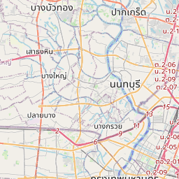
Bangkok kaardil
Andmeallikad ja metoodika
Meie ilmaprognoosid põhinevad professionaalsel ilmaandmete pakkujal, mis koondab andmeid riiklikelt ilmateenistustelt, satelliidivaatlustelt, radarivõrkudelt ja enam kui 80 000 ilmajaamalt üle maailma. Prognoosiandmeid uuendatakse mitu korda päevas. Me teisendame toorandmed selgeteks kokkuvõteteks – tuulekiirus m/s-des, rõhk mmHg-des – et saaksite oma päeva enesekindlalt planeerida.