5 päeva ilmaprognoos Bangkok 01-08-2026
Ilmaprognoos Bangkok laupäev, 1. august 01.08.2026: osaliselt pilves, temperatuur 26 °C kuni 32 °C.
Sademete tõenäosus 52%. Tuul kuni 4.81 m/s (iilid 6.5 m/s). Õhuniiskus 57–78%, õhurõhk 753–756 mm Hg, UV-indeks kuni 11.9.
Ilmahoiatused
Peida hoiatusedHeavy Rain Risk Area
Heavy Rain
The monsoon trough lies across the upper North and upper Northeast while the rather strong southwest monsoon prevails over the Andaman Sea, Thailand and the Gulf. Isolated very heavy rains are forecast in the Northeast and the East while isolated heavy rains are possible in the North, the Central including Bangkok and its vicinity and the South regions.
The rather strong winds force the waves in the upper Andaman Sea up to 2–3 meters high and above 3 meters high in thundershowers. In the lower Andaman Sea and the upper Gulf, the waves are expected to be about 2 meters high and above 2 meters high in thundershowers.
People should beware of heavy to very heavy rains and accumulation that may cause flash floods, overflows and landslides especially along the waterways near foothills and lowlands.
All ships should proceed with caution and keep off thundershowers, small boats in the upper Andaman Sea should keep ashore.
พื้นที่เสี่ยงภัยฝนตกหนักบริเวณประเทศไทย
Heavy Rain
พยากรณ์อากาศ 24 ชั่วโมงข้างหน้า ภาคตะวันออกเฉียงเหนือ และภาคตะวันออก มีฝนตกหนักมากบางแห่ง ส่วนภาคเหนือ ภาคกลาง รวมทั้งกรุงเทพมหานครและปริมณฑล และภาคใต้ มีฝนตกหนักบางพื้นที่ เนื่องจากร่องมรสุมพาดผ่านภาคเหนือตอนบน และภาคตะวันออกเฉียงเหนือตอนบน ประกอบกับมรสุมตะวันตกเฉียงใต้กำลังค่อนข้างแรงพัดปกคลุมทะเลอันดามัน ประเทศไทย และอ่าวไทย
สำหรับคลื่นลมบริเวณทะเลอันดามันตอนบนมีกำลังค่อนข้างแรง โดยมีคลื่นสูง 2-3 เมตร บริเวณที่มีฝนฟ้าคะนองจะมีคลื่นสูงมากกว่า 3 เมตร ส่วนทะเลอันดามันตอนล่างและอ่าวไทยตอนบนมีคลื่นสูงประมาณ 2 เมตร บริเวณที่มีฝนฟ้าคะนองจะมีคลื่นสูงมากกว่า 2 เมตร
ขอให้ประชาชนระวังอันตรายจากฝนตกหนักถึงหนักมากและฝนที่ตกสะสม ซึ่งอาจทำให้เกิดน้ำท่วมฉับพลันและน้ำป่าไหลหลาก โดยเฉพาะพื้นที่ลาดเชิงเขาใกล้ทางน้ำไหลผ่านและพื้นที่ลุ่ม
ขอให้ชาวเรือเดินเรือด้วยความระมัดระวัง และหลีกเลี่ยงการเดินเรือในบริเวณที่มีฝนฟ้าคะนอง ส่วนเรือเล็กบริเวณทะเลอันดามันตอนบนควรงดออกจากฝั่งในระยะนี้ไว้ด้วย
พื้นที่เสี่ยงภัยฝนตกหนักบริเวณประเทศไทย
Heavy Rain
พยากรณ์อากาศ 24 ชั่วโมงข้างหน้า ภาคตะวันออกเฉียงเหนือ และภาคตะวันออก มีฝนตกหนักมากบางแห่ง ส่วนภาคเหนือ ภาคกลาง รวมทั้งกรุงเทพมหานครและปริมณฑล และภาคใต้ มีฝนตกหนักบางพื้นที่ เนื่องจากร่องมรสุมพาดผ่านภาคเหนือตอนบน และภาคตะวันออกเฉียงเหนือตอนบน ประกอบกับมรสุมตะวันตกเฉียงใต้กำลังค่อนข้างแรงพัดปกคลุมทะเลอันดามัน ประเทศไทย และอ่าวไทย
สำหรับคลื่นลมบริเวณทะเลอันดามันตอนบนมีกำลังค่อนข้างแรง โดยมีคลื่นสูง 2-3 เมตร บริเวณที่มีฝนฟ้าคะนองจะมีคลื่นสูงมากกว่า 3 เมตร ส่วนทะเลอันดามันตอนล่างและอ่าวไทยตอนบนมีคลื่นสูงประมาณ 2 เมตร บริเวณที่มีฝนฟ้าคะนองจะมีคลื่นสูงมากกว่า 2 เมตร
ขอให้ประชาชนระวังอันตรายจากฝนตกหนักถึงหนักมากและฝนที่ตกสะสม ซึ่งอาจทำให้เกิดน้ำท่วมฉับพลันและน้ำป่าไหลหลาก โดยเฉพาะพื้นที่ลาดเชิงเขาใกล้ทางน้ำไหลผ่านและพื้นที่ลุ่ม
ขอให้ชาวเรือเดินเรือด้วยความระมัดระวัง และหลีกเลี่ยงการเดินเรือในบริเวณที่มีฝนฟ้าคะนอง ส่วนเรือเล็กบริเวณทะเลอันดามันตอนบนควรงดออกจากฝั่งในระยะนี้ไว้ด้วย
Heavy Rain Risk Area
Heavy Rain
The monsoon trough lies across the upper North and upper Northeast while the rather strong southwest monsoon prevails over the Andaman Sea, Thailand and the Gulf. Isolated very heavy rains are forecast in the Northeast and the East while isolated heavy rains are possible in the North, the Central including Bangkok and its vicinity and the South regions.
The rather strong winds force the waves in the upper Andaman Sea up to 2–3 meters high and above 3 meters high in thundershowers. In the lower Andaman Sea and the upper Gulf, the waves are expected to be about 2 meters high and above 2 meters high in thundershowers.
People should beware of heavy to very heavy rains and accumulation that may cause flash floods, overflows and landslides especially along the waterways near foothills and lowlands.
All ships should proceed with caution and keep off thundershowers, small boats in the upper Andaman Sea should keep ashore.
5 päeva ühe pilguga — puuduta päeva, et see avada
Päikesetõus 06:02
Päikeseloojang 18:46
Kahanev kuu83% valgustatud
Kuutõus 20:44 · Kuuloojang 08:10
Graafik
Tabel
| Temperatuur | Vihma tõenäosus | Pilvisus | Niiskus | Rõhk | Tuul | UV-indeks | ||
|---|---|---|---|---|---|---|---|---|
| 00:00 | Pilves | 27 °C | 17% | 85% | 73% | 755 mm Hg | SW 228° 3.5 (5.28) m/s | 0 |
| 01:00 | Osaliselt pilves | 27 °C | 12% | 56% | 73% | 755 mm Hg | SW 230° 3.81 (5.72) m/s | 0 |
| 02:00 | Kohati kerge vihm võimalik | 27 °C | 21% (0.04 mm/h) | 89% | 73% | 755 mm Hg | SW 234° 3.61 (5.42) m/s | 0 |
| 03:00 | Pilvine | 27 °C | 20% | 95% | 75% | 755 mm Hg | SW 235° 3.11 (4.67) m/s | 0 |
| 04:00 | Pilves | 27 °C | 17% | 78% | 76% | 754 mm Hg | SW 217° 2.5 (3.75) m/s | 0 |
| 05:00 | Pilves | 27 °C | 17% | 78% | 77% | 755 mm Hg | SW 217° 2.5 (3.81) m/s | 0 |
| 06:00 | Osaliselt pilves | 26 °C | 12% | 38% | 78% | 755 mm Hg | SW 216° 2.39 (3.83) m/s | 0 |
| 07:00 | Pilves | 27 °C | 17% | 81% | 76% | 755 mm Hg | SW 217° 2.31 (3.33) m/s | 0.4 |
| 08:00 | Kohati kerge vihm võimalik | 28 °C | 21% (0.05 mm/h) | 100% | 69% | 755 mm Hg | SW 224° 3.31 (4.19) m/s | 1.7 |
| 09:00 | Pilvine | 29 °C | 16% | 100% | 66% | 756 mm Hg | SW 229° 3.39 (4.17) m/s | 2.9 |
| 10:00 | Pilves | 30 °C | 10% | 71% | 63% | 756 mm Hg | WSW 237° 3.19 (3.92) m/s | 4.8 |
| 11:00 | Kohati kerge vihm võimalik | 32 °C | 11% (0.01 mm/h) | 82% | 57% | 755 mm Hg | SW 235° 3.19 (3.67) m/s | 7.5 |
| 12:00 | Nõrk vihmahoog | 31 °C | 52% (0.94 mm/h) | 98% | 60% | 755 mm Hg | SW 229° 3.69 (4.72) m/s | 11.9 |
| 13:00 | Nõrk vihmahoog | 31 °C | 44% (0.76 mm/h) | 83% | 61% | 755 mm Hg | SW 222° 4 (5.56) m/s | 10.5 |
| 14:00 | Nõrk vihmahoog | 31 °C | 49% (0.94 mm/h) | 81% | 63% | 754 mm Hg | SSW 209° 4.69 (5.92) m/s | 6.9 |
| 15:00 | Nõrk vihmahoog | 31 °C | 36% (0.41 mm/h) | 85% | 63% | 753 mm Hg | SSW 209° 4.81 (6.5) m/s | 3.4 |
| 16:00 | Pilves | 31 °C | 10% | 69% | 62% | 753 mm Hg | SSW 207° 4.39 (6.03) m/s | 2.1 |
| 17:00 | Osaliselt pilves | 31 °C | 7% | 48% | 61% | 753 mm Hg | SSW 208° 4.39 (5.69) m/s | 0.8 |
| 18:00 | Osaliselt pilves | 31 °C | 6% | 39% | 62% | 753 mm Hg | SW 216° 3.61 (4.97) m/s | 0.1 |
| 19:00 | Osaliselt pilves | 30 °C | 7% | 37% | 66% | 754 mm Hg | SW 228° 3.31 (4.89) m/s | 0 |
| 20:00 | Selge | 29 °C | 6% | 23% | 68% | 755 mm Hg | WSW 238° 3.11 (4.39) m/s | 0 |
| 21:00 | Osaliselt pilves | 29 °C | 7% | 34% | 68% | 755 mm Hg | WSW 247° 2.89 (4.11) m/s | 0 |
| 22:00 | Osaliselt pilves | 28 °C | 8% | 40% | 68% | 755 mm Hg | WSW 237° 2.5 (3.64) m/s | 0 |
| 23:00 | Osaliselt pilves | 28 °C | 8% | 36% | 69% | 755 mm Hg | WSW 239° 2.61 (3.78) m/s | 0 |
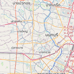
Bangkok kaardil
Andmeallikad ja metoodika
Meie ilmaprognoosid põhinevad professionaalsel ilmaandmete pakkujal, mis koondab andmeid riiklikelt ilmateenistustelt, satelliidivaatlustelt, radarivõrkudelt ja enam kui 80 000 ilmajaamalt üle maailma. Prognoosiandmeid uuendatakse mitu korda päevas. Me teisendame toorandmed selgeteks kokkuvõteteks – tuulekiirus m/s-des, rõhk mmHg-des – et saaksite oma päeva enesekindlalt planeerida.