5 päeva ilmaprognoos San Diego 28-07-2026

Ilmaprognoos San Diego täna 28.07.2026: päikesepaisteline, temperatuur 20 °C kuni 27 °C.

Sademete tõenäosus 33%. Tuul kuni 4.11 m/s (iilid 4.72 m/s). Õhuniiskus 60–96%, õhurõhk 757–759 mm Hg, UV-indeks kuni 10.4.

Ilmahoiatused

Peida hoiatused
Minor27. juuli, 13:3627. juuli, 21:45Tõlgi Google'iga
Coastal Flood Advisory issued July 27 at 1:36PM PDT until August 1 at 3:00AM PDT by NWS San Diego CA

Coastal Flood Advisory

* WHAT...For the Beach Hazards Statement, 3-6 feet with sets to 7 feet expected. For the Coastal Flood Advisory, minor coastal flooding expected. For the High Surf Advisory, large breaking waves of 5-8 feet with sets up to 9 feet on south-southwest facing beaches and 3-6 feet on west-facing beaches. * WHERE...San Diego County Coastal Areas and Orange County Coastal Areas. * WHEN...For the Beach Hazards Statement, through Wednesday afternoon. For the Coastal Flood Advisory, from 5 PM Wednesday to 3 AM PDT Saturday. For the High Surf Advisory, from 5 PM Wednesday to 5 PM PDT Saturday. * IMPACTS...Flooding of lots, parks, and roads with only isolated road closures expected. Dangerous swimming and surfing conditions and localized beach erosion. Breaking waves can sweep people off jetties and docks, and into dangerous seas. * ADDITIONAL DETAILS...A long period southerly swell of 3 feet at 17 seconds continues through Wednesday. A higher amplitude swell associated with Hurricane Genevieve of around 5 feet at 14 seconds builds late Wednesday into Thursday. Swell and associated surf look to subside late Saturday into Sunday. Also, the following are the evening high tides for La Jolla: Wednesday: 6.11 ft at 9:36 PM PDT Thursday: 5.96 ft at 10:08 PM PDT Friday: 5.65 ft at 10:41 PM PDT Note, tides have been chronically underpredicted this summer, with observed tides at La Jolla generally 0.3-0.4 ft higher than these predictions.
Inexperienced swimmers should remain out of the water due to dangerous surf conditions.
Minor27. juuli, 13:3627. juuli, 21:45Tõlgi Google'iga
High Surf Advisory issued July 27 at 1:36PM PDT until August 1 at 5:00PM PDT by NWS San Diego CA

High Surf Advisory

* WHAT...For the Beach Hazards Statement, 3-6 feet with sets to 7 feet expected. For the Coastal Flood Advisory, minor coastal flooding expected. For the High Surf Advisory, large breaking waves of 5-8 feet with sets up to 9 feet on south-southwest facing beaches and 3-6 feet on west-facing beaches. * WHERE...San Diego County Coastal Areas and Orange County Coastal Areas. * WHEN...For the Beach Hazards Statement, through Wednesday afternoon. For the Coastal Flood Advisory, from 5 PM Wednesday to 3 AM PDT Saturday. For the High Surf Advisory, from 5 PM Wednesday to 5 PM PDT Saturday. * IMPACTS...Flooding of lots, parks, and roads with only isolated road closures expected. Dangerous swimming and surfing conditions and localized beach erosion. Breaking waves can sweep people off jetties and docks, and into dangerous seas. * ADDITIONAL DETAILS...A long period southerly swell of 3 feet at 17 seconds continues through Wednesday. A higher amplitude swell associated with Hurricane Genevieve of around 5 feet at 14 seconds builds late Wednesday into Thursday. Swell and associated surf look to subside late Saturday into Sunday. Also, the following are the evening high tides for La Jolla: Wednesday: 6.11 ft at 9:36 PM PDT Thursday: 5.96 ft at 10:08 PM PDT Friday: 5.65 ft at 10:41 PM PDT Note, tides have been chronically underpredicted this summer, with observed tides at La Jolla generally 0.3-0.4 ft higher than these predictions.
Inexperienced swimmers should remain out of the water due to dangerous surf conditions.
Moderate27. juuli, 13:3627. juuli, 21:45Tõlgi Google'iga
Beach Hazards Statement issued July 27 at 1:36PM PDT until July 29 at 5:00PM PDT by NWS San Diego CA

Beach Hazards Statement

* WHAT...For the Beach Hazards Statement, 3-6 feet with sets to 7 feet expected. For the Coastal Flood Advisory, minor coastal flooding expected. For the High Surf Advisory, large breaking waves of 5-8 feet with sets up to 9 feet on south-southwest facing beaches and 3-6 feet on west-facing beaches. * WHERE...San Diego County Coastal Areas and Orange County Coastal Areas. * WHEN...For the Beach Hazards Statement, through Wednesday afternoon. For the Coastal Flood Advisory, from 5 PM Wednesday to 3 AM PDT Saturday. For the High Surf Advisory, from 5 PM Wednesday to 5 PM PDT Saturday. * IMPACTS...Flooding of lots, parks, and roads with only isolated road closures expected. Dangerous swimming and surfing conditions and localized beach erosion. Breaking waves can sweep people off jetties and docks, and into dangerous seas. * ADDITIONAL DETAILS...A long period southerly swell of 3 feet at 17 seconds continues through Wednesday. A higher amplitude swell associated with Hurricane Genevieve of around 5 feet at 14 seconds builds late Wednesday into Thursday. Swell and associated surf look to subside late Saturday into Sunday. Also, the following are the evening high tides for La Jolla: Wednesday: 6.11 ft at 9:36 PM PDT Thursday: 5.96 ft at 10:08 PM PDT Friday: 5.65 ft at 10:41 PM PDT Note, tides have been chronically underpredicted this summer, with observed tides at La Jolla generally 0.3-0.4 ft higher than these predictions.
Inexperienced swimmers should remain out of the water due to dangerous surf conditions.
Minor27. juuli, 21:1128. juuli, 13:15Tõlgi Google'iga
High Surf Advisory issued July 27 at 9:11PM PDT until August 1 at 5:00PM PDT by NWS San Diego CA

High Surf Advisory

* WHAT...For the Beach Hazards Statement, 3-6 feet with sets to 7 feet expected. For the Coastal Flood Advisory, minor coastal flooding expected. For the High Surf Advisory, large breaking waves of 5-8 feet with sets up to 9 feet on south-southwest facing beaches and 3-6 feet on west-facing beaches. * WHERE...San Diego County Coastal Areas and Orange County Coastal Areas. * WHEN...For the Beach Hazards Statement, through Wednesday afternoon. For the Coastal Flood Advisory, from 5 PM Wednesday to 3 AM PDT Saturday. For the High Surf Advisory, from 5 PM Wednesday to 5 PM PDT Saturday. * IMPACTS...Flooding of lots, parks, and roads with only isolated road closures expected. Dangerous swimming and surfing conditions and localized beach erosion. Breaking waves can sweep people off jetties and docks, and into dangerous seas. * ADDITIONAL DETAILS...A long period southerly swell of 3 feet at 17 seconds continues through Wednesday. A higher amplitude swell associated with Hurricane Genevieve of around 5 feet at 14 seconds builds late Wednesday into Thursday. Swell and associated surf look to subside late Saturday into Sunday.
If travel is required, allow extra time as some roads may be closed. Do not drive around barricades or through water of unknown depth. Take the necessary actions to protect flood-prone property. Inexperienced swimmers should remain out of the water due to dangerous surf conditions. Remain out of the water to avoid hazardous swimming conditions.
Moderate27. juuli, 21:1128. juuli, 13:15Tõlgi Google'iga
Beach Hazards Statement issued July 27 at 9:11PM PDT until July 29 at 5:00PM PDT by NWS San Diego CA

Beach Hazards Statement

* WHAT...For the Beach Hazards Statement, 3-6 feet with sets to 7 feet expected. For the Coastal Flood Advisory, minor coastal flooding expected. For the High Surf Advisory, large breaking waves of 5-8 feet with sets up to 9 feet on south-southwest facing beaches and 3-6 feet on west-facing beaches. * WHERE...San Diego County Coastal Areas and Orange County Coastal Areas. * WHEN...For the Beach Hazards Statement, through Wednesday afternoon. For the Coastal Flood Advisory, from 5 PM Wednesday to 3 AM PDT Saturday. For the High Surf Advisory, from 5 PM Wednesday to 5 PM PDT Saturday. * IMPACTS...Flooding of lots, parks, and roads with only isolated road closures expected. Dangerous swimming and surfing conditions and localized beach erosion. Breaking waves can sweep people off jetties and docks, and into dangerous seas. * ADDITIONAL DETAILS...A long period southerly swell of 3 feet at 17 seconds continues through Wednesday. A higher amplitude swell associated with Hurricane Genevieve of around 5 feet at 14 seconds builds late Wednesday into Thursday. Swell and associated surf look to subside late Saturday into Sunday.
If travel is required, allow extra time as some roads may be closed. Do not drive around barricades or through water of unknown depth. Take the necessary actions to protect flood-prone property. Inexperienced swimmers should remain out of the water due to dangerous surf conditions. Remain out of the water to avoid hazardous swimming conditions.
5 päeva ühe pilguga — puuduta päeva, et see avada
Päikesetõus 06:00
Päikeseloojang 19:50
Täiskuu100% valgustatud
Kuutõus 19:47 · Kuuloojang 05:14
Graafik
Tabel
T, 28. juuli 2026
TemperatuurVihma tõenäosusPilvisusNiiskusRõhkTuulUV-indeks
00:00Ilm
Pilvine
21 °C31% 100%92%759 mm HgSSW 202° 1.89 (2.44) m/s0
01:00Ilm
Pilvine
21 °C31% 100%93%759 mm HgSSW 206° 1.89 (2.53) m/s0
02:00Ilm
Vine
21 °C32% 100%94%758 mm HgSSW 209° 1.61 (2.11) m/s0
03:00Ilm
Pilvine
21 °C33% 100%83%758 mm HgS 189° 2 (2.64) m/s0
04:00Ilm
Vine
20 °C33% 100%96%758 mm HgSSW 207° 2.11 (2.81) m/s0
05:00Ilm
Vine
20 °C33% 100%96%758 mm HgSSW 201° 1.81 (2.36) m/s0
06:00Ilm
Vine
20 °C33% 100%96%758 mm HgSSW 194° 2.11 (2.75) m/s0
07:00Ilm
Vine
20 °C33% 100%96%758 mm HgSSW 193° 2 (2.53) m/s0.4
08:00Ilm
Pilvine
20 °C32% 100%94%759 mm HgS 186° 2.61 (3.14) m/s1.3
09:00Ilm
Pilvine
21 °C31% 100%92%758 mm HgSSW 199° 2.5 (2.89) m/s3.1
10:00Ilm
Pilvine
22 °C30% 100%91%759 mm HgSSW 208° 3.19 (3.67) m/s5.5
11:00Ilm
Pilvine
22 °C32% 100%93%759 mm HgSW 216° 3.5 (4.03) m/s8.2
12:00Ilm
Pilvine
23 °C27% 100%86%758 mm HgSW 221° 3.81 (4.36) m/s9.8
13:00Ilm
Pilves
25 °C18% 71%81%758 mm HgSW 227° 3.89 (4.5) m/s10.4
14:00Ilm
Osaliselt pilves
27 °C9% 33%74%758 mm HgSW 232° 4.11 (4.72) m/s9.6
15:00Ilm
Päikesepaisteline
26 °C3% 0%60%758 mm HgSW 236° 4 (4.61) m/s7.5
16:00Ilm
Päikesepaisteline
25 °C4% 0%61%758 mm HgWSW 237° 3.61 (4.14) m/s4.8
17:00Ilm
Päikesepaisteline
25 °C4% 0%62%757 mm HgSW 233° 3.61 (4.14) m/s2.5
18:00Ilm
Päikesepaisteline
24 °C4% 0%63%757 mm HgSW 232° 3 (3.44) m/s0.9
19:00Ilm
Päikesepaisteline
24 °C4% 0%64%757 mm HgSW 227° 2.5 (2.89) m/s0.2
20:00Ilm
Selge
23 °C5% 0%66%758 mm HgSW 221° 1.89 (2.33) m/s0
21:00Ilm
Selge
23 °C5% 0%67%758 mm HgSSW 206° 1.81 (2.25) m/s0
22:00Ilm
Selge
23 °C5% 0%68%758 mm HgSSW 205° 2.19 (2.75) m/s0
23:00Ilm
Selge
23 °C6% 0%71%758 mm HgSSW 207° 2.31 (2.92) m/s0
T, 28. juuli 2026

Korduma kippuvad küsimused San Diego 5 päeva ilma kohta

Järgmise 5 päeva jooksul on temperatuur San Diego umbes 20 kuni 28 °C. Iga 5 päeva üksikasjalikku tunniprognoosi vaata ülal olevatelt graafikutelt.

Sademete tõenäosus San Diego ulatub järgmise 5 päeva jooksul 33%-ni. Ülal olevalt 5 päeva sademetegraafikult näed täpselt, millistel päevadel ja tundidel sajab.

5 päeva prognoos on üsna usaldusväärne: esimesed 2–3 päeva on tavaliselt väga täpsed, päevad 4–5 võivad täpsustuda. Andmeid uuendatakse mitu korda päevas, seega vaata enne tähtsaid plaane uuesti.

Järgmise 5 päeva jooksul kõigub temperatuur San Diego umbes 20 kuni 28 °C. Kõige soojemat ja jahedamat päeva saad võrrelda ülal oleval temperatuurigraafikul.

Järgmise 5 päeva jooksul tugevneb tuul San Diego kuni 5 m/s. Kõige tuulisemad päevad on ülal oleval tuulegraafikul hästi näha.

Jalutuskäiguks või reisiks vali väikseima sajutõenäosusega (kuni 33%) ja nõrga tuulega päevad – neid on lihtne võrrelda ülal olevatel 5 päeva graafikutel.

Esimesed 2–3 päeva on kindlateks otsusteks piisavalt usaldusväärsed, päevad 4–5 on juhis, mis lähenedes täpsustub. Prognoosi uuendatakse mitu korda päevas, seega vaata enne tähtsaid plaane uuesti.

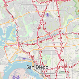
San Diego kaardil

Andmeallikad ja metoodika

Meie ilmaprognoosid põhinevad professionaalsel ilmaandmete pakkujal, mis koondab andmeid riiklikelt ilmateenistustelt, satelliidivaatlustelt, radarivõrkudelt ja enam kui 80 000 ilmajaamalt üle maailma. Prognoosiandmeid uuendatakse mitu korda päevas. Me teisendame toorandmed selgeteks kokkuvõteteks – tuulekiirus m/s-des, rõhk mmHg-des – et saaksite oma päeva enesekindlalt planeerida.