
Pronóstico del tiempo a 5 días Los Angeles 8 oct 2026

33°26° · Soleado

Pronóstico del tiempo Los Angeles jueves 8 oct 2026: soleado, temperatura de 26 °C a 33 °C.

Probabilidad de precipitaciones 3%. Viento de hasta 5.11 m/s (ráfagas 10 m/s). Humedad del aire 28–56%, presión atmosférica 756–758 mm Hg, índice UV de hasta 7.2.

Alertas meteorológicas

Severe4 oct, 21:10 — 5 oct, 06:15Traducir con Google
Extreme Heat Warning issued October 4 at 9:10PM PDT until October 8 at 8:00PM PDT by NWS San Diego CA

Extreme Heat Warning

* WHAT...Dangerously hot conditions with high temperatures ranging from the mid 80s to mid 90s at the beaches to the upper 90s for the inland coastal areas and warm nights with lows in the 70s. * WHERE...Orange County Coastal Areas. * WHEN...Until 8 PM PDT Thursday. * IMPACTS...Heat related illnesses increase significantly during extreme heat events.
Drink plenty of fluids, stay in an air-conditioned room, stay out of the sun, and check up on relatives and neighbors. Do not leave young children and pets in unattended vehicles. Car interiors will reach lethal temperatures in a matter of minutes.
Severe4 oct, 21:10 — 5 oct, 06:15Traducir con Google
Extreme Heat Warning issued October 4 at 9:10PM PDT until October 8 at 8:00PM PDT by NWS San Diego CA

Extreme Heat Warning

* WHAT...Dangerously hot conditions with high temperatures 90 to 100 and warm nights with lows in the low to mid 70s. * WHERE...Santa Ana Mountains and Foothills. * WHEN...Until 8 PM PDT Thursday. * IMPACTS...Heat related illnesses increase significantly during extreme heat events.
Drink plenty of fluids, stay in an air-conditioned room, stay out of the sun, and check up on relatives and neighbors. Do not leave young children and pets in unattended vehicles. Car interiors will reach lethal temperatures in a matter of minutes.
Severe4 oct, 21:10 — 5 oct, 06:15Traducir con Google
Extreme Heat Warning issued October 4 at 9:10PM PDT until October 8 at 8:00PM PDT by NWS San Diego CA

Extreme Heat Warning

* WHAT...Dangerously hot conditions with high temperatures in the mid 90s to 103 and warm nights with low temperatures in the 70s. * WHERE...Orange County Inland Areas. * WHEN...Until 8 PM PDT Thursday. * IMPACTS...Heat related illnesses increase significantly during extreme heat events.
Drink plenty of fluids, stay in an air-conditioned room, stay out of the sun, and check up on relatives and neighbors. Do not leave young children and pets in unattended vehicles. Car interiors will reach lethal temperatures in a matter of minutes.
Severe5 oct, 03:19 — 5 oct, 15:45Traducir con Google
Extreme Heat Warning issued October 5 at 3:19AM PDT until October 8 at 8:00PM PDT by NWS San Diego CA

Extreme Heat Warning

* WHAT...Dangerously hot conditions with high temperatures in the upper 90s to 103. Nights will be very warm with low temperatures in the lower to mid 70s. * WHERE...Orange County Inland Areas. * WHEN...Until 8 PM PDT Thursday. * IMPACTS...Heat related illnesses increase significantly during extreme heat events.
Drink plenty of fluids, stay in an air-conditioned room, stay out of the sun, and check up on relatives and neighbors. Do not leave young children and pets in unattended vehicles. Car interiors will reach lethal temperatures in a matter of minutes.
Severe5 oct, 03:19 — 5 oct, 15:45Traducir con Google
Extreme Heat Warning issued October 5 at 3:19AM PDT until October 8 at 8:00PM PDT by NWS San Diego CA

Extreme Heat Warning

* WHAT...Dangerously hot conditions with high temperatures 90s. Nights will be very warm with low temperatures in the upper 60s to mid 70s. * WHERE...Santa Ana Mountains and Foothills. * WHEN...Until 8 PM PDT Thursday. * IMPACTS...Heat related illnesses increase significantly during extreme heat events.
Drink plenty of fluids, stay in an air-conditioned room, stay out of the sun, and check up on relatives and neighbors. Do not leave young children and pets in unattended vehicles. Car interiors will reach lethal temperatures in a matter of minutes.
Los 5 días de un vistazo — toca un día para abrirlo
Amanecer 06:52
Atardecer 18:28
Luna menguante4% iluminada
Salida de la luna 04:36 · Puesta de la luna 17:14
Gráfico
Tabla

Pronóstico de 26 °C a 33 °C y precipitaciones

Temperatura & Precipitaciones
Hora00:0001:0002:0003:0004:0005:0006:0007:0008:0009:0010:0011:0012:0013:0014:0015:0016:0017:0018:0019:0020:0021:0022:0023:00
Temperatura (°C)272727262626262626272930323333323030292827272626
Precipitaciones (mm/h)000000000000000000000000

Nubosidad y probabilidad de precipitaciones

Nubosidad & Probabilidad de lluvia
Hora00:0001:0002:0003:0004:0005:0006:0007:0008:0009:0010:0011:0012:0013:0014:0015:0016:0017:0018:0019:0020:0021:0022:0023:00
Nubosidad (%)000000000000000000000010
Probabilidad de lluvia (%)222222232211000011111122

Velocidad y dirección del viento

Viento & Ráfaga de viento
Hora00:0001:0002:0003:0004:0005:0006:0007:0008:0009:0010:0011:0012:0013:0014:0015:0016:0017:0018:0019:0020:0021:0022:0023:00
Viento (m/s)1.1910.811.111.111.111.311.311.1910.891.392.193.314.555.114.313.613.192.812.392.111.89
Ráfaga de viento (m/s)1.2243.814.116.111.111.391.426.1943.894.397.196.317.5108.114.694.113.3936.396.116.89
Dirección del viento (°)S 191°SSO 204°SSO 198°SSO 213°SO 233°OSO 249°SO 232°SO 221°SO 217°SSO 208°SSO 203°SO 215°SO 223°SO 230°OSO 237°OSO 243°OSO 248°OSO 242°OSO 237°SO 228°SO 227°SO 226°SO 222°SO 226°

Humedad del aire

Humedad
Hora00:0001:0002:0003:0004:0005:0006:0007:0008:0009:0010:0011:0012:0013:0014:0015:0016:0017:0018:0019:0020:0021:0022:0023:00
Humedad (%)515353535454555655504437312828313436384244474950

Presión atmosférica

Presión
Hora00:0001:0002:0003:0004:0005:0006:0007:0008:0009:0010:0011:0012:0013:0014:0015:0016:0017:0018:0019:0020:0021:0022:0023:00
Presión (mm Hg)757757757757757757757757758758758758758757756756756756756756757757758758

Índice ultravioleta

Índice UV
Hora00:0001:0002:0003:0004:0005:0006:0007:0008:0009:0010:0011:0012:0013:0014:0015:0016:0017:0018:0019:0020:0021:0022:0023:00
Índice UV000000000.31.335.16.77.26.44.62.50.90.200000

Calidad del aire y polen

La calidad del aire solo está disponible para los tres primeros días.

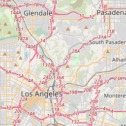
Los Angeles en el mapa
Fuentes de datos y metodología

Nuestros pronósticos meteorológicos se basan en un proveedor profesional de datos meteorológicos que agrega datos de servicios meteorológicos nacionales, observaciones satelitales, redes de radar y más de 80 000 estaciones meteorológicas en todo el mundo. Los datos de pronóstico se actualizan varias veces al día. Convertimos los datos en bruto en resúmenes claros — velocidad del viento en m/s, presión en mm Hg — para que pueda planificar su día con confianza.