Pronóstico del tiempo a 5 días Los Angeles 7 nov 2026

29°16° · Soleado

Pronóstico del tiempo Los Angeles mañana 7 nov 2026: soleado, temperatura de 16 °C a 29 °C.

Probabilidad de precipitaciones 1%. Viento de hasta 3.31 m/s (ráfagas 6.81 m/s). Humedad del aire 11–41%, presión atmosférica 761–763 mm Hg, índice UV de hasta 4.5.

Alertas meteorológicas

Severe5 nov, 13:36 — 6 nov, 14:00Traducir con Google
Red Flag Warning issued November 5 at 1:36PM PST until November 7 at 6:00PM PST by NWS Los Angeles/Oxnard CA

Red Flag Warning

...RISK FOR RAPID FIRE GROWTH AND EXTREME FIRE BEHAVIOR WITH ANY NEW FIRE STARTS, ESPECIALLY LATE FRIDAY NIGHT THROUGH SATURDAY... .Weak to moderate Santa Ana winds will be on the increase, peaking on Saturday. During the peak, gusts of 30 to 45 mph will be common in the typical wind-prone areas of Los Angeles and Ventura Counties. Meanwhile, the air will warm and dry, with minimum humidities in the 8 to 20 percent range common by Saturday. Fuels remain critically dry despite some minor greenup from recent rains. There is a high risk for fast-moving fires where the plants are driest and the winds are strongest, which this targeted Red Flag Warning addresses. The National Weather Service in Los Angeles/Oxnard has issued a Red Flag Warning for wind and low relative humidity, which is in effect from 2 AM to 6 PM PST Saturday. * AFFECTED AREA...Santa Clarita Valley, Santa Monica Mountains Recreational Area, Santa Susana Mountains and Western San Gabriel Mountains. * TIMING...From 2 AM to 6 PM PST Saturday. * WINDS...Periods of northeast 20 to 30 mph with gusts to 45 mph. Isolated gusts of 45 to 55 mph possible. * RELATIVE HUMIDITY...Minimums of 8 to 20 percent. Poor overnight recoveries. * IMPACTS...If fire ignition occurs, conditions are favorable for extreme fire behavior which would threaten life and property.
Moderate5 nov, 14:56 — 6 nov, 15:00Traducir con Google
Beach Hazards Statement issued November 5 at 2:56PM PST until November 10 at 12:00PM PST by NWS Los Angeles/Oxnard CA

Beach Hazards Statement

* WHAT...Dangerous rip currents and breaking waves due to elevated surf up to 4 to 6 feet expected. * WHERE...Catalina and Santa Barbara Islands, Santa Barbara County South Coast, Malibu Coast and Los Angeles County Beaches. * WHEN...From late tonight through Tuesday morning. * IMPACTS...There is an increased risk of ocean drowning. Rip currents can pull swimmers and surfers out to sea. Waves can wash people off beaches and rocks, and capsize small boats nearshore. Pooling of sea water is possible around high tide at beach and harbor areas that is uncommon with normal tidal ranges. Enhanced beach erosion is also possible. * ADDITIONAL DETAILS...High tides of 7.2 to 7.6 feet (MLLW) are expected each morning. Surf and coastal flooding impacts peak on Monday, when it is possible that a Coastal Flood Advisory is need.
Los 5 días de un vistazo — toca un día para abrirlo
Amanecer 06:18
Atardecer 16:55
Luna nueva2% iluminada
Salida de la luna 04:44 · Puesta de la luna 15:45
Gráfico
Tabla

Pronóstico de 16 °C a 29 °C y precipitaciones

Temperatura & Precipitaciones
Hora00:0001:0002:0003:0004:0005:0006:0007:0008:0009:0010:0011:0012:0013:0014:0015:0016:0017:0018:0019:0020:0021:0022:0023:00
Temperatura (°C)221822211621211622232426272929282625242224242024
Precipitaciones (mm/h)000000000000000000000000

Nubosidad y probabilidad de precipitaciones

Nubosidad & Probabilidad de lluvia
Hora00:0001:0002:0003:0004:0005:0006:0007:0008:0009:0010:0011:0012:0013:0014:0015:0016:0017:0018:0019:0020:0021:0022:0023:00
Nubosidad (%)510000000000000000000000
Probabilidad de lluvia (%)110010010000000000011010

Velocidad y dirección del viento

Viento & Ráfaga de viento
Hora00:0001:0002:0003:0004:0005:0006:0007:0008:0009:0010:0011:0012:0013:0014:0015:0016:0017:0018:0019:0020:0021:0022:0023:00
Viento (m/s)1.51.812.312.111.311.611.811.611.51.390.611.311.611.392.813.312.813.112.50.690.891.111.191.19
Ráfaga de viento (m/s)1.53.56.312.112.361.616.812.971.891.8131.722.113.866.816.315.673.643.312.581.111.222.391.22
Dirección del viento (°)N 10°N 10°NNO 339°NNO 342°N 10°N 9°N 357°NNE 16°N 6°N 352°N 355°NO 306°O 275°OSO 244°OSO 238°OSO 239°OSO 245°OSO 252°O 265°NNO 347°N 355°NNE 13°NNE 17°NNE 21°

Humedad del aire

Humedad
Hora00:0001:0002:0003:0004:0005:0006:0007:0008:0009:0010:0011:0012:0013:0014:0015:0016:0017:0018:0019:0020:0021:0022:0023:00
Humedad (%)223320203821224120182315131411132124293931263521

Presión atmosférica

Presión
Hora00:0001:0002:0003:0004:0005:0006:0007:0008:0009:0010:0011:0012:0013:0014:0015:0016:0017:0018:0019:0020:0021:0022:0023:00
Presión (mm Hg)762762761761762761762763763763763762762761761761761761762762762762763762

Índice ultravioleta

Índice UV
Hora00:0001:0002:0003:0004:0005:0006:0007:0008:0009:0010:0011:0012:0013:0014:0015:0016:0017:0018:0019:0020:0021:0022:0023:00
Índice UV000000000.61.634.14.53.92.71.40.40000000

Calidad del aire y polen

Calidad del aire
Hora00:0001:0002:0003:0004:0005:0006:0007:0008:0009:0010:0011:0012:0013:0014:0015:0016:0017:0018:0019:0020:0021:0022:0023:00
PM2.5 (µg/m³)9.59.49.39.39.29.29.610.511.811.47.15.45.25.15.15.36.27.27.27.58.39.411.113.2
PM10 (µg/m³)9.99.89.69.59.59.59.810.812.111.97.65.95.75.65.65.86.77.57.57.88.69.711.413.5
Ozono (O₃) (µg/m³)161716141296922405874899910210093785840261340
NO₂ (µg/m³)47.444.642.339.8383838.637.53326.720.715.210.176.58.112.119.729.839.347.755.661.464.2
SO₂ (µg/m³)1.61.51.41.21.21.31.51.61.61.61.82.32.93.43.63.63.53.12.62.22222
CO (µg/m³)241239228216219255306330304252206177154140134138156202264307317309297282

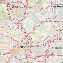
Los Angeles en el mapa

Fuentes de datos y metodología

Nuestros pronósticos meteorológicos se basan en un proveedor profesional de datos meteorológicos que agrega datos de servicios meteorológicos nacionales, observaciones satelitales, redes de radar y más de 80 000 estaciones meteorológicas en todo el mundo. Los datos de pronóstico se actualizan varias veces al día. Convertimos los datos en bruto en resúmenes claros — velocidad del viento en m/s, presión en mm Hg — para que pueda planificar su día con confianza.