Pronóstico del tiempo a 5 días Kali 25 nov 2026

11°6° · Llovizna ligera

Pronóstico del tiempo Kali miércoles 25 nov 2026: llovizna ligera, temperatura de 6 °C a 11 °C.

Probabilidad de precipitaciones 65%. Viento de hasta 8 m/s (ráfagas 16.17 m/s). Humedad del aire 41–79%, presión atmosférica 759–770 mm Hg, índice UV de hasta 2.

Alertas meteorológicas

Moderate21 nov, 06:43 — 22 nov, 23:59Traducir con Google
Yellow wind warning
SE wind increasing to strong or near gale force, veering to southwesterly by the end of the day. Maximum wind gusts 35-40 knots (65-75 km/h)
IMPACT: Although rather usual in this region, locally or potentially dangerous wind speeds are expected to produce dangerous wave conditions to small crafts. Inexperienced mariners, especially those operating smaller vessels, should avoid navigating in these conditions. Mariners should pay close attention to the marine forecast and consider wind and sea conditions in planning. It is possible that some ferry lines will not operate so follow traffic information if travelling.
Moderate21 nov, 06:43 — 22 nov, 23:59Traducir con Google
Yellow wind warning
SE wind increasing to strong or near gale force, veering to southwesterly by the end of the day. Maximum wind gusts 35-40 knots (65-75 km/h)
IMPACT: Although rather usual in this region, locally or potentially dangerous wind speeds are expected to produce dangerous wave conditions to small crafts. Inexperienced mariners, especially those operating smaller vessels, should avoid navigating in these conditions. Mariners should pay close attention to the marine forecast and consider wind and sea conditions in planning. It is possible that some ferry lines will not operate so follow traffic information if travelling.
Moderate21 nov, 06:43 — 22 nov, 23:59Traducir con Google
Yellow wind warning
SE wind increasing to strong or near gale force, veering to southwesterly and northwesterly by the end of the day. Maximum wind gusts 35-40 knots (65-75 km/h)
IMPACT: Although rather usual in this region, locally or potentially dangerous wind speeds are expected to produce dangerous wave conditions to small crafts. Inexperienced mariners, especially those operating smaller vessels, should avoid navigating in these conditions. Mariners should pay close attention to the marine forecast and consider wind and sea conditions in planning. It is possible that some ferry lines will not operate so follow traffic information if travelling.
Moderate21 nov, 06:43 — 22 nov, 23:59Traducir con Google
Yellow wind warning
SE wind increasing to strong or near gale force, veering to southwesterly and northwesterly by the end of the day. Maximum wind gusts 35-40 knots (65-75 km/h)
IMPACT: Although rather usual in this region, locally or potentially dangerous wind speeds are expected to produce dangerous wave conditions to small crafts. Inexperienced mariners, especially those operating smaller vessels, should avoid navigating in these conditions. Mariners should pay close attention to the marine forecast and consider wind and sea conditions in planning. It is possible that some ferry lines will not operate so follow traffic information if travelling.
Moderate21 nov, 06:43 — 22 nov, 23:59Traducir con Google
Yellow wind warning
SE wind increasing to strong or near gale force, veering to southwesterly and northwesterly by the end of the day. Maximum wind gusts 35-40 knots (65-75 km/h)
IMPACT: Although rather usual in this region, locally or potentially dangerous wind speeds are expected to produce dangerous wave conditions to small crafts. Inexperienced mariners, especially those operating smaller vessels, should avoid navigating in these conditions. Mariners should pay close attention to the marine forecast and consider wind and sea conditions in planning. It is possible that some ferry lines will not operate so follow traffic information if travelling.
Los 5 días de un vistazo — toca un día para abrirlo
Amanecer 07:07
Atardecer 16:25
Luna llena96% iluminada
Salida de la luna 16:32 · Puesta de la luna 08:06
Gráfico
Tabla
mié, 25 nov 2026

Pronóstico de 6 °C a 11 °C y precipitaciones

Temperatura & Precipitaciones
Hora00:0001:0002:0003:0004:0005:0006:0007:0008:0009:0010:0011:0012:0013:0014:0015:0016:0017:0018:0019:0020:0021:0022:0023:00
Temperatura (°C)666666778991010101099991010101011
Precipitaciones (mm/h)00000000000.030.090.220.130.20.460.440.620.730.90.680.470.270.18

Nubosidad y probabilidad de precipitaciones

Nubosidad & Probabilidad de lluvia
Hora00:0001:0002:0003:0004:0005:0006:0007:0008:0009:0010:0011:0012:0013:0014:0015:0016:0017:0018:0019:0020:0021:0022:0023:00
Nubosidad (%)99100100999999100100100100100100100100100100100100100100100100100100
Probabilidad de lluvia (%)161615141413121211101217292029454655626564584638

Velocidad y dirección del viento

Viento & Ráfaga de viento
Hora00:0001:0002:0003:0004:0005:0006:0007:0008:0009:0010:0011:0012:0013:0014:0015:0016:0017:0018:0019:0020:0021:0022:0023:00
Viento (m/s)2.192.192.312.312.52.692.813.193.614.114.615.315.896.696.817.197.5887.816.395.815.395.89
Ráfaga de viento (m/s)3.834.064.334.755.225.645.837.067.788.979.4710.6412.3614.514.3914.8115.9216.1715.514.3612.1711.1111.8312.69
Dirección del viento (°)E 88°E 91°E 94°E 98°E 98°E 99°ESE 102°E 101°ESE 105°ESE 106°ESE 107°ESE 107°ESE 108°ESE 109°ESE 110°ESE 109°ESE 106°ESE 108°ESE 110°ESE 106°E 98°E 97°E 92°E 98°

Humedad del aire

Humedad
Hora00:0001:0002:0003:0004:0005:0006:0007:0008:0009:0010:0011:0012:0013:0014:0015:0016:0017:0018:0019:0020:0021:0022:0023:00
Humedad (%)656361595754504744424144484953586268747978787773

Presión atmosférica

Presión
Hora00:0001:0002:0003:0004:0005:0006:0007:0008:0009:0010:0011:0012:0013:0014:0015:0016:0017:0018:0019:0020:0021:0022:0023:00
Presión (mm Hg)770769769768768768767767767767767767766765764764763762762761761760760759

Índice ultravioleta

Índice UV
Hora00:0001:0002:0003:0004:0005:0006:0007:0008:0009:0010:0011:0012:0013:0014:0015:0016:0017:0018:0019:0020:0021:0022:0023:00
Índice UV0000000000.30.7110.82220000000

Calidad del aire y polen

La calidad del aire solo está disponible para los tres primeros días.

mié, 25 nov 2026

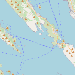
Kali en el mapa

Fuentes de datos y metodología

Nuestros pronósticos meteorológicos se basan en un proveedor profesional de datos meteorológicos que agrega datos de servicios meteorológicos nacionales, observaciones satelitales, redes de radar y más de 80 000 estaciones meteorológicas en todo el mundo. Los datos de pronóstico se actualizan varias veces al día. Convertimos los datos en bruto en resúmenes claros — velocidad del viento en m/s, presión en mm Hg — para que pueda planificar su día con confianza.