
Pronóstico del tiempo a 5 días Kali 14 oct 2026
 20°
20°Pronóstico del tiempo Kali miércoles 14 oct 2026: soleado, temperatura de 14 °C a 20 °C.
Probabilidad de precipitaciones 3%. Viento de hasta 5.89 m/s (ráfagas 10.61 m/s). Humedad del aire 39–59%, presión atmosférica 769–770 mm Hg, índice UV de hasta 3.5.
Alertas meteorológicas
Yellow wind warning
Locally fresh, in the evening also strong NE wind. Maximum wind gusts 35-45 knots (65-85 km/h)
IMPACT: Although rather usual in this region, locally or potentially dangerous wind speeds are expected to produce dangerous wave conditions to small crafts. Inexperienced mariners, especially those operating smaller vessels, should avoid navigating in these conditions.
Mariners should pay close attention to the marine forecast and consider wind and sea conditions in planning. It is possible that some ferry lines will not operate so follow traffic information if travelling.
Yellow wind warning
Locally fresh, in the evening also strong NE wind. Maximum wind gusts 35-45 knots (65-85 km/h)
IMPACT: Although rather usual in this region, locally or potentially dangerous wind speeds are expected to produce dangerous wave conditions to small crafts. Inexperienced mariners, especially those operating smaller vessels, should avoid navigating in these conditions.
Mariners should pay close attention to the marine forecast and consider wind and sea conditions in planning. It is possible that some ferry lines will not operate so follow traffic information if travelling.
Yellow wind warning
Locally fresh to strong NE wind. Maximum wind gusts 35-45 knots (65-85 km/h)
IMPACT: Although rather usual in this region, locally or potentially dangerous wind speeds are expected to produce dangerous wave conditions to small crafts. Inexperienced mariners, especially those operating smaller vessels, should avoid navigating in these conditions.
Mariners should pay close attention to the marine forecast and consider wind and sea conditions in planning. It is possible that some ferry lines will not operate so follow traffic information if travelling.
Yellow wind warning
Locally fresh NE wind. Maximum wind gusts 35-40 knots (65-75 km/h)
IMPACT: Although rather usual in this region, locally or potentially dangerous wind speeds are expected to produce dangerous wave conditions to small crafts. Inexperienced mariners, especially those operating smaller vessels, should avoid navigating in these conditions.
Mariners should pay close attention to the marine forecast and consider wind and sea conditions in planning. It is possible that some ferry lines will not operate so follow traffic information if travelling.
Yellow wind warning
Strong, locally near gale NE wind. Maximum wind gusts 35-55 knots (65-100 km/h)
IMPACT: Although rather usual in this region, locally or potentially dangerous wind speeds are expected to produce dangerous wave conditions to small crafts. Inexperienced mariners, especially those operating smaller vessels, should avoid navigating in these conditions.
Mariners should pay close attention to the marine forecast and consider wind and sea conditions in planning. It is possible that some ferry lines will not operate so follow traffic information if travelling.
Los 5 días de un vistazo — toca un día para abrirlo
Amanecer 07:12
Atardecer 18:17
Atardecer 18:17
Luna creciente18% iluminada
Salida de la luna 11:44 · Puesta de la luna 20:06
Salida de la luna 11:44 · Puesta de la luna 20:06
Gráfico
TablaPronóstico de 14 °C a 20 °C y precipitaciones
Nubosidad y probabilidad de precipitaciones
Velocidad y dirección del viento
Humedad del aire
Presión atmosférica
Índice ultravioleta
Calidad del aire y polen
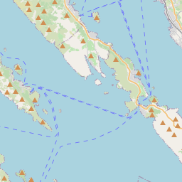
Kali en el mapa
Fuentes de datos y metodología
Nuestros pronósticos meteorológicos se basan en un proveedor profesional de datos meteorológicos que agrega datos de servicios meteorológicos nacionales, observaciones satelitales, redes de radar y más de 80 000 estaciones meteorológicas en todo el mundo. Los datos de pronóstico se actualizan varias veces al día. Convertimos los datos en bruto en resúmenes claros — velocidad del viento en m/s, presión en mm Hg — para que pueda planificar su día con confianza.