Pronóstico del tiempo a 5 días Auerbach 23-08-2026

Pronóstico del tiempo Auerbach domingo, 23 de agosto 23.08.2026: soleado, temperatura de 8 °C a 13 °C.

Probabilidad de precipitaciones 38%. Viento de hasta 4.19 m/s (ráfagas 6.61 m/s). Humedad del aire 47–96%, presión atmosférica 767–769 mm Hg, índice UV de hasta 4.8.

Alertas meteorológicas

Ocultar alertas
Severe20 ago, 18:1022 ago, 01:59Traducir con Google
Major Thunderstorm Impact
Risk of very severe thunderstorms with torrential rain (around 40 mm in a short time), in combination with rain around 70 mm, wind gusts 20 to 25 m/s (70 to 90 km/h) and hail around 2 cm. Local property damage and complications, especially in the energy industry, transport, and agriculture. Potential for dangerous flooding, flash floods. Increased runoff from slopes, rapid flooding of low-lying areas, dry gullies, small streams, undercutting of roads. Significant wind damage to trees, parks, buildings, property, energy infrastructure etc. Power outages. Travel delays and disruptions. Driving conditions difficult due to wind gusts, reduced visibility, fallen trees/branches, high risk of hydroplaning. Extensive damage to vegetation, buildings, and property from hail. Risk of fire caused by lightning strike. Risk of serious injury from flying or falling objects and lightning strikes.
Beware of lightning strikes, hail, and falling or windblown objects. Seek shelter in a building with lightning protection. Outdoors, take cover in dense forest or low vegetation; avoid water, hilltops, metal structures, isolated trees, and rock overhangs. Avoid stream courses in the mountains, as water and debris flows may occur there suddenly. Secure windows, doors, greenhouses, and loose objects. Be prepared for possible power outages. When driving, reduce speed, do not enter or drive into flowing water or flooded areas. Stay informed of the driving conditions. Observe weather warnings, weather radar (www.chmi.cz or mobile apps) and flash flood risk https://produkty.chmi.cz/ffi.
Moderate20 ago, 18:1022 ago, 01:59Traducir con Google
Moderate Thunderstorm Impact
Risk of severe thunderstorms with torrential rain (around 40 mm in a short time), wind gusts up to 20 m/s (70 km/h) and hail up to 2 cm. Possible local property damage and complications, especially in the energy industry and transport. Potential for local flooding, especially of low-lying areas. Local wind damage to roofs, fences, soft shelters and trees. Local power outages. Some travel delays. Driving conditions difficult. Possible crop damage from small hail. Risk of fire caused by lightning strike. Risk of injury from flying or falling objects, and lightning strikes.
Beware of lightning strikes and flying or falling objects (especially branches). Seek shelter in a building equipped with lightning protection. Outdoors, take cover in dense forest or low vegetation; avoid water bodies, hilltops, metal structures, isolated trees, and rock overhangs. When driving reduce speed. Observe weather warnings, weather radar (www.chmi.cz or mobile apps) and local flood risk https://produkty.chmi.cz/ffi.
Severe20 ago, 18:1022 ago, 01:59Traducir con Google
Major Thunderstorm Impact
Risk of very severe thunderstorms with torrential rain (around 40 mm in a short time), in combination with rain around 70 mm, wind gusts 20 to 25 m/s (70 to 90 km/h) and hail around 2 cm. Local property damage and complications, especially in the energy industry, transport, and agriculture. Potential for dangerous flooding, flash floods. Increased runoff from slopes, rapid flooding of low-lying areas, dry gullies, small streams, undercutting of roads. Significant wind damage to trees, parks, buildings, property, energy infrastructure etc. Power outages. Travel delays and disruptions. Driving conditions difficult due to wind gusts, reduced visibility, fallen trees/branches, high risk of hydroplaning. Extensive damage to vegetation, buildings, and property from hail. Risk of fire caused by lightning strike. Risk of serious injury from flying or falling objects and lightning strikes.
Beware of lightning strikes, hail, and falling or windblown objects. Seek shelter in a building with lightning protection. Outdoors, take cover in dense forest or low vegetation; avoid water, hilltops, metal structures, isolated trees, and rock overhangs. Avoid stream courses in the mountains, as water and debris flows may occur there suddenly. Secure windows, doors, greenhouses, and loose objects. Be prepared for possible power outages. When driving, reduce speed, do not enter or drive into flowing water or flooded areas. Stay informed of the driving conditions. Observe weather warnings, weather radar (www.chmi.cz or mobile apps) and flash flood risk https://produkty.chmi.cz/ffi.
Moderate20 ago, 18:1022 ago, 01:59Traducir con Google
Moderate Thunderstorm Impact
Risk of severe thunderstorms with torrential rain (around 40 mm in a short time), wind gusts up to 20 m/s (70 km/h) and hail up to 2 cm. Possible local property damage and complications, especially in the energy industry and transport. Potential for local flooding, especially of low-lying areas. Local wind damage to roofs, fences, soft shelters and trees. Local power outages. Some travel delays. Driving conditions difficult. Possible crop damage from small hail. Risk of fire caused by lightning strike. Risk of injury from flying or falling objects, and lightning strikes.
Beware of lightning strikes and flying or falling objects (especially branches). Seek shelter in a building equipped with lightning protection. Outdoors, take cover in dense forest or low vegetation; avoid water bodies, hilltops, metal structures, isolated trees, and rock overhangs. When driving reduce speed. Observe weather warnings, weather radar (www.chmi.cz or mobile apps) and local flood risk https://produkty.chmi.cz/ffi.
Severe20 ago, 18:1022 ago, 01:59Traducir con Google
Major Thunderstorm Impact
Risk of very severe thunderstorms with torrential rain (around 40 mm in a short time), in combination with rain around 70 mm, wind gusts 20 to 25 m/s (70 to 90 km/h) and hail around 2 cm. Local property damage and complications, especially in the energy industry, transport, and agriculture. Potential for dangerous flooding, flash floods. Increased runoff from slopes, rapid flooding of low-lying areas, dry gullies, small streams, undercutting of roads. Significant wind damage to trees, parks, buildings, property, energy infrastructure etc. Power outages. Travel delays and disruptions. Driving conditions difficult due to wind gusts, reduced visibility, fallen trees/branches, high risk of hydroplaning. Extensive damage to vegetation, buildings, and property from hail. Risk of fire caused by lightning strike. Risk of serious injury from flying or falling objects and lightning strikes.
Beware of lightning strikes, hail, and falling or windblown objects. Seek shelter in a building with lightning protection. Outdoors, take cover in dense forest or low vegetation; avoid water, hilltops, metal structures, isolated trees, and rock overhangs. Avoid stream courses in the mountains, as water and debris flows may occur there suddenly. Secure windows, doors, greenhouses, and loose objects. Be prepared for possible power outages. When driving, reduce speed, do not enter or drive into flowing water or flooded areas. Stay informed of the driving conditions. Observe weather warnings, weather radar (www.chmi.cz or mobile apps) and flash flood risk https://produkty.chmi.cz/ffi.
Los 5 días de un vistazo — toca un día para abrirlo
Amanecer 06:11
Atardecer 20:14
Gibosa creciente86% iluminada
Salida de la luna 18:34 · Puesta de la luna 00:49
Gráfico
Tabla

Pronóstico de 8 °C a 13 °C y precipitaciones

Temperatura & Precipitaciones
Hora00:0001:0002:0003:0004:0005:0006:0007:0008:0009:0010:0011:0012:0013:0014:0015:0016:0017:0018:0019:0020:0021:0022:0023:00
Temperatura (°C)1212111111111111891111111012131313131113121111
Precipitaciones (mm/h)00.01000000000.030.010.010.010000000000

Nubosidad y probabilidad de precipitaciones

Nubosidad & Probabilidad de lluvia
Hora00:0001:0002:0003:0004:0005:0006:0007:0008:0009:0010:0011:0012:0013:0014:0015:0016:0017:0018:0019:0020:0021:0022:0023:00
Nubosidad (%)2666633971674165879298852140142400004
Probabilidad de lluvia (%)22312024382115131061715151445322379910

Velocidad y dirección del viento

Viento & Ráfaga de viento
Hora00:0001:0002:0003:0004:0005:0006:0007:0008:0009:0010:0011:0012:0013:0014:0015:0016:0017:0018:0019:0020:0021:0022:0023:00
Viento (m/s)1.191.391.391.611.611.691.8921.892.813.53.894.113.813.894.194.113.6943.692.1910.810.69
Ráfaga de viento (m/s)1.421.51.535.615.615.692.032.315.115.195.255.335.535.226.036.1165.835.336.56.611.221.111.11
Dirección del viento (°)SO 230°SO 229°SO 229°SO 221°SSO 213°SSO 207°SSO 209°SSO 210°OSO 243°O 274°ONO 289°ONO 295°ONO 298°NO 306°NO 313°NO 309°NO 304°ONO 303°NO 319°NNO 329°NNO 334°NO 320°O 275°OSO 258°

Humedad del aire

Humedad
Hora00:0001:0002:0003:0004:0005:0006:0007:0008:0009:0010:0011:0012:0013:0014:0015:0016:0017:0018:0019:0020:0021:0022:0023:00
Humedad (%)959696969594939080706663616256525047495973797981

Presión atmosférica

Presión
Hora00:0001:0002:0003:0004:0005:0006:0007:0008:0009:0010:0011:0012:0013:0014:0015:0016:0017:0018:0019:0020:0021:0022:0023:00
Presión (mm Hg)767767767767767767767767767767767767767767767767767767767767768769769769

Índice ultravioleta

Índice UV
Hora00:0001:0002:0003:0004:0005:0006:0007:0008:0009:0010:0011:0012:0013:0014:0015:0016:0017:0018:0019:0020:0021:0022:0023:00
Índice UV00000000.10.51.42.644.74.84.64.231.70.80.20000

Calidad del aire y polen

Calidad del aire
Hora00:0001:0002:0003:0004:0005:0006:0007:0008:0009:0010:0011:0012:0013:0014:0015:0016:0017:0018:0019:0020:0021:0022:0023:00
PM2.5 (µg/m³)4.655.25.65.96.86.76.15.75.254.74.343.83.74.34.23.83.94.24.655.1
PM10 (µg/m³)6.97.177.78.29.39.18.27.87.66.86.96.96.46.265.86.16.66.77.28.28.48.6
Ozono (O₃) (µg/m³)605856535150495254606364707172757777777674716461
NO₂ (µg/m³)3.13.43.43.63.53.43.73.52.61.81.30.90.80.70.60.60.50.60.81.11.722.53
SO₂ (µg/m³)0.20.30.30.30.30.30.30.30.30.40.30.30.20.10.10.10.10.10.20.20.30.30.30.4
CO (µg/m³)146147149151150150149147147149152151151150149148150151152153154160159165

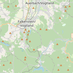
Auerbach en el mapa

Fuentes de datos y metodología

Nuestros pronósticos meteorológicos se basan en un proveedor profesional de datos meteorológicos que agrega datos de servicios meteorológicos nacionales, observaciones satelitales, redes de radar y más de 80 000 estaciones meteorológicas en todo el mundo. Los datos de pronóstico se actualizan varias veces al día. Convertimos los datos en bruto en resúmenes claros — velocidad del viento en m/s, presión en mm Hg — para que pueda planificar su día con confianza.