Pronóstico del tiempo a 5 días Grožnjan 28 sept 2026

22°18° · Soleado

Pronóstico del tiempo Grožnjan lunes 28 sept 2026: soleado, temperatura de 18 °C a 22 °C.

Probabilidad de precipitaciones 5%. Viento de hasta 3.61 m/s (ráfagas 7.61 m/s). Humedad del aire 56–68%, presión atmosférica 766–767 mm Hg, índice UV de hasta 6.

Alertas meteorológicas

Moderate23 sept, 08:4824 sept, 23:59Traducir con Google
Moderate Thunderstorms Warning (Degree 2/4) - Slovenia / South-West

Moderate Thunderstorms Warning

Thunderstorms are possible, accompanied by local intense precipitation and gusty winds. Intense local showers with wind blasts and lightning strikes are possible. Torrential watercourses may rise quickly. Rainwater floods are possible.
Beware of approaching storm clouds. Do not linger in exposed locations, e.g. under trees or power lines. Wait in a safe place, as storms usually do not last long.
Moderate23 sept, 08:4025 sept, 11:59Traducir con Google
Yellow thunderstorm warning
Severe thundershowers locally.
STAY ALERT for possible heavy thunderstorms. Be especially careful in high-exposure areas such as mountains, forests, meadows and open grounds. Interruptions in outdoor activities are possible.
Moderate22 sept, 13:1325 sept, 23:59Traducir con Google
Yellow wind warning
In the morning locally strong, in the evening fresh NE wind. Maximum wind gusts 35-45 knots (65-85 km/h)
IMPACT: Although rather usual in this region, locally or potentially dangerous wind speeds are expected to produce dangerous wave conditions to small crafts. Inexperienced mariners, especially those operating smaller vessels, should avoid navigating in these conditions. Mariners should pay close attention to the marine forecast and consider wind and sea conditions in planning. It is possible that some ferry lines will not operate so follow traffic information if travelling.
Moderate22 sept, 13:1325 sept, 13:00Traducir con Google
Yellow wind warning
Locally near gale NE wind. Maximum wind gusts 35-55 knots (65-100 km/h)
IMPACT: Although rather usual in this region, locally or potentially dangerous wind speeds are expected to produce dangerous wave conditions to small crafts. Inexperienced mariners, especially those operating smaller vessels, should avoid navigating in these conditions. Mariners should pay close attention to the marine forecast and consider wind and sea conditions in planning. It is possible that some ferry lines will not operate so follow traffic information if travelling.
Moderate22 sept, 13:1325 sept, 23:59Traducir con Google
Yellow wind warning
In the morning locally strong, in the evening fresh NE wind. Maximum wind gusts 35-45 knots (65-85 km/h)
IMPACT: Although rather usual in this region, locally or potentially dangerous wind speeds are expected to produce dangerous wave conditions to small crafts. Inexperienced mariners, especially those operating smaller vessels, should avoid navigating in these conditions. Mariners should pay close attention to the marine forecast and consider wind and sea conditions in planning. It is possible that some ferry lines will not operate so follow traffic information if travelling.
Los 5 días de un vistazo — toca un día para abrirlo
Amanecer 06:59
Atardecer 18:51
Gibosa menguante91% iluminada
Salida de la luna 19:14 · Puesta de la luna 08:56
Gráfico
Tabla
lun, 28 sept 2026

Pronóstico de 18 °C a 22 °C y precipitaciones

Temperatura & Precipitaciones
Hora00:0001:0002:0003:0004:0005:0006:0007:0008:0009:0010:0011:0012:0013:0014:0015:0016:0017:0018:0019:0020:0021:0022:0023:00
Temperatura (°C)191919191818181818191920212121212122222121212020
Precipitaciones (mm/h)000000000000000000000000

Nubosidad y probabilidad de precipitaciones

Nubosidad & Probabilidad de lluvia
Hora00:0001:0002:0003:0004:0005:0006:0007:0008:0009:0010:0011:0012:0013:0014:0015:0016:0017:0018:0019:0020:0021:0022:0023:00
Nubosidad (%)555020000000002000000000
Probabilidad de lluvia (%)554444444333333333333333

Velocidad y dirección del viento

Viento & Ráfaga de viento
Hora00:0001:0002:0003:0004:0005:0006:0007:0008:0009:0010:0011:0012:0013:0014:0015:0016:0017:0018:0019:0020:0021:0022:0023:00
Viento (m/s)2.312.192.192.312.192.192.112.112.1922.192.392.693.193.53.53.613.112.612.192.312.312.312.31
Ráfaga de viento (m/s)7.317.195.196.316.196.197.116.116.1922.532.722.697.197.56.57.613.222.722.422.422.392.52.5
Dirección del viento (°)ENE 58°NE 54°NE 48°NE 45°NE 42°NE 45°NE 47°NE 46°NE 40°NNE 25°N 1°NNO 345°NNO 332°NO 319°NO 312°NO 313°NO 313°NO 318°NNO 329°N 349°NNE 18°NNE 24°NNE 29°NE 35°

Humedad del aire

Humedad
Hora00:0001:0002:0003:0004:0005:0006:0007:0008:0009:0010:0011:0012:0013:0014:0015:0016:0017:0018:0019:0020:0021:0022:0023:00
Humedad (%)686664636363636362595756565658595858595960606060

Presión atmosférica

Presión
Hora00:0001:0002:0003:0004:0005:0006:0007:0008:0009:0010:0011:0012:0013:0014:0015:0016:0017:0018:0019:0020:0021:0022:0023:00
Presión (mm Hg)767767767767767767766766767767767767767767767766766766766766766766766766

Índice ultravioleta

Índice UV
Hora00:0001:0002:0003:0004:0005:0006:0007:0008:0009:0010:0011:0012:0013:0014:0015:0016:0017:0018:0019:0020:0021:0022:0023:00
Índice UV000000000.20.71.7344.54.1666600000

Calidad del aire y polen

La calidad del aire solo está disponible para los tres primeros días.

lun, 28 sept 2026

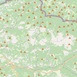
Grožnjan en el mapa

Fuentes de datos y metodología

Nuestros pronósticos meteorológicos se basan en un proveedor profesional de datos meteorológicos que agrega datos de servicios meteorológicos nacionales, observaciones satelitales, redes de radar y más de 80 000 estaciones meteorológicas en todo el mundo. Los datos de pronóstico se actualizan varias veces al día. Convertimos los datos en bruto en resúmenes claros — velocidad del viento en m/s, presión en mm Hg — para que pueda planificar su día con confianza.