Pronóstico del tiempo a 5 días Grožnjan 26-07-2026

Pronóstico del tiempo Grožnjan domingo, 26 de julio 26.07.2026: soleado, temperatura de 19 °C a 28 °C.

Probabilidad de precipitaciones 88%. Viento de hasta 9.31 m/s (ráfagas 16.53 m/s). Humedad del aire 62–88%, presión atmosférica 756–759 mm Hg, índice UV de hasta 7.

Alertas meteorológicas

Ocultar alertas
Severe23 jul, 07:3127 jul, 00:59Traducir con Google
Severe Forestfire danger Warning (Degree 3/4) - Slovenia / South-West

Severe Forestfire danger Warning

There is a large risk of forest and bush fire.
Stay vigilant and be prepared there is a large risk of forest and bush fire. Immediately react to any developing fire. The public are asked to exercise extreme caution in the countryside, and immediately notify emergency services on any fire.
Moderate24 jul, 07:5025 jul, 10:00Traducir con Google
Yellow wind warning
Locally fresh NE wind. Maximum wind gusts 35-40 knots (65-75 km/h)
IMPACT: Although rather usual in this region, locally or potentially dangerous wind speeds are expected to produce dangerous wave conditions to small crafts. Inexperienced mariners, especially those operating smaller vessels, should avoid navigating in these conditions. Mariners should pay close attention to the marine forecast and consider wind and sea conditions in planning. It is possible that some ferry lines will not operate so follow traffic information if travelling.
Moderate24 jul, 07:5025 jul, 09:00Traducir con Google
Yellow wind warning
Locally fresh NE wind. Maximum wind gusts 35-40 knots (65-75 km/h)
IMPACT: Although rather usual in this region, locally or potentially dangerous wind speeds are expected to produce dangerous wave conditions to small crafts. Inexperienced mariners, especially those operating smaller vessels, should avoid navigating in these conditions. Mariners should pay close attention to the marine forecast and consider wind and sea conditions in planning. It is possible that some ferry lines will not operate so follow traffic information if travelling.
Moderate24 jul, 07:4924 jul, 23:59Traducir con Google
Yellow wind warning
Locally strong NE wind. Maximum wind gusts 35-50 knots (65-95 km/h)
IMPACT: Although rather usual in this region, locally or potentially dangerous wind speeds are expected to produce dangerous wave conditions to small crafts. Inexperienced mariners, especially those operating smaller vessels, should avoid navigating in these conditions. Mariners should pay close attention to the marine forecast and consider wind and sea conditions in planning. It is possible that some ferry lines will not operate so follow traffic information if travelling.
Moderate24 jul, 07:4924 jul, 23:59Traducir con Google
Yellow wind warning
Locally fresh and strong NE wind. Maximum wind gusts 35-50 knots (65-95 km/h)
IMPACT: Although rather usual in this region, locally or potentially dangerous wind speeds are expected to produce dangerous wave conditions to small crafts. Inexperienced mariners, especially those operating smaller vessels, should avoid navigating in these conditions. Mariners should pay close attention to the marine forecast and consider wind and sea conditions in planning. It is possible that some ferry lines will not operate so follow traffic information if travelling.
Los 5 días de un vistazo — toca un día para abrirlo
Amanecer 05:42
Atardecer 20:40
Gibosa creciente95% iluminada
Salida de la luna 19:20 · Puesta de la luna 02:24
Gráfico
Tabla

Pronóstico de 19 °C a 28 °C y precipitaciones

Temperatura & Precipitaciones
Hora00:0001:0002:0003:0004:0005:0006:0007:0008:0009:0010:0011:0012:0013:0014:0015:0016:0017:0018:0019:0020:0021:0022:0023:00
Temperatura (°C)202020192020202124262727272728272727272524222120
Precipitaciones (mm/h)000.02000000000000.070.10.140.140.3102.917.053.52.03

Nubosidad y probabilidad de precipitaciones

Nubosidad & Probabilidad de lluvia
Hora00:0001:0002:0003:0004:0005:0006:0007:0008:0009:0010:0011:0012:0013:0014:0015:0016:0017:0018:0019:0020:0021:0022:0023:00
Nubosidad (%)6681667655981314689717673851668906680
Probabilidad de lluvia (%)54145556765455419182122361074887873

Velocidad y dirección del viento

Viento & Ráfaga de viento
Hora00:0001:0002:0003:0004:0005:0006:0007:0008:0009:0010:0011:0012:0013:0014:0015:0016:0017:0018:0019:0020:0021:0022:0023:00
Viento (m/s)3.613.313.193.53.614.695.55.615.894.8156.8987.587.117.55.814.318.118.899.314.814.61
Ráfaga de viento (m/s)7.316.536.447.116.978.9410.179.177.835.865.757.949.198.649.198.178.727.425.5311.2512.6916.539.228.86
Dirección del viento (°)ESE 108°E 97°E 90°E 95°ESE 104°E 96°ESE 104°ESE 122°SE 136°SSE 157°S 182°S 180°S 175°S 174°S 174°S 170°SSE 167°SSE 160°SSE 162°SSE 151°SSE 166°SSO 207°SE 144°ESE 107°

Humedad del aire

Humedad
Hora00:0001:0002:0003:0004:0005:0006:0007:0008:0009:0010:0011:0012:0013:0014:0015:0016:0017:0018:0019:0020:0021:0022:0023:00
Humedad (%)666464656567707271676364636264656770677983888786

Presión atmosférica

Presión
Hora00:0001:0002:0003:0004:0005:0006:0007:0008:0009:0010:0011:0012:0013:0014:0015:0016:0017:0018:0019:0020:0021:0022:0023:00
Presión (mm Hg)758758758758758758758758758758758758758758758757757757756756758758758759

Índice ultravioleta

Índice UV
Hora00:0001:0002:0003:0004:0005:0006:0007:0008:0009:0010:0011:0012:0013:0014:0015:0016:0017:0018:0019:0020:0021:0022:0023:00
Índice UV00000000.30.92.13.75.36.576.45.43.82.310.40000

Calidad del aire y polen

Calidad del aire
Hora00:0001:0002:0003:0004:0005:0006:0007:0008:0009:0010:0011:0012:0013:0014:0015:0016:0017:0018:0019:0020:0021:0022:0023:00
PM2.5 (µg/m³)4.54.34.44.24.14.13.844.34.14.24.44.74.74.44.95.14.84.43.944.24.54.3
PM10 (µg/m³)8.48.17.87.97.97.47.78.38.68.58.89.19910.41010.398.78.28.58.57.18.1
Ozono (O₃) (µg/m³)788081828281838785868990919293979898969796939087
NO₂ (µg/m³)2.21.91.81.71.61.51.51.41.31.110.90.90.70.70.70.70.70.81.11.41.61.81.9
SO₂ (µg/m³)0.20.20.20.20.20.20.20.20.20.20.20.20.20.20.20.20.10.10.10.10.10.10.10.1
CO (µg/m³)121121121121122122122123123122122122123120121122123123124123125128126128

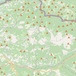
Grožnjan en el mapa

Fuentes de datos y metodología

Nuestros pronósticos meteorológicos se basan en un proveedor profesional de datos meteorológicos que agrega datos de servicios meteorológicos nacionales, observaciones satelitales, redes de radar y más de 80 000 estaciones meteorológicas en todo el mundo. Los datos de pronóstico se actualizan varias veces al día. Convertimos los datos en bruto en resúmenes claros — velocidad del viento en m/s, presión en mm Hg — para que pueda planificar su día con confianza.