Pronóstico del tiempo a 5 días Grožnjan 21 sept 2026
Pronóstico del tiempo Grožnjan hoy 21 sept 2026: cubierto, temperatura de 20 °C a 25 °C.
Probabilidad de precipitaciones 23%. Viento de hasta 5.31 m/s (ráfagas 7.89 m/s). Humedad del aire 60–80%, presión atmosférica 764–767 mm Hg, índice UV de hasta 4.3.
Alertas meteorológicas
Moderate Wind Warning (Degree 2/4) - Slovenia / South-West
Moderate Wind Warning
Maximum wind speed : from 50 to 70 km/h. Wind sways trees and may break branches. It impedes road traffic of certain categories and may hinder movement to some extent. The sea is fairly rough (3).
Before the event:
Close all windows and doors. Stow or fasten anything that could be carried away by the wind. Check the situation of vessels in berths.
During the event:
Doors and windows should be kept closed. When moving in the open, pay attention to possible falling objects. Stop all work at heights. Do not repair damage during the event. We recommend additional caution in traffic, especially in crosswinds and in exposed areas (e.g. bridges, cuttings). Caution is recommended in water sports. Less skilled sailors should not sail out. Swimmers should stay close to the shore.
Yellow wind warning
Fresh, locally strong NE wind. Maximum wind gusts 35-45 knots (65-85 km/h)
IMPACT: Although rather usual in this region, locally or potentially dangerous wind speeds are expected to produce dangerous wave conditions to small crafts. Inexperienced mariners, especially those operating smaller vessels, should avoid navigating in these conditions.
Mariners should pay close attention to the marine forecast and consider wind and sea conditions in planning. It is possible that some ferry lines will not operate so follow traffic information if travelling.
Yellow wind warning
NE wind increasing to near gale force. Maximum wind gusts 35-55 knots (65-100 km/h)
IMPACT: Although rather usual in this region, locally or potentially dangerous wind speeds are expected to produce dangerous wave conditions to small crafts. Inexperienced mariners, especially those operating smaller vessels, should avoid navigating in these conditions.
Mariners should pay close attention to the marine forecast and consider wind and sea conditions in planning. It is possible that some ferry lines will not operate so follow traffic information if travelling.
Yellow wind warning
Fresh, locally strong NE wind. Maximum wind gusts 35-45 knots (65-85 km/h)
IMPACT: Although rather usual in this region, locally or potentially dangerous wind speeds are expected to produce dangerous wave conditions to small crafts. Inexperienced mariners, especially those operating smaller vessels, should avoid navigating in these conditions.
Mariners should pay close attention to the marine forecast and consider wind and sea conditions in planning. It is possible that some ferry lines will not operate so follow traffic information if travelling.
Orange wind warning
Strong, locally gale NE wind. Maximum wind gusts 35-65 knots (65-120 km/h)
IMPACT: Be prepared for gale and strong gale wind speeds combined with locally high waves that are imminent or occurring. Operating a vessel in these conditions requires experience and properly equipped vessels.
It is highly recommended that mariners without the proper experience seek safe harbor prior to onset of potentially dangerous wind and wave conditions. It is likely that many ferries will not operate so follow traffic information if travelling.
Los 5 días de un vistazo — toca un día para abrirlo
Amanecer 06:51
Atardecer 19:05
Atardecer 19:05
Gibosa creciente82% iluminada
Salida de la luna 17:04 · Puesta de la luna 01:11
Gráfico
Tabla
lun, 21 sept 2026
| Hora | Tiempo | Temperatura | Probabilidad de lluvia | Nubosidad | Humedad | Presión | Viento | Índice UV |
|---|---|---|---|---|---|---|---|---|
| 00:00 | Cubierto | 22 °C | 20% | 99% | 74% | 767 mm Hg | NE 54° 2.11 (2.11) m/s | 0 |
| 01:00 | Cubierto | 22 °C | 20% | 100% | 73% | 767 mm Hg | NNE 32° 1.69 (1.69) m/s | 0 |
| 02:00 | Cubierto | 22 °C | 20% | 100% | 74% | 767 mm Hg | NNE 12° 2 (2.31) m/s | 0 |
| 03:00 | Cubierto | 22 °C | 20% | 100% | 74% | 766 mm Hg | NNE 15° 2.39 (2.72) m/s | 0 |
| 04:00 | Nublado | 22 °C | 16% | 74% | 75% | 766 mm Hg | NNE 22° 1.89 (2) m/s | 0 |
| 05:00 | Despejado | 22 °C | 8% | 6% | 77% | 766 mm Hg | NNE 13° 2.89 (3.33) m/s | 0 |
| 06:00 | Cubierto | 21 °C | 22% | 99% | 79% | 766 mm Hg | NNE 15° 3 (3.5) m/s | 0 |
| 07:00 | Cubierto | 21 °C | 23% | 97% | 80% | 766 mm Hg | NNE 17° 3.69 (4.33) m/s | 0 |
| 08:00 | Cubierto | 21 °C | 23% | 100% | 79% | 766 mm Hg | NNE 18° 3.31 (4.03) m/s | 0.2 |
| 09:00 | Cubierto | 22 °C | 21% | 100% | 75% | 766 mm Hg | N 8° 2.5 (3.11) m/s | 0.7 |
| 10:00 | Parcialmente nublado | 22 °C | 11% | 52% | 71% | 766 mm Hg | N 358° 2.5 (2.83) m/s | 1.4 |
| 11:00 | Cubierto | 23 °C | 21% | 100% | 74% | 766 mm Hg | N 352° 1.69 (1.81) m/s | 2.8 |
| 12:00 | Cubierto | 24 °C | 18% | 100% | 71% | 765 mm Hg | SO 221° 0.5 (1.53) m/s | 4.1 |
| 13:00 | Cubierto | 24 °C | 17% | 100% | 67% | 765 mm Hg | S 172° 3 (4.22) m/s | 4.3 |
| 14:00 | Cubierto | 25 °C | 15% | 100% | 63% | 765 mm Hg | S 181° 3.89 (3.92) m/s | 3.9 |
| 15:00 | Nublado | 24 °C | 13% | 87% | 64% | 764 mm Hg | SSO 201° 3.89 (7.89) m/s | 2.9 |
| 16:00 | Cubierto | 24 °C | 15% | 100% | 61% | 764 mm Hg | SO 230° 2.39 (6.39) m/s | 1.8 |
| 17:00 | Cubierto | 24 °C | 14% | 100% | 60% | 764 mm Hg | ONO 290° 1.19 (6.19) m/s | 0.9 |
| 18:00 | Cubierto | 24 °C | 16% | 100% | 65% | 764 mm Hg | NNO 344° 3.31 (3.89) m/s | 0.3 |
| 19:00 | Cubierto | 23 °C | 14% | 99% | 60% | 764 mm Hg | N 11° 3.81 (3.92) m/s | 0 |
| 20:00 | Nublado | 22 °C | 12% | 82% | 64% | 764 mm Hg | E 92° 3 (3.61) m/s | 0 |
| 21:00 | Despejado | 21 °C | 5% | 6% | 66% | 765 mm Hg | SE 126° 5.31 (5.81) m/s | 0 |
| 22:00 | Despejado | 20 °C | 4% | 6% | 63% | 765 mm Hg | E 81° 4.39 (5.03) m/s | 0 |
| 23:00 | Cubierto | 20 °C | 15% | 100% | 62% | 765 mm Hg | ENE 57° 4.31 (4.81) m/s | 0 |
lun, 21 sept 2026
Preguntas frecuentes sobre el tiempo a 5 días en Grožnjan
¿Cómo será el tiempo en Grožnjan durante los próximos 5 días?
Durante los próximos 5 días en Grožnjan la temperatura oscilará aproximadamente entre 16 y 25 °C. Consulta la previsión horaria detallada de cada uno de los 5 días en los gráficos de arriba.
¿En cuáles de los próximos 5 días lloverá en Grožnjan?
La probabilidad de lluvia en Grožnjan en los próximos 5 días llega al 58%. Consulta el gráfico de precipitación a 5 días de arriba para ver qué días y horas traen lluvia.
¿Qué precisión tiene la previsión del tiempo a 5 días para Grožnjan?
Una previsión a 5 días es bastante fiable: los primeros 2–3 días suelen ser muy precisos, y los días 4–5 pueden ajustarse. Los datos se actualizan varias veces al día, así que vuelve a consultarlos antes de planes importantes.
¿Cuál de los próximos 5 días en Grožnjan será el más cálido y cuál el más frío?
Durante los próximos 5 días la temperatura en Grožnjan varía aproximadamente entre 16 y 25 °C. Compara el día más cálido y el más frío en el gráfico de temperatura de arriba.
¿Hará viento en Grožnjan durante los próximos 5 días?
Durante los próximos 5 días el viento en Grožnjan llega hasta 7 m/s. Los días más ventosos se ven fácilmente en el gráfico de viento de arriba.
¿Qué día de la semana en Grožnjan es mejor para pasear o viajar?
Para pasear o viajar, elige los días con menor probabilidad de lluvia (hasta 58%) y viento flojo, fáciles de comparar en los gráficos a 5 días de arriba.
¿Cómo aprovechar mejor la previsión a 5 días de Grožnjan?
Los primeros 2–3 días son bastante fiables para decisiones firmes, mientras que los días 4–5 son una guía que se afina al acercarse. La previsión se actualiza varias veces al día, así que vuelve a consultarla antes de planes importantes.
¿Necesitaré paraguas o protector solar en Grožnjan esta semana?
La probabilidad de lluvia llega al 58% en los próximos 5 días, así que lleva algo impermeable para los más húmedos — la tira de días de arriba muestra cuáles. El índice UV de hoy alcanza 4.3; el protector solar compensa a partir de 3 aproximadamente.
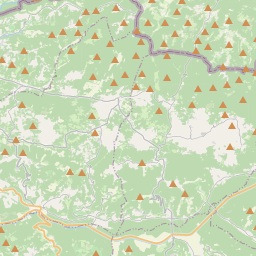
Grožnjan en el mapa
Fuentes de datos y metodología
Nuestros pronósticos meteorológicos se basan en un proveedor profesional de datos meteorológicos que agrega datos de servicios meteorológicos nacionales, observaciones satelitales, redes de radar y más de 80 000 estaciones meteorológicas en todo el mundo. Los datos de pronóstico se actualizan varias veces al día. Convertimos los datos en bruto en resúmenes claros — velocidad del viento en m/s, presión en mm Hg — para que pueda planificar su día con confianza.