5-day weather forecast Wara Wara Nov 20, 2026

34°20° · Severe sandstorm

Weather forecast Wara Wara tomorrow Nov 20, 2026: severe sandstorm, temperature from 20 °C to 34 °C.

Precipitation probability 4%. Wind up to 6.5 m/s (gusts 10.75 m/s). Air humidity 12–23%, atmospheric pressure 758–762 mm Hg, UV index up to 6.8.

Sunrise 06:32
Sunset 18:04
Waxing Gibbous89% illuminated
Moonrise 14:49 · Moonset 02:35
Chart
Table

Forecast from 20 °C to 34 °C and precipitation

Temperature & Precipitation
Time00:0001:0002:0003:0004:0005:0006:0007:0008:0009:0010:0011:0012:0013:0014:0015:0016:0017:0018:0019:0020:0021:0022:0023:00
Temperature (°C)232322222121212022252830323334343432302827262524
Precipitation (mm/hr)000000000000000000000000

Cloud cover and precipitation probability

Cloud cover & Rain chance
Time00:0001:0002:0003:0004:0005:0006:0007:0008:0009:0010:0011:0012:0013:0014:0015:0016:0017:0018:0019:0020:0021:0022:0023:00
Cloud cover (%)36524433241811205860634528162396810161061740
Rain chance (%)233211114443211111111112

Wind speed and direction

Wind & Wind gust
Time00:0001:0002:0003:0004:0005:0006:0007:0008:0009:0010:0011:0012:0013:0014:0015:0016:0017:0018:0019:0020:0021:0022:0023:00
Wind (m/s)3.313.313.393.693.894.114.314.315.196.116.56.56.315.895.55.114.894.193.53.113.193.193.313.19
Wind gust (m/s)66.066.317.177.948.6199.1710.2810.7210.7510.3610.089.839.088.397.947.285.614.835.255.085.225.28
Wind direction (°)E 79°ENE 78°ENE 75°ENE 75°ENE 78°E 82°E 84°E 85°E 84°E 84°E 84°E 83°E 82°E 79°ENE 76°ENE 72°ENE 67°ENE 63°ENE 60°ENE 60°ENE 66°ENE 73°ENE 78°E 79°

Air humidity

Humidity
Time00:0001:0002:0003:0004:0005:0006:0007:0008:0009:0010:0011:0012:0013:0014:0015:0016:0017:0018:0019:0020:0021:0022:0023:00
Humidity (%)202122222323232321191615131212121213151718181920

Atmospheric pressure

Pressure
Time00:0001:0002:0003:0004:0005:0006:0007:0008:0009:0010:0011:0012:0013:0014:0015:0016:0017:0018:0019:0020:0021:0022:0023:00
Pressure (mm Hg)761761761760760761761761761762762761761759758758758758759759760761761761

Ultraviolet index

UV Index
Time00:0001:0002:0003:0004:0005:0006:0007:0008:0009:0010:0011:0012:0013:0014:0015:0016:0017:0018:0019:0020:0021:0022:0023:00
UV Index000000000.41.43.25.46.76.85.73.71.80.6000000

Air quality & pollen

Air quality
Time00:0001:0002:0003:0004:0005:0006:0007:0008:0009:0010:0011:0012:0013:0014:0015:0016:0017:0018:0019:0020:0021:0022:0023:00
PM2.5 (µg/m³)106.2117.1128.5136.9143.4148.1151.3155.1176.5142.5153.7154.6150.9138.8123.9106.993.191.786.185.289.992.494.594.8
PM10 (µg/m³)415.4517.8614.7689.2752.5799.1834.5860.5946.2838.2972.310171005.8920.1815.8696.6599.8566.2459.1399.5386.5366343.7336.2
Ozone (O₃) (µg/m³)423937373736353847597079879410010410496837161524540
NO₂ (µg/m³)10.5109.186.96.25.64.93.72.41.41110.90.81.22.23.75.37.19.110.511.1
SO₂ (µg/m³)32.72.42.11.81.71.61.51.41.41.31.21.110.90.80.91.11.51.92.32.733
CO (µg/m³)735676640609574532485435375312263237225217198183212323478605677721750766

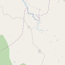
Wara Wara on the map

Data Sources & Methodology

Our weather forecasts are powered by a professional weather data provider that aggregates data from national weather services, satellite observations, radar networks, and over 80,000 weather stations worldwide. Forecast data is updated multiple times daily. We convert raw data into clear summaries — wind speed in m/s, pressure in mmHg — so you can plan your day with confidence.