
5-day weather forecast Seville Nov 14, 2026

21°13° · Patchy rain possible

Weather forecast Seville Saturday Nov 14, 2026: patchy rain possible, temperature from 13 °C to 21 °C.

Precipitation probability 41%. Wind up to 4.69 m/s (gusts 8.19 m/s). Air humidity 68–96%, atmospheric pressure 763–766 mm Hg, UV index up to 2.8.

Weather Alerts

SevereNov 10, 11:37 AM — Nov 11, 11:59 PMTranslate with Google
Severe wind warning. Campiña sevillana

Severe wind warning

Maximum gust of wind: 90 km/h. Vientos del suroeste.
Be prepared. Take precautions and keep up to date with the latest weather forecast. Severe damages to people and properties may occur, especially to those vulnerable or in exposed areas.
ModerateNov 10, 11:37 AM — Nov 11, 11:59 PMTranslate with Google
Moderate rain warning. Campiña sevillana

Moderate rain warning

One-hour accumulated precipitation: 20 mm.
Be aware, keep up to date with the latest weather forecast. Moderate damages to people and properties may occur, especially to those vulnerable or in exposed areas.
ModerateNov 10, 06:57 PM — Nov 11, 11:59 PMTranslate with Google
Moderate rain warning. Campiña sevillana

Moderate rain warning

Twelve-hours accumulated precipitation: 60 mm.
Be aware, keep up to date with the latest weather forecast. Moderate damages to people and properties may occur, especially to those vulnerable or in exposed areas.
SevereNov 9, 11:49 AM — Nov 11, 11:59 PMTranslate with Google
Severe rain warning. Sierra norte de Sevilla

Severe rain warning

Twelve-hours accumulated precipitation: 80 mm.
Be prepared. Take precautions and keep up to date with the latest weather forecast. Severe damages to people and properties may occur, especially to those vulnerable or in exposed areas.
ModerateNov 9, 07:01 PM — Nov 11, 11:59 PMTranslate with Google
Moderate rain warning. Sierra norte de Sevilla

Moderate rain warning

One-hour accumulated precipitation: 15 mm.
Be aware, keep up to date with the latest weather forecast. Moderate damages to people and properties may occur, especially to those vulnerable or in exposed areas.
Sunrise 08:02
Sunset 18:14
First Quarter31% illuminated
Moonrise 12:55 · Moonset 22:39
Chart
Table

Forecast from 13 °C to 21 °C and precipitation

Temperature & Precipitation
Time00:0001:0002:0003:0004:0005:0006:0007:0008:0009:0010:0011:0012:0013:0014:0015:0016:0017:0018:0019:0020:0021:0022:0023:00
Temperature (°C)151514141313131313141517192020212019181616161515
Precipitation (mm/hr)0000.010.010.020.020.030.040.040.050.070.10.130.160.20.280.240.290.160.070.040.030.01

Cloud cover and precipitation probability

Cloud cover & Rain chance
Time00:0001:0002:0003:0004:0005:0006:0007:0008:0009:0010:0011:0012:0013:0014:0015:0016:0017:0018:0019:0020:0021:0022:0023:00
Cloud cover (%)9108818884887980857662707969598984856686858878
Rain chance (%)151620343736383637332924242422213233413334323934

Wind speed and direction

Wind & Wind gust
Time00:0001:0002:0003:0004:0005:0006:0007:0008:0009:0010:0011:0012:0013:0014:0015:0016:0017:0018:0019:0020:0021:0022:0023:00
Wind (m/s)1.891.691.391.1910.890.690.610.50.6111.612.393.193.614.114.694.193.52.812.392.111.811.69
Wind gust (m/s)3.442.7221.891.811.51.220.920.535.6162.423.614.535.56.036.816.837.928.197.815.113.113.11
Wind direction (°)SW 236°WSW 240°WSW 244°WSW 242°WSW 246°WSW 238°SW 234°SW 225°SSW 205°S 191°S 173°SSW 203°SW 218°SW 230°SW 233°SW 235°SW 236°SW 235°SW 235°WSW 237°SW 236°SW 227°SW 224°SW 226°

Air humidity

Humidity
Time00:0001:0002:0003:0004:0005:0006:0007:0008:0009:0010:0011:0012:0013:0014:0015:0016:0017:0018:0019:0020:0021:0022:0023:00
Humidity (%)939494959596969695949185787068686874818891939596

Atmospheric pressure

Pressure
Time00:0001:0002:0003:0004:0005:0006:0007:0008:0009:0010:0011:0012:0013:0014:0015:0016:0017:0018:0019:0020:0021:0022:0023:00
Pressure (mm Hg)763763763763763764764764764764765765764764764764764764764764765765765766

Ultraviolet index

UV Index
Time00:0001:0002:0003:0004:0005:0006:0007:0008:0009:0010:0011:0012:0013:0014:0015:0016:0017:0018:0019:0020:0021:0022:0023:00
UV Index0000000000.10.61.52.32.82.72.11.20.5000000

Air quality & pollen

Air quality is available for the first three days only.

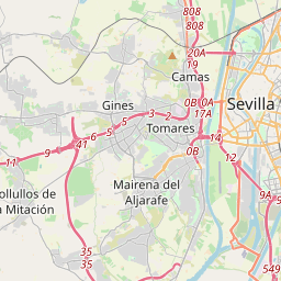
Seville on the map
Data Sources & Methodology

Our weather forecasts are powered by a professional weather data provider that aggregates data from national weather services, satellite observations, radar networks, and over 80,000 weather stations worldwide. Forecast data is updated multiple times daily. We convert raw data into clear summaries — wind speed in m/s, pressure in mmHg — so you can plan your day with confidence.