5-day weather forecast Santiago de Compostela Nov 21, 2026

14°10° · Light rain

Weather forecast Santiago de Compostela Saturday Nov 21, 2026: light rain, temperature from 10 °C to 14 °C.

Precipitation probability 89%. Wind up to 5.39 m/s (gusts 13.36 m/s). Air humidity 94–98%, atmospheric pressure 756–762 mm Hg, UV index up to 0.2.

Weather Alerts

SevereNov 18, 11:41 AM — Nov 20, 11:59 AMTranslate with Google
Severe coastalevent warning. Costa - Suroeste de A Coruña

Severe coastalevent warning

Mar combinada del NW de 5 a 6 m.
Be prepared. Take precautions and keep up to date with the latest weather forecast. Severe damages to people and properties may occur, especially to those vulnerable or in exposed areas.
ModerateNov 18, 11:41 AM — Nov 20, 05:59 PMTranslate with Google
Moderate coastalevent warning. Costa - Suroeste de A Coruña

Moderate coastalevent warning

Mar combinada del NW de 4 a 5 m.
Be aware, keep up to date with the latest weather forecast. Moderate damages to people and properties may occur, especially to those vulnerable or in exposed areas.
SevereNov 18, 06:49 PM — Nov 19, 11:59 PMTranslate with Google
Severe coastalevent warning. Costa - Suroeste de A Coruña

Severe coastalevent warning

Mar combinada del Oeste o Noroeste de 6 a 8 m. Viento del Suroeste de 50 a 61 km/h (fuerza 7), temporalmente 62 a 74 km/h (fuerza 8) por la noche al norte de Cabo Vilán.
Be prepared. Take precautions and keep up to date with the latest weather forecast. Severe damages to people and properties may occur, especially to those vulnerable or in exposed areas.
SevereNov 18, 11:41 AM — Nov 20, 08:59 AMTranslate with Google
Severe coastalevent warning. Costa - Rias Baixas

Severe coastalevent warning

Mar combinada del NW de 5 a 6 m.
Be prepared. Take precautions and keep up to date with the latest weather forecast. Severe damages to people and properties may occur, especially to those vulnerable or in exposed areas.
ModerateNov 18, 11:41 AM — Nov 20, 03:59 PMTranslate with Google
Moderate coastalevent warning. Costa - Rias Baixas

Moderate coastalevent warning

Mar combinada del NW de 4 a 5 m.
Be aware, keep up to date with the latest weather forecast. Moderate damages to people and properties may occur, especially to those vulnerable or in exposed areas.
Sunrise 08:33
Sunset 18:06
Waxing Gibbous95% illuminated
Moonrise 15:55 · Moonset 04:53
Chart
Table

Forecast from 10 °C to 14 °C and precipitation

Temperature & Precipitation
Time00:0001:0002:0003:0004:0005:0006:0007:0008:0009:0010:0011:0012:0013:0014:0015:0016:0017:0018:0019:0020:0021:0022:0023:00
Temperature (°C)111010111112121213131313131413131313131312111010
Precipitation (mm/hr)1.171.632.031.92.471.961.490.80.50.350.340.460.290.340.640.643.952.91.361.843.011.30.520.42

Cloud cover and precipitation probability

Cloud cover & Rain chance
Time00:0001:0002:0003:0004:0005:0006:0007:0008:0009:0010:0011:0012:0013:0014:0015:0016:0017:0018:0019:0020:0021:0022:0023:00
Cloud cover (%)10010010010010010010010010010010010010010010010010099989890826879
Rain chance (%)788183828583807366586369616374748987788186745756

Wind speed and direction

Wind & Wind gust
Time00:0001:0002:0003:0004:0005:0006:0007:0008:0009:0010:0011:0012:0013:0014:0015:0016:0017:0018:0019:0020:0021:0022:0023:00
Wind (m/s)3.393.893.813.613.814.114.194.114.114.114.114.194.1943.813.53.113.614.695.395.315.395.114.89
Wind gust (m/s)8.259.510.6110.8912.861312.1411.5811.2210.8610.6910.6410.3910.259.869.788.8310.0811.5812.2812.7813.3612.9412.14
Wind direction (°)SSE 147°SSE 147°SSE 154°SSE 158°SSE 167°S 182°S 184°S 186°S 183°S 181°S 180°S 179°S 176°S 179°S 178°S 179°S 181°SSW 200°SSW 207°SW 218°SW 234°WSW 255°WSW 255°WSW 254°

Air humidity

Humidity
Time00:0001:0002:0003:0004:0005:0006:0007:0008:0009:0010:0011:0012:0013:0014:0015:0016:0017:0018:0019:0020:0021:0022:0023:00
Humidity (%)979696979696979797979797979797989898959497969695

Atmospheric pressure

Pressure
Time00:0001:0002:0003:0004:0005:0006:0007:0008:0009:0010:0011:0012:0013:0014:0015:0016:0017:0018:0019:0020:0021:0022:0023:00
Pressure (mm Hg)762761761760759759759758758758759758758758758757756756757757758759760761

Ultraviolet index

UV Index
Time00:0001:0002:0003:0004:0005:0006:0007:0008:0009:0010:0011:0012:0013:0014:0015:0016:0017:0018:0019:0020:0021:0022:0023:00
UV Index000000000000.10.20.10.20.20.20000000

Air quality & pollen

Air quality
Time00:0001:0002:0003:0004:0005:0006:0007:0008:0009:0010:0011:0012:0013:0014:0015:0016:0017:0018:0019:0020:0021:0022:0023:00
PM2.5 (µg/m³)4.94.84.63.53.332.52.41.81.71.41.21.31.31.31.41.21.51.82332.73.7
PM10 (µg/m³)5.25.45.44.53.93.22.62.62.32.21.91.51.41.71.61.61.71.72.32.73.845.16.6
Ozone (O₃) (µg/m³)545148455158585856545660595757575859585860686869.8
NO₂ (µg/m³)8.38.57.16.15.54.93.83.23.23.42.92.83.23.63.84.43.84.255.453.62.71.9
SO₂ (µg/m³)0.70.50.50.50.40.40.40.40.40.40.40.40.40.40.30.30.30.30.30.40.40.40.30.3
CO (µg/m³)150150149149148142134135135132128128129129129130128125127125120124131133.3

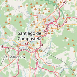
Santiago de Compostela on the map

Data Sources & Methodology

Our weather forecasts are powered by a professional weather data provider that aggregates data from national weather services, satellite observations, radar networks, and over 80,000 weather stations worldwide. Forecast data is updated multiple times daily. We convert raw data into clear summaries — wind speed in m/s, pressure in mmHg — so you can plan your day with confidence.