
5-day weather forecast Salinas Nov 19, 2026
 14°
Weather forecast Salinas Thursday Nov 19, 2026: light rain shower, temperature from 10 °C to 14 °C.
Precipitation probability 77%. Wind up to 8.39 m/s (gusts 15.25 m/s). Air humidity 69–92%, atmospheric pressure 755–763 mm Hg, UV index up to 1.3.
Weather Alerts
Flash Flood Watch issued November 17 at 11:48AM PST until November 19 at 4:00AM PST by NWS San Francisco CA
Flash Flood Watch
* WHAT...Flash flooding and debris flows caused by excessive rainfall
are possible over the Plaskett and Timber burn areas.
* WHERE...For the Timber Scar, portions of CA Highway 1 and the Los
Padres National Forecast from Andrew Molera State Park to
Partington Ridge including the town of Big Sur.
For the Plaskett Scar, areas near CA Highway 1 mile marker 17 to mile
marker 11 including Los Burros Road.
* WHEN...From early Wednesday morning to early Thursday morning.
* IMPACTS...Heavy rainfall over the Timber and Plaskett burn areas is
expected during the watch period. Residents near the Timber burn
area should prepare for potential debris flow moving through the
drainages within Lafler, Castro, and Graves Canyons, as well as
drainages between Grimes and Castro Canyons.
Residents near the Plaskett burn area should prepare for potential
debris flow moving through the Alder, Plaskett, and Prewitt Creeks.
Be sure to stay up to date with information from local authorities.
Heavy rainfall could trigger flash flooding of low-lying areas,
roadway flooding, and debris flows in and near recent wildfire burn
scars.
* ADDITIONAL DETAILS...
- National Weather Service Meteorologists are forecasting heavy
rainfall over the Timber and Plaskett burn areas, which may lead
to flash flooding and debris flows.
- Some locations that may experience flash flooding include...
Big Sur, Plaskett, and Pfeiffer Big Sur State Park
- http://www.weather.gov/safety/flood
Small Craft Advisory issued November 17 at 2:29PM PST until November 18 at 3:00AM PST by NWS San Francisco CA
Small Craft Advisory
* WHAT...For the Small Craft Advisory, south winds 10 to 20 kt
with gusts up to 30 kt expected. For the Gale Warning, south
winds 20 to 30 kt with gusts up to 45 kt expected.
* WHERE...Monterey Bay.
* WHEN...For the Small Craft Advisory, from 9 PM this evening to
3 AM PST Wednesday. For the Gale Warning, from 3 AM to 3 PM
PST Wednesday.
* IMPACTS...Strong winds will cause hazardous seas which could
capsize or damage vessels and reduce visibility.
Gale Warning issued November 17 at 2:29PM PST until November 18 at 3:00PM PST by NWS San Francisco CA
Gale Warning
* WHAT...For the Small Craft Advisory, south winds 10 to 20 kt
with gusts up to 30 kt expected. For the Gale Warning, south
winds 20 to 30 kt with gusts up to 45 kt expected.
* WHERE...Monterey Bay.
* WHEN...For the Small Craft Advisory, from 9 PM this evening to
3 AM PST Wednesday. For the Gale Warning, from 3 AM to 3 PM
PST Wednesday.
* IMPACTS...Strong winds will cause hazardous seas which could
capsize or damage vessels and reduce visibility.
5 days at a glance — tap a day to open it
Sunrise 06:48
Sunset 16:55
Sunset 16:55
Waxing Gibbous81% illuminated
Moonrise 13:56 · Moonset 01:37
Moonrise 13:56 · Moonset 01:37
Chart
TableForecast from 10 °C to 14 °C and precipitation
Cloud cover and precipitation probability
Wind speed and direction
Air humidity
Atmospheric pressure
Ultraviolet index
Air quality & pollen
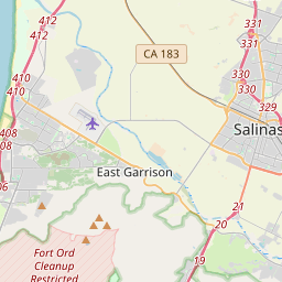
Salinas on the map
Data Sources & Methodology
Our weather forecasts are powered by a professional weather data provider that aggregates data from national weather services, satellite observations, radar networks, and over 80,000 weather stations worldwide. Forecast data is updated multiple times daily. We convert raw data into clear summaries — wind speed in m/s, pressure in mmHg — so you can plan your day with confidence.