5-day weather forecast Mount Isa Nov 20, 2026

34°24° · Patchy rain possible

Weather forecast Mount Isa tomorrow Nov 20, 2026: patchy rain possible, temperature from 24 °C to 34 °C.

Precipitation probability 24%. Wind up to 2.89 m/s (gusts 5.19 m/s). Air humidity 41–87%, atmospheric pressure 758–762 mm Hg, UV index up to 13.1.

Sunrise 05:52
Sunset 19:02
Waxing Gibbous89% illuminated
Moonrise 14:54 · Moonset 02:26
Chart
Table

Forecast from 24 °C to 34 °C and precipitation

Temperature & Precipitation
Time00:0001:0002:0003:0004:0005:0006:0007:0008:0009:0010:0011:0012:0013:0014:0015:0016:0017:0018:0019:0020:0021:0022:0023:00
Temperature (°C)252524242424242526283031323334343434323231303029
Precipitation (mm/hr)0.05000000000.010.010.010.010.020.010.010.010.010.0900000

Cloud cover and precipitation probability

Cloud cover & Rain chance
Time00:0001:0002:0003:0004:0005:0006:0007:0008:0009:0010:0011:0012:0013:0014:0015:0016:0017:0018:0019:0020:0021:0022:0023:00
Cloud cover (%)805312221028375868389887588685236221435
Rain chance (%)24111111121211118141011910107971744434

Wind speed and direction

Wind & Wind gust
Time00:0001:0002:0003:0004:0005:0006:0007:0008:0009:0010:0011:0012:0013:0014:0015:0016:0017:0018:0019:0020:0021:0022:0023:00
Wind (m/s)2.3922.111.611.51.52.192.692.392.612.892.51.811.390.890.390.390.190.110.891.51.51.611.69
Wind gust (m/s)4.283.673.392.832.723.033.974.474.364.725.194.894.11444.033.8643.833.673.693.173.083.72
Wind direction (°)NNE 14°NNE 27°NE 45°NE 39°NNE 32°NE 40°NE 53°NE 47°NNE 33°NNE 26°NNE 18°N 11°N 4°N 352°NNW 331°W 277°SW 230°SE 144°SE 145°SE 136°ESE 104°ESE 104°E 93°E 82°

Air humidity

Humidity
Time00:0001:0002:0003:0004:0005:0006:0007:0008:0009:0010:0011:0012:0013:0014:0015:0016:0017:0018:0019:0020:0021:0022:0023:00
Humidity (%)828485868786868476685954494543414144495255586062

Atmospheric pressure

Pressure
Time00:0001:0002:0003:0004:0005:0006:0007:0008:0009:0010:0011:0012:0013:0014:0015:0016:0017:0018:0019:0020:0021:0022:0023:00
Pressure (mm Hg)761761761761761761761761762762762761761760759758758758758758759760760760

Ultraviolet index

UV Index
Time00:0001:0002:0003:0004:0005:0006:0007:0008:0009:0010:0011:0012:0013:0014:0015:0016:0017:0018:0019:0020:0021:0022:0023:00
UV Index00000000.31.43.87.110.312.713.111.68.65.22.30.700000

Air quality & pollen

Air quality
Time00:0001:0002:0003:0004:0005:0006:0007:0008:0009:0010:0011:0012:0013:0014:0015:0016:0017:0018:0019:0020:0021:0022:0023:00
PM2.5 (µg/m³)29.73126.825.326.831.230.724.112.912.523.317.614.616.221.624.523.119.415.54452.450.549.952
PM10 (µg/m³)3031.22725.527.131.431.124.613.513.124.418.71617.523.225.924.520.81745.353.851.85153
Ozone (O₃) (µg/m³)413634353741475360677688102113120124120104806047383230
NO₂ (µg/m³)12.113.813.913.412.712.111.310.28.56.54.73.22.11.72.33.86.19.814.317.819.520.220.319.6
SO₂ (µg/m³)44.54.74.84.74.33.83.43.33.23.12.72.321.922.22.42.733.544.44.5
CO (µg/m³)155156150141134130129132143157167168164157147134125124128131133136138140

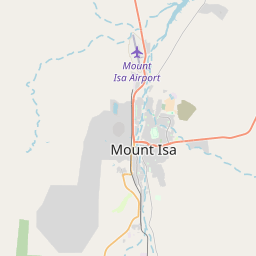
Mount Isa on the map

Data Sources & Methodology

Our weather forecasts are powered by a professional weather data provider that aggregates data from national weather services, satellite observations, radar networks, and over 80,000 weather stations worldwide. Forecast data is updated multiple times daily. We convert raw data into clear summaries — wind speed in m/s, pressure in mmHg — so you can plan your day with confidence.