5-day weather forecast Fargo Nov 19, 2026

9°5° · Overcast

Weather forecast Fargo tomorrow Nov 19, 2026: overcast, temperature from 5 °C to 9 °C.

Precipitation probability 27%. Wind up to 8.39 m/s (gusts 14.25 m/s). Air humidity 61–85%, atmospheric pressure 755–766 mm Hg, UV index up to 1.

5 days at a glance — tap a day to open it
Sunrise 07:35
Sunset 16:49
Waxing Gibbous81% illuminated
Moonrise 14:13 · Moonset 01:52
Chart
Table

Forecast from 5 °C to 9 °C and precipitation

Temperature & Precipitation
Time00:0001:0002:0003:0004:0005:0006:0007:0008:0009:0010:0011:0012:0013:0014:0015:0016:0017:0018:0019:0020:0021:0022:0023:00
Temperature (°C)998887778889999988776655
Precipitation (mm/hr)0.010.010000000000000000000000

Cloud cover and precipitation probability

Cloud cover & Rain chance
Time00:0001:0002:0003:0004:0005:0006:0007:0008:0009:0010:0011:0012:0013:0014:0015:0016:0017:0018:0019:0020:0021:0022:0023:00
Cloud cover (%)10010010010010010010010010099797472747779869310010099999999
Rain chance (%)161615151718192020211714121212121517202122242527

Wind speed and direction

Wind & Wind gust
Time00:0001:0002:0003:0004:0005:0006:0007:0008:0009:0010:0011:0012:0013:0014:0015:0016:0017:0018:0019:0020:0021:0022:0023:00
Wind (m/s)6.3977.588.198.198.118.118.398.317.57.197.116.195.194.113.312.111.390.690.110.811.52
Wind gust (m/s)10.9411.8312.6913.3313.7213.9214.1114.1114.2513.9213.2512.3311.8310.869.538.226.474.222.531.641.081.061.862.97
Wind direction (°)SW 233°WSW 237°WSW 238°WSW 238°WSW 242°WSW 246°WSW 249°WSW 255°W 262°W 272°W 279°WNW 283°WNW 290°WNW 292°WNW 294°WNW 295°WNW 288°W 278°W 267°W 271°SSE 164°SE 124°SE 127°SE 131°

Air humidity

Humidity
Time00:0001:0002:0003:0004:0005:0006:0007:0008:0009:0010:0011:0012:0013:0014:0015:0016:0017:0018:0019:0020:0021:0022:0023:00
Humidity (%)636361616569697274767470666564646670737577808285

Atmospheric pressure

Pressure
Time00:0001:0002:0003:0004:0005:0006:0007:0008:0009:0010:0011:0012:0013:0014:0015:0016:0017:0018:0019:0020:0021:0022:0023:00
Pressure (mm Hg)755756757757758758758759761761762764764764764765765766766766766766766765

Ultraviolet index

UV Index
Time00:0001:0002:0003:0004:0005:0006:0007:0008:0009:0010:0011:0012:0013:0014:0015:0016:0017:0018:0019:0020:0021:0022:0023:00
UV Index00000000000.10.710.70.40.20.10000000

Air quality & pollen

Air quality
Time00:0001:0002:0003:0004:0005:0006:0007:0008:0009:0010:0011:0012:0013:0014:0015:0016:0017:0018:0019:0020:0021:0022:0023:00
PM2.5 (µg/m³)0.30.30.30.50.80.60.50.50.60.60.50.50.50.50.60.70.81.546.465.34.84.2
PM10 (µg/m³)0.30.30.30.50.90.60.50.50.60.60.60.50.50.50.60.70.81.64.16.56.15.44.84.3
Ozone (O₃) (µg/m³)444544423934312927273035394245443830221712101113
NO₂ (µg/m³)2.62.42.42.52.83.23.63.843.93.32.621.41.12.36.41216.920.623.624.722.819
SO₂ (µg/m³)1.41.41.41.51.71.92.12.22.32.221.61.41.31.31.41.72.22.73.33.94.24.13.6
CO (µg/m³)139137136136136137138142146148145139134130128130140154171191213229235235

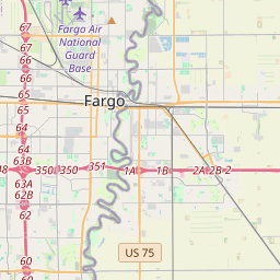
Fargo on the map

Data Sources & Methodology

Our weather forecasts are powered by a professional weather data provider that aggregates data from national weather services, satellite observations, radar networks, and over 80,000 weather stations worldwide. Forecast data is updated multiple times daily. We convert raw data into clear summaries — wind speed in m/s, pressure in mmHg — so you can plan your day with confidence.