5-day weather forecast Cuernavaca Nov 11, 2026

26°12° · Patchy rain possible

Weather forecast Cuernavaca Wednesday Nov 11, 2026: patchy rain possible, temperature from 12 °C to 26 °C.

Precipitation probability 64%. Wind up to 3 m/s (gusts 7.19 m/s). Air humidity 49–83%, atmospheric pressure 760–765 mm Hg, UV index up to 8.9.

Sunrise 06:41
Sunset 17:59
Waxing Crescent7% illuminated
Moonrise 09:04 · Moonset 20:04
Chart
Table

Forecast from 12 °C to 26 °C and precipitation

Temperature & Precipitation
Time00:0001:0002:0003:0004:0005:0006:0007:0008:0009:0010:0011:0012:0013:0014:0015:0016:0017:0018:0019:0020:0021:0022:0023:00
Temperature (°C)191413181313171215221819251920261918221515201515
Precipitation (mm/hr)000000000000.050.080.020.170.130.350.190.311.020.690.280.520.18

Cloud cover and precipitation probability

Cloud cover & Rain chance
Time00:0001:0002:0003:0004:0005:0006:0007:0008:0009:0010:0011:0012:0013:0014:0015:0016:0017:0018:0019:0020:0021:0022:0023:00
Cloud cover (%)31414051741236741784767783687877588987857482
Rain chance (%)81111108889146415171222173625366456345034

Wind speed and direction

Wind & Wind gust
Time00:0001:0002:0003:0004:0005:0006:0007:0008:0009:0010:0011:0012:0013:0014:0015:0016:0017:0018:0019:0020:0021:0022:0023:00
Wind (m/s)0.891.191.611.52.1121.191.890.391.112.192.812.532.8922.3120.691.3111.611.310.69
Wind gust (m/s)2.424.194.612.476.1172.256.890.52.677.195.814.9776.894.536.3162.032.4262.564.313.69
Wind direction (°)NNE 25°N 3°N 0°N 5°N 356°N 359°N 3°N 354°N 352°SSE 165°S 179°S 181°S 176°S 177°S 178°S 179°S 182°S 181°WSW 244°WNW 290°N 352°NNW 346°NNW 346°NNW 333°

Air humidity

Humidity
Time00:0001:0002:0003:0004:0005:0006:0007:0008:0009:0010:0011:0012:0013:0014:0015:0016:0017:0018:0019:0020:0021:0022:0023:00
Humidity (%)687474717576747873616359516159496368638079728283

Atmospheric pressure

Pressure
Time00:0001:0002:0003:0004:0005:0006:0007:0008:0009:0010:0011:0012:0013:0014:0015:0016:0017:0018:0019:0020:0021:0022:0023:00
Pressure (mm Hg)764765764764764764764765765765765764763762761760761761761763764763764764

Ultraviolet index

UV Index
Time00:0001:0002:0003:0004:0005:0006:0007:0008:0009:0010:0011:0012:0013:0014:0015:0016:0017:0018:0019:0020:0021:0022:0023:00
UV Index000000000.524.57.18.98.97.552.20.6000000

Air quality & pollen

Air quality
Time00:0001:0002:0003:0004:0005:0006:0007:0008:0009:0010:0011:0012:0013:0014:0015:0016:0017:0018:0019:0020:0021:0022:0023:00
PM2.5 (µg/m³)1918.819.720.319.718.517.819.722.210.47.15.75.35.25.25.25.55.57.61215.915.717.318.4
PM10 (µg/m³)19.31919.820.419.818.517.919.822.310.57.35.95.45.45.35.45.65.77.712.21615.817.418.5
Ozone (O₃) (µg/m³)201713101012214270931061151211261291281241171068764453529
NO₂ (µg/m³)60.159.659.358.658.257.453.142.528.516.99.95.22.20.70.82.14.17.413.324.337.948.352.954.3
SO₂ (µg/m³)10.19.99.59.410.311.51211.39.98.26.242.41.91.92.12.12.22.94.46.58.410.111.6
CO (µg/m³)645506350240207220245286339363329266219201198214269343347363429.5534586618

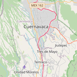
Cuernavaca on the map

Data Sources & Methodology

Our weather forecasts are powered by a professional weather data provider that aggregates data from national weather services, satellite observations, radar networks, and over 80,000 weather stations worldwide. Forecast data is updated multiple times daily. We convert raw data into clear summaries — wind speed in m/s, pressure in mmHg — so you can plan your day with confidence.