
5-day weather forecast Cold Lake Nov 17, 2026
 5°
Weather forecast Cold Lake Tuesday Nov 17, 2026: partly cloudy, temperature from -1 °C to 5 °C.
Precipitation probability 12%. Wind up to 3.61 m/s (gusts 6.69 m/s). Air humidity 54–76%, atmospheric pressure 759–762 mm Hg, UV index up to 0.5.
Weather Alerts
yellow advisory - fog - in effect
fog
Areas of dense fog are expected or occurring.
Conditions are expected to improve on Saturday.
###
Visibility will likely be suddenly reduced at times.
Please continue to monitor alerts and forecasts issued by Environment Canada. To report severe weather, send an email to ABstorm@ec.gc.ca, call 1-800-239-0484 or post reports on social media using #ABStorm.
Be prepared for areas of near-zero visibility and allow extra time to reach your destination. If driving, turn on your lights, slow down and maintain a safe following distance.
yellow advisory - fog - in effect
fog
Areas of dense fog are expected or occurring.
Conditions are expected to improve later today.
###
Visibility will likely be suddenly reduced at times.
Please continue to monitor alerts and forecasts issued by Environment Canada. To report severe weather, send an email to ABstorm@ec.gc.ca, call 1-800-239-0484 or post reports on social media using #ABStorm.
Be prepared for areas of near-zero visibility and allow extra time to reach your destination. If driving, turn on your lights, slow down and maintain a safe following distance.
5 days at a glance — tap a day to open it
Sunrise 08:54
Sunset 17:16
Sunset 17:16
First Quarter63% illuminated
Moonrise 14:49 · Moonset 00:18
Moonrise 14:49 · Moonset 00:18
Chart
Table
| Time | Weather | Temperature | Rain chance | Cloud cover | Humidity | Pressure | Wind | UV Index |
|---|---|---|---|---|---|---|---|---|
| 00:00 |  Clear | 1 °C | 6% | 1% | 68% | 759 mm Hg | WSW 246° 3.5 (5.28) m/s | 0 |
| 01:00 | Clear | 0 °C | 6% | 1% | 67% | 760 mm Hg | WSW 248° 3.39 (5.11) m/s | 0 |
| 02:00 | Clear | 0 °C | 5% | 1% | 66% | 760 mm Hg | WSW 250° 3.61 (5.86) m/s | 0 |
| 03:00 | Clear | 0 °C | 5% | 1% | 67% | 761 mm Hg | WSW 252° 3.61 (6.17) m/s | 0 |
| 04:00 | Clear | 0 °C | 6% | 2% | 68% | 761 mm Hg | WSW 252° 3.5 (5.72) m/s | 0 |
| 05:00 |  Partly cloudy | 0 °C | 9% | 35% | 70% | 761 mm Hg | WSW 250° 3.39 (5.39) m/s | 0 |
| 06:00 | Clear | -1 °C | 8% | 24% | 71% | 761 mm Hg | WSW 253° 3.11 (4.83) m/s | 0 |
| 07:00 | Clear | -1 °C | 8% | 9% | 72% | 761 mm Hg | WSW 247° 3 (4.64) m/s | 0 |
| 08:00 |  Sunny | -1 °C | 7% | 0% | 74% | 761 mm Hg | WSW 245° 2.89 (4.47) m/s | 0 |
| 09:00 | Sunny | -1 °C | 8% | 0% | 76% | 761 mm Hg | WSW 238° 2.81 (4.22) m/s | 0 |
| 10:00 | Sunny | 0 °C | 6% | 0% | 70% | 761 mm Hg | SW 234° 3 (4.78) m/s | 0.2 |
| 11:00 | Partly cloudy | 1 °C | 7% | 37% | 64% | 761 mm Hg | SW 234° 3 (5.64) m/s | 0.4 |
| 12:00 | Partly cloudy | 3 °C | 6% | 40% | 58% | 761 mm Hg | WSW 237° 3.31 (6.06) m/s | 0.5 |
| 13:00 | Partly cloudy | 4 °C | 6% | 40% | 56% | 761 mm Hg | WSW 239° 3.19 (5.14) m/s | 0.5 |
| 14:00 | Partly cloudy | 4 °C | 5% | 40% | 54% | 761 mm Hg | WSW 240° 3.11 (4.97) m/s | 0.4 |
| 15:00 | Partly cloudy | 5 °C | 5% | 40% | 54% | 761 mm Hg | SW 236° 2.61 (4) m/s | 0.2 |
| 16:00 | Partly cloudy | 3 °C | 6% | 38% | 58% | 761 mm Hg | WSW 237° 2.69 (6.69) m/s | 0 |
| 17:00 | Partly cloudy | 2 °C | 8% | 40% | 64% | 761 mm Hg | WSW 244° 2.61 (5.61) m/s | 0 |
| 18:00 | Partly cloudy | 1 °C | 9% | 39% | 68% | 761 mm Hg | WSW 247° 2.5 (6.5) m/s | 0 |
| 19:00 | Partly cloudy | 0 °C | 9% | 40% | 70% | 761 mm Hg | WSW 248° 2.69 (6.69) m/s | 0 |
| 20:00 | Partly cloudy | 0 °C | 10% | 40% | 72% | 762 mm Hg | WSW 248° 2.81 (5.81) m/s | 0 |
| 21:00 | Partly cloudy | 0 °C | 11% | 40% | 73% | 762 mm Hg | WSW 252° 2.69 (6.69) m/s | 0 |
| 22:00 | Partly cloudy | -1 °C | 11% | 38% | 75% | 762 mm Hg | WSW 256° 2.61 (6.61) m/s | 0 |
| 23:00 | Partly cloudy | -1 °C | 12% | 40% | 76% | 762 mm Hg | W 262° 2.5 (2.81) m/s | 0 |
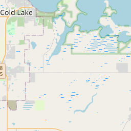
Cold Lake on the map
Data Sources & Methodology
Our weather forecasts are powered by a professional weather data provider that aggregates data from national weather services, satellite observations, radar networks, and over 80,000 weather stations worldwide. Forecast data is updated multiple times daily. We convert raw data into clear summaries — wind speed in m/s, pressure in mmHg — so you can plan your day with confidence.