
5-Tage-Wettervorhersage Kali 16. Okt. 2026
 18°
18°Wettervorhersage Kali Freitag 16. Okt. 2026: sonnig, Temperatur von 14 °C bis 18 °C.
Niederschlagswahrscheinlichkeit 16%. Wind bis zu 8.31 m/s (Böen 11.22 m/s). Luftfeuchtigkeit 40–66%, Luftdruck 765–767 mm Hg, UV-Index bis 5.
Wetterwarnungen
Yellow wind warning
Locally fresh, in the evening also strong NE wind. Maximum wind gusts 35-45 knots (65-85 km/h)
IMPACT: Although rather usual in this region, locally or potentially dangerous wind speeds are expected to produce dangerous wave conditions to small crafts. Inexperienced mariners, especially those operating smaller vessels, should avoid navigating in these conditions.
Mariners should pay close attention to the marine forecast and consider wind and sea conditions in planning. It is possible that some ferry lines will not operate so follow traffic information if travelling.
Yellow wind warning
Locally fresh, in the evening also strong NE wind. Maximum wind gusts 35-45 knots (65-85 km/h)
IMPACT: Although rather usual in this region, locally or potentially dangerous wind speeds are expected to produce dangerous wave conditions to small crafts. Inexperienced mariners, especially those operating smaller vessels, should avoid navigating in these conditions.
Mariners should pay close attention to the marine forecast and consider wind and sea conditions in planning. It is possible that some ferry lines will not operate so follow traffic information if travelling.
Yellow wind warning
Locally fresh to strong NE wind. Maximum wind gusts 35-45 knots (65-85 km/h)
IMPACT: Although rather usual in this region, locally or potentially dangerous wind speeds are expected to produce dangerous wave conditions to small crafts. Inexperienced mariners, especially those operating smaller vessels, should avoid navigating in these conditions.
Mariners should pay close attention to the marine forecast and consider wind and sea conditions in planning. It is possible that some ferry lines will not operate so follow traffic information if travelling.
Yellow wind warning
Locally fresh NE wind. Maximum wind gusts 35-40 knots (65-75 km/h)
IMPACT: Although rather usual in this region, locally or potentially dangerous wind speeds are expected to produce dangerous wave conditions to small crafts. Inexperienced mariners, especially those operating smaller vessels, should avoid navigating in these conditions.
Mariners should pay close attention to the marine forecast and consider wind and sea conditions in planning. It is possible that some ferry lines will not operate so follow traffic information if travelling.
Yellow wind warning
Strong, locally near gale NE wind. Maximum wind gusts 35-55 knots (65-100 km/h)
IMPACT: Although rather usual in this region, locally or potentially dangerous wind speeds are expected to produce dangerous wave conditions to small crafts. Inexperienced mariners, especially those operating smaller vessels, should avoid navigating in these conditions.
Mariners should pay close attention to the marine forecast and consider wind and sea conditions in planning. It is possible that some ferry lines will not operate so follow traffic information if travelling.
5 Tage im Überblick — tippen Sie auf einen Tag, um ihn zu öffnen
Sonnenaufgang 07:15
Sonnenuntergang 18:14
Sonnenuntergang 18:14
Erstes Viertel37% beleuchtet
Mondaufgang 13:39 · Monduntergang 21:54
Mondaufgang 13:39 · Monduntergang 21:54
Diagramm
TabelleFr., 16. Okt. 2026
Vorhersage von 14 °C bis 18 °C und Niederschlag
Bewölkung und Niederschlagswahrscheinlichkeit
Windgeschwindigkeit und -richtung
Luftfeuchtigkeit
Luftdruck
Ultraviolett-Index
Luftqualität & Pollen
Luftqualitätsdaten sind nur für die ersten drei Tage verfügbar.
Fr., 16. Okt. 2026
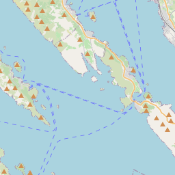
Kali auf der Karte
Datenquellen & Methodik
Unsere Wettervorhersagen werden von einem professionellen Wetterdatenanbieter bereitgestellt, der Daten von nationalen Wetterdiensten, Satellitenbeobachtungen, Radarnetzwerken und über 80.000 Wetterstationen weltweit zusammenführt. Die Vorhersagedaten werden mehrmals täglich aktualisiert. Wir wandeln Rohdaten in übersichtliche Zusammenfassungen um – Windgeschwindigkeit in m/s, Luftdruck in mmHg – damit Sie Ihren Tag mit Zuversicht planen können.