5-Tage-Wettervorhersage Kali 26-07-2026
Wettervorhersage Kali Sonntag, 26. Juli 26.07.2026: sonnig, Temperatur von 22 °C bis 27 °C.
Niederschlagswahrscheinlichkeit 61%. Wind bis zu 12 m/s (Böen 15.33 m/s). Luftfeuchtigkeit 44–78%, Luftdruck 755–758 mm Hg, UV-Index bis 7.
Wetterwarnungen
Warnungen ausblendenYellow wind warning
Locally fresh NE wind. Maximum wind gusts 35-40 knots (65-75 km/h)
IMPACT: Although rather usual in this region, locally or potentially dangerous wind speeds are expected to produce dangerous wave conditions to small crafts. Inexperienced mariners, especially those operating smaller vessels, should avoid navigating in these conditions.
Mariners should pay close attention to the marine forecast and consider wind and sea conditions in planning. It is possible that some ferry lines will not operate so follow traffic information if travelling.
Yellow wind warning
Locally strong NE wind. Maximum wind gusts 35-60 knots (65-110 km/h)
IMPACT: Although rather usual in this region, locally or potentially dangerous wind speeds are expected to produce dangerous wave conditions to small crafts. Inexperienced mariners, especially those operating smaller vessels, should avoid navigating in these conditions.
Mariners should pay close attention to the marine forecast and consider wind and sea conditions in planning. It is possible that some ferry lines will not operate so follow traffic information if travelling.
Yellow wind warning
Locally strong NE wind. Maximum wind gusts 35-45 knots (65-85 km/h)
IMPACT: Although rather usual in this region, locally or potentially dangerous wind speeds are expected to produce dangerous wave conditions to small crafts. Inexperienced mariners, especially those operating smaller vessels, should avoid navigating in these conditions.
Mariners should pay close attention to the marine forecast and consider wind and sea conditions in planning. It is possible that some ferry lines will not operate so follow traffic information if travelling.
Sonnenaufgang 05:40
Sonnenuntergang 20:30
Sonnenuntergang 20:30
Zunehmender Mond95% beleuchtet
Mondaufgang 19:07 · Monduntergang 02:25
Mondaufgang 19:07 · Monduntergang 02:25
Diagramm
Tabelle
So., 26. Juli 2026
| Temperatur | Regenwahrscheinlichkeit | Bewölkung | Feuchtigkeit | Druck | Wind | UV-Index | ||
|---|---|---|---|---|---|---|---|---|
| 00:00 |  Klar | 23 °C | 2% | 12% | 49% | 758 mm Hg | OSO 105° 2.61 (4.64) m/s | 0 |
| 01:00 |  Teilweise bewölkt | 23 °C | 4% | 31% | 50% | 758 mm Hg | OSO 103° 3.69 (6.75) m/s | 0 |
| 02:00 | Klar | 23 °C | 2% | 6% | 50% | 758 mm Hg | OSO 104° 4.31 (7.83) m/s | 0 |
| 03:00 | Klar | 22 °C | 2% | 8% | 49% | 758 mm Hg | OSO 111° 4.61 (8.58) m/s | 0 |
| 04:00 | Klar | 22 °C | 3% | 25% | 49% | 758 mm Hg | OSO 111° 4.69 (8.75) m/s | 0 |
| 05:00 | Klar | 22 °C | 2% | 10% | 50% | 758 mm Hg | OSO 110° 5.81 (10.83) m/s | 0 |
| 06:00 |  Sonnig | 22 °C | 2% | 5% | 50% | 758 mm Hg | OSO 116° 5.5 (10.22) m/s | 6 |
| 07:00 | Sonnig | 23 °C | 2% | 3% | 50% | 758 mm Hg | OSO 114° 6 (9.92) m/s | 6 |
| 08:00 | Sonnig | 25 °C | 2% | 20% | 44% | 758 mm Hg | OSO 121° 6.19 (8.42) m/s | 6 |
| 09:00 |  Teilweise bewölkt | 26 °C | 3% | 27% | 44% | 758 mm Hg | SO 144° 7.89 (10.19) m/s | 7 |
| 10:00 |  Stellenweise Regen möglich | 26 °C | 21% (0.28 mm/Std.) | 80% | 47% | 758 mm Hg | SSO 150° 9.11 (11.31) m/s | 6 |
| 11:00 | Sonnig | 27 °C | 2% | 10% | 48% | 755 mm Hg | SO 139° 12 (14.53) m/s | 7 |
| 12:00 | Sonnig | 27 °C | 2% | 13% | 46% | 757 mm Hg | SO 146° 11.39 (13.86) m/s | 7 |
| 13:00 | Sonnig | 27 °C | 3% | 19% | 50% | 757 mm Hg | SSO 154° 11.69 (13.92) m/s | 7 |
| 14:00 | Sonnig | 27 °C | 3% | 10% | 53% | 757 mm Hg | SSO 152° 11.69 (13.75) m/s | 7 |
| 15:00 | Stellenweise Regen möglich | 27 °C | 17% (0.1 mm/Std.) | 34% | 55% | 756 mm Hg | SSO 148° 11.5 (14.31) m/s | 6 |
| 16:00 | Sonnig | 27 °C | 36% (0.3 mm/Std.) | 59% | 57% | 756 mm Hg | SO 144° 11.39 (14.81) m/s | 7 |
| 17:00 | Stellenweise Regen möglich | 27 °C | 36% (0.38 mm/Std.) | 84% | 58% | 755 mm Hg | SO 140° 11.19 (15.33) m/s | 6 |
| 18:00 | Stellenweise Regen möglich | 25 °C | 44% (0.7 mm/Std.) | 81% | 65% | 755 mm Hg | OSO 107° 9.89 (14.61) m/s | 6 |
| 19:00 | Stellenweise Regen möglich | 24 °C | 53% (0.9 mm/Std.) | 79% | 72% | 756 mm Hg | ONO 73° 8.5 (13.89) m/s | 5 |
| 20:00 | Stellenweise Regen möglich | 22 °C | 61% (1.2 mm/Std.) | 76% | 78% | 756 mm Hg | NO 40° 7.19 (13.14) m/s | 5 |
| 21:00 |  Vereinzelte Gewitter möglich | 22 °C | 54% (0.8 mm/Std.) | 78% | 77% | 756 mm Hg | NO 51° 6.31 (11.89) m/s | 0 |
| 22:00 |  Stellenweise Regen möglich | 22 °C | 40% (0.4 mm/Std.) | 79% | 75% | 756 mm Hg | ONO 63° 5.39 (10.61) m/s | 0 |
| 23:00 | Vereinzelte Gewitter möglich | 22 °C | 17% (0.01 mm/Std.) | 81% | 73% | 756 mm Hg | ONO 75° 4.5 (9.36) m/s | 0 |
So., 26. Juli 2026
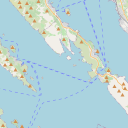
Kali auf der Karte
Datenquellen & Methodik
Unsere Wettervorhersagen werden von einem professionellen Wetterdatenanbieter bereitgestellt, der Daten von nationalen Wetterdiensten, Satellitenbeobachtungen, Radarnetzwerken und über 80.000 Wetterstationen weltweit zusammenführt. Die Vorhersagedaten werden mehrmals täglich aktualisiert. Wir wandeln Rohdaten in übersichtliche Zusammenfassungen um – Windgeschwindigkeit in m/s, Luftdruck in mmHg – damit Sie Ihren Tag mit Zuversicht planen können.