Прогноз погоды на 5 дней Торонто 17-06-2026

Прогноз погоды Торонто среда, 17 июня 17.06.2026: местами дождь, температура от 15 °C до 19 °C.

Вероятность осадков 11%. Ветер до 5.39 м/с (порывы 8.69 м/с). Влажность воздуха 69–97%, атмосферное давление 752–755 мм рт. ст., УФ-индекс до 6.7.

Погодные предупреждения

скрыть предупреждения
ModerateJun 13, 04:15 PMJun 14, 04:00 AMПеревести с Google
yellow watch - severe thunderstorm - in effect

thunderstorm — Service Notice – April 2026: The Environment and Climate Change Canada (ECCC) CAP Service undergoes changes from time to time as the business of alerting evolves. For Spring 2026, changes are expected to include... 1) ECCC's initiative to introduce free-form polygons to represent the true threat area of a weather hazard is tentatively set for June 2026 deployment. Data changes will appear in CAP following this deployment, 2) marine alerts will now be issued for smaller zone splits in certain areas of Atlantic and Pacific waters and 3) other minor improvements and corrections. For more information on these changes: https://comm.collab.science.gc.ca/mailman3/hyperkitty/list/dd_info@comm.collab.science.gc.ca/ | Notification de service – avril 2026: Le service du PAC d’Environnement et Changement climatique Canada (ECCC) subit périodiquement des changements à mesure que le système d’alerte évolue. Pour le printemps 2026, il y aura des changements incluant... 1) l’initiative d’ECCC visant à introduire des polygones libres pour représenter la véritable zone de menace d’un danger météorologique devrait être déployée provisoirement en juin 2026. Des changements de données apparaîtront dans le PAC à la suite de ce déploiement, 2) les alertes marines seront désormais émises pour des subdivisions de zones plus petites dans certaines régions des eaux de l’Atlantique et du Pacifique et 3) d’autres améliorations et corrections mineures. Pour plus d’informations sur ces changements: https://comm.collab.science.gc.ca/mailman3/hyperkitty/list/dd_info@comm.collab.science.gc.ca/

Conditions are favourable for the development of severe thunderstorms that may be capable of producing strong wind gusts and large hail. What: Wind gusts up to 90 km/h. Hail up to toonie-sized. When: This afternoon into this evening. ### Local utility outages are possible. Damage to roofs, fences, branches or soft shelters is possible. There is a risk of injury. Severe thunderstorm watches are issued when conditions are favourable for the development of thunderstorms capable of producing damaging hail, wind or rain. Please continue to monitor alerts and forecasts issued by Environment Canada. To report severe weather, send an email to ONstorm@ec.gc.ca or post reports on X using #ONStorm. For more information: https://www.ontario.ca/page/be-prepared-emergency.
When thunder roars, go indoors! Lightning kills and injures Canadians every year. Secure loose objects. Emergency Management Ontario recommends that you take cover immediately if threatening weather approaches.
ModerateJun 13, 11:14 PMJun 14, 02:12 AMПеревести с Google
yellow warning - severe thunderstorm - in effect

thunderstorm — Service Notice – April 2026: The Environment and Climate Change Canada (ECCC) CAP Service undergoes changes from time to time as the business of alerting evolves. For Spring 2026, changes are expected to include... 1) ECCC's initiative to introduce free-form polygons to represent the true threat area of a weather hazard is tentatively set for June 2026 deployment. Data changes will appear in CAP following this deployment, 2) marine alerts will now be issued for smaller zone splits in certain areas of Atlantic and Pacific waters and 3) other minor improvements and corrections. For more information on these changes: https://comm.collab.science.gc.ca/mailman3/hyperkitty/list/dd_info@comm.collab.science.gc.ca/ | Notification de service – avril 2026: Le service du PAC d’Environnement et Changement climatique Canada (ECCC) subit périodiquement des changements à mesure que le système d’alerte évolue. Pour le printemps 2026, il y aura des changements incluant... 1) l’initiative d’ECCC visant à introduire des polygones libres pour représenter la véritable zone de menace d’un danger météorologique devrait être déployée provisoirement en juin 2026. Des changements de données apparaîtront dans le PAC à la suite de ce déploiement, 2) les alertes marines seront désormais émises pour des subdivisions de zones plus petites dans certaines régions des eaux de l’Atlantique et du Pacifique et 3) d’autres améliorations et corrections mineures. Pour plus d’informations sur ces changements: https://comm.collab.science.gc.ca/mailman3/hyperkitty/list/dd_info@comm.collab.science.gc.ca/

At 7:13 p.m. EDT, Environment Canada meteorologists are tracking a line of severe thunderstorms capable of producing damaging wind gusts, up to quarter size hail and heavy rain. Thunderstorm Location: Steenburg Lake to Norwood to Janetville Motion: Moving east at 50 km/h Hazards: Wind: damaging (90 - 110 km/h) Hail: up to quarter size (up to 2.5 cm) Rain: heavy (15 - 50 mm) Locations in the Path: Lakefield Omemee Peterborough Marmora Campbellford ### Local utility outages are likely. Damage to roofs, fences, soft shelters or trees is likely. Large hail may cause significant damage and injury. Severe thunderstorm warnings are issued when imminent or occurring thunderstorms are expected to produce damaging hail, wind or rain.
Take immediate cover if a thunderstorm approaches. If outside, protect yourself from flying debris and hail. Emergency Management Ontario recommends that you take cover immediately if threatening weather approaches.
ModerateJun 13, 11:14 PMJun 14, 02:12 AMПеревести с Google
yellow warning - severe thunderstorm - in effect

thunderstorm — Service Notice – April 2026: The Environment and Climate Change Canada (ECCC) CAP Service undergoes changes from time to time as the business of alerting evolves. For Spring 2026, changes are expected to include... 1) ECCC's initiative to introduce free-form polygons to represent the true threat area of a weather hazard is tentatively set for June 2026 deployment. Data changes will appear in CAP following this deployment, 2) marine alerts will now be issued for smaller zone splits in certain areas of Atlantic and Pacific waters and 3) other minor improvements and corrections. For more information on these changes: https://comm.collab.science.gc.ca/mailman3/hyperkitty/list/dd_info@comm.collab.science.gc.ca/ | Notification de service – avril 2026: Le service du PAC d’Environnement et Changement climatique Canada (ECCC) subit périodiquement des changements à mesure que le système d’alerte évolue. Pour le printemps 2026, il y aura des changements incluant... 1) l’initiative d’ECCC visant à introduire des polygones libres pour représenter la véritable zone de menace d’un danger météorologique devrait être déployée provisoirement en juin 2026. Des changements de données apparaîtront dans le PAC à la suite de ce déploiement, 2) les alertes marines seront désormais émises pour des subdivisions de zones plus petites dans certaines régions des eaux de l’Atlantique et du Pacifique et 3) d’autres améliorations et corrections mineures. Pour plus d’informations sur ces changements: https://comm.collab.science.gc.ca/mailman3/hyperkitty/list/dd_info@comm.collab.science.gc.ca/

At 7:13 p.m. EDT, Environment Canada meteorologists are tracking a line of severe thunderstorms capable of producing damaging wind gusts, up to quarter size hail and heavy rain. ### Local utility outages are likely. Damage to roofs, fences, soft shelters or trees is likely. Large hail may cause significant damage and injury. Severe thunderstorm warnings are issued when imminent or occurring thunderstorms are expected to produce damaging hail, wind or rain.
Take immediate cover if a thunderstorm approaches. If outside, protect yourself from flying debris and hail. Emergency Management Ontario recommends that you take cover immediately if threatening weather approaches.
ModerateJun 13, 11:00 PMJun 14, 01:58 AMПеревести с Google
yellow warning - severe thunderstorm - in effect

thunderstorm — Service Notice – April 2026: The Environment and Climate Change Canada (ECCC) CAP Service undergoes changes from time to time as the business of alerting evolves. For Spring 2026, changes are expected to include... 1) ECCC's initiative to introduce free-form polygons to represent the true threat area of a weather hazard is tentatively set for June 2026 deployment. Data changes will appear in CAP following this deployment, 2) marine alerts will now be issued for smaller zone splits in certain areas of Atlantic and Pacific waters and 3) other minor improvements and corrections. For more information on these changes: https://comm.collab.science.gc.ca/mailman3/hyperkitty/list/dd_info@comm.collab.science.gc.ca/ | Notification de service – avril 2026: Le service du PAC d’Environnement et Changement climatique Canada (ECCC) subit périodiquement des changements à mesure que le système d’alerte évolue. Pour le printemps 2026, il y aura des changements incluant... 1) l’initiative d’ECCC visant à introduire des polygones libres pour représenter la véritable zone de menace d’un danger météorologique devrait être déployée provisoirement en juin 2026. Des changements de données apparaîtront dans le PAC à la suite de ce déploiement, 2) les alertes marines seront désormais émises pour des subdivisions de zones plus petites dans certaines régions des eaux de l’Atlantique et du Pacifique et 3) d’autres améliorations et corrections mineures. Pour plus d’informations sur ces changements: https://comm.collab.science.gc.ca/mailman3/hyperkitty/list/dd_info@comm.collab.science.gc.ca/

At 6:59 p.m. EDT, Environment Canada meteorologists are tracking a line of severe thunderstorms capable of producing damaging wind gusts, up to quarter size hail and heavy rain. Thunderstorm Location: Denbigh to 15 km (16 km) west of Millbridge to Greenbank Motion: Moving east at 50 km/h Hazards: Wind: damaging (90 - 110 km/h) Hail: up to quarter size (up to 2.5 cm) Rain: heavy (15 - 50 mm) Locations in the Path: Lindsay Curve Lake Lakefield Omemee Peterborough Northbrook Marmora Campbellford ### Local utility outages are likely. Damage to roofs, fences, soft shelters or trees is likely. Large hail may cause significant damage and injury. Severe thunderstorm warnings are issued when imminent or occurring thunderstorms are expected to produce damaging hail, wind or rain.
Take immediate cover if a thunderstorm approaches. If outside, protect yourself from flying debris and hail. Emergency Management Ontario recommends that you take cover immediately if threatening weather approaches.
ModerateJun 13, 11:00 PMJun 14, 01:58 AMПеревести с Google
yellow warning - severe thunderstorm - in effect

thunderstorm — Service Notice – April 2026: The Environment and Climate Change Canada (ECCC) CAP Service undergoes changes from time to time as the business of alerting evolves. For Spring 2026, changes are expected to include... 1) ECCC's initiative to introduce free-form polygons to represent the true threat area of a weather hazard is tentatively set for June 2026 deployment. Data changes will appear in CAP following this deployment, 2) marine alerts will now be issued for smaller zone splits in certain areas of Atlantic and Pacific waters and 3) other minor improvements and corrections. For more information on these changes: https://comm.collab.science.gc.ca/mailman3/hyperkitty/list/dd_info@comm.collab.science.gc.ca/ | Notification de service – avril 2026: Le service du PAC d’Environnement et Changement climatique Canada (ECCC) subit périodiquement des changements à mesure que le système d’alerte évolue. Pour le printemps 2026, il y aura des changements incluant... 1) l’initiative d’ECCC visant à introduire des polygones libres pour représenter la véritable zone de menace d’un danger météorologique devrait être déployée provisoirement en juin 2026. Des changements de données apparaîtront dans le PAC à la suite de ce déploiement, 2) les alertes marines seront désormais émises pour des subdivisions de zones plus petites dans certaines régions des eaux de l’Atlantique et du Pacifique et 3) d’autres améliorations et corrections mineures. Pour plus d’informations sur ces changements: https://comm.collab.science.gc.ca/mailman3/hyperkitty/list/dd_info@comm.collab.science.gc.ca/

At 6:59 p.m. EDT, Environment Canada meteorologists are tracking a line of severe thunderstorms capable of producing damaging wind gusts, up to quarter size hail and heavy rain. ### Local utility outages are likely. Damage to roofs, fences, soft shelters or trees is likely. Large hail may cause significant damage and injury. Severe thunderstorm warnings are issued when imminent or occurring thunderstorms are expected to produce damaging hail, wind or rain.
Take immediate cover if a thunderstorm approaches. If outside, protect yourself from flying debris and hail. Emergency Management Ontario recommends that you take cover immediately if threatening weather approaches.
Восход 05:35
Заход 21:01
Растущий серп11% освещённости
Восход луны 07:49 · Заход луны 23:31
График
Таблица

Температура от 15 °C до 19 °C и осадки

Температура & Осадки
Время00:0001:0002:0003:0004:0005:0006:0007:0008:0009:0010:0011:0012:0013:0014:0015:0016:0017:0018:0019:0020:0021:0022:0023:00
Температура (°C)171615151515151515171818181919191919191918171717
Осадки (мм/ч)00.071.980.960.111.072.080.890.980.520.580.670.530.30.030.020.010.040.0100000

Облачность и вероятность осадков

Облачность & Вероятность осадков
Время00:0001:0002:0003:0004:0005:0006:0007:0008:0009:0010:0011:0012:0013:0014:0015:0016:0017:0018:0019:0020:0021:0022:0023:00
Облачность (%)47699499819910010098718480726656788694712821152457
Вероятность осадков (%)112279754477837475555656483514161620138891116

Скорость и направление ветра

Ветер & Порывы ветра
Время00:0001:0002:0003:0004:0005:0006:0007:0008:0009:0010:0011:0012:0013:0014:0015:0016:0017:0018:0019:0020:0021:0022:0023:00
Ветер (м/с)333.112.313.393.53.393.813.814.195.195.395.115.194.895.315.194.693.813.813.812.611.690.69
Порывы ветра (м/с)54.644.613.3355.224.945.565.646.317.318.288.258.698.256.726.866.585.565.756.034.443.031.25
Направление ветра (°)ЮВ 222°ЗЮЗ 238°ЮВ 216°ЮЮВ 152°ЮВ 131°ЮВ 143°ЮВ 144°ЮЮВ 148°ЮЮВ 166°ЮЮВ 195°ЮВ 218°ЮВ 224°ЮВ 232°ЗЮЗ 248°ЗЮЗ 247°ЗЮЗ 245°ЗЮЗ 248°ЗЮЗ 247°ЗЮЗ 245°ЗЮЗ 247°ЗЮЗ 248°З 262°З 270°ССЗ 328°

Влажность воздуха

Влажность
Время00:0001:0002:0003:0004:0005:0006:0007:0008:0009:0010:0011:0012:0013:0014:0015:0016:0017:0018:0019:0020:0021:0022:0023:00
Влажность (%)747791959696979796938482788172697169697173788182

Атмосферное давление

Давление
Время00:0001:0002:0003:0004:0005:0006:0007:0008:0009:0010:0011:0012:0013:0014:0015:0016:0017:0018:0019:0020:0021:0022:0023:00
Давление (мм рт. ст.)754754753753752752752752752752752752752752752752752753752753754754755754

Ультрафиолетовый индекс
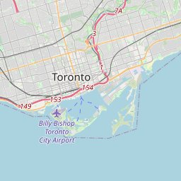
УФ-индекс
Время00:0001:0002:0003:0004:0005:0006:0007:0008:0009:0010:0011:0012:0013:0014:0015:0016:0017:0018:0019:0020:0021:0022:0023:00
УФ-индекс00000000.10.32.13.85.36.76.44.35.84.53.11.60.60.2000

Торонто на карте

Источники данных и методология

Наши прогнозы погоды обеспечиваются профессиональным поставщиком метеорологических данных, который агрегирует данные от национальных метеослужб, спутниковых наблюдений, радарных сетей и более 80 000 метеостанций по всему миру. Данные прогнозов обновляются несколько раз в день. Мы преобразуем необработанные данные в понятные сводки — скорость ветра в м/с, давление в мм рт. ст. — чтобы вы могли уверенно планировать свой день.