
Прогноз погоды на 5 дней Кали 25 нояб. 2026 г.
 11°
Прогноз погоды — Кали, среда, 25 нояб. 2026 г.: слабая морось, температура от 6 °C до 11 °C.
Вероятность осадков 65%. Ветер до 8 м/с (порывы 16.17 м/с). Влажность воздуха 41–79%, атмосферное давление 759–770 мм рт. ст., УФ-индекс до 2.
Погодные предупреждения
Yellow wind warning
SE wind increasing to strong or near gale force, veering to southwesterly by the end of the day. Maximum wind gusts 35-40 knots (65-75 km/h)
IMPACT: Although rather usual in this region, locally or potentially dangerous wind speeds are expected to produce dangerous wave conditions to small crafts. Inexperienced mariners, especially those operating smaller vessels, should avoid navigating in these conditions.
Mariners should pay close attention to the marine forecast and consider wind and sea conditions in planning. It is possible that some ferry lines will not operate so follow traffic information if travelling.
Yellow wind warning
SE wind increasing to strong or near gale force, veering to southwesterly by the end of the day. Maximum wind gusts 35-40 knots (65-75 km/h)
IMPACT: Although rather usual in this region, locally or potentially dangerous wind speeds are expected to produce dangerous wave conditions to small crafts. Inexperienced mariners, especially those operating smaller vessels, should avoid navigating in these conditions.
Mariners should pay close attention to the marine forecast and consider wind and sea conditions in planning. It is possible that some ferry lines will not operate so follow traffic information if travelling.
Yellow wind warning
SE wind increasing to strong or near gale force, veering to southwesterly and northwesterly by the end of the day. Maximum wind gusts 35-40 knots (65-75 km/h)
IMPACT: Although rather usual in this region, locally or potentially dangerous wind speeds are expected to produce dangerous wave conditions to small crafts. Inexperienced mariners, especially those operating smaller vessels, should avoid navigating in these conditions.
Mariners should pay close attention to the marine forecast and consider wind and sea conditions in planning. It is possible that some ferry lines will not operate so follow traffic information if travelling.
Yellow wind warning
SE wind increasing to strong or near gale force, veering to southwesterly and northwesterly by the end of the day. Maximum wind gusts 35-40 knots (65-75 km/h)
IMPACT: Although rather usual in this region, locally or potentially dangerous wind speeds are expected to produce dangerous wave conditions to small crafts. Inexperienced mariners, especially those operating smaller vessels, should avoid navigating in these conditions.
Mariners should pay close attention to the marine forecast and consider wind and sea conditions in planning. It is possible that some ferry lines will not operate so follow traffic information if travelling.
Yellow wind warning
SE wind increasing to strong or near gale force, veering to southwesterly and northwesterly by the end of the day. Maximum wind gusts 35-40 knots (65-75 km/h)
IMPACT: Although rather usual in this region, locally or potentially dangerous wind speeds are expected to produce dangerous wave conditions to small crafts. Inexperienced mariners, especially those operating smaller vessels, should avoid navigating in these conditions.
Mariners should pay close attention to the marine forecast and consider wind and sea conditions in planning. It is possible that some ferry lines will not operate so follow traffic information if travelling.
5 дней кратко — нажмите день, чтобы открыть
Восход 07:07
Заход 16:25
Заход 16:25
Полнолуние96% освещённости
Восход луны 16:32 · Заход луны 08:06
Восход луны 16:32 · Заход луны 08:06
График
Таблицаср, 25 нояб. 2026 г.
Температура от 6 °C до 11 °C и осадки
Облачность и вероятность осадков
Скорость и направление ветра
Влажность воздуха
Атмосферное давление
Ультрафиолетовый индекс
Качество воздуха и пыльца
Данные о качестве воздуха доступны только на первые три дня.
ср, 25 нояб. 2026 г.
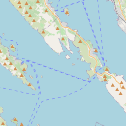
Кали на карте
Источники данных и методология
Наши прогнозы погоды обеспечиваются профессиональным поставщиком метеорологических данных, который агрегирует данные от национальных метеослужб, спутниковых наблюдений, радарных сетей и более 80 000 метеостанций по всему миру. Данные прогнозов обновляются несколько раз в день. Мы преобразуем необработанные данные в понятные сводки — скорость ветра в м/с, давление в мм рт. ст. — чтобы вы могли уверенно планировать свой день.