Laika prognoze 5 dienām Grožnjan 26-07-2026
Laika prognoze Grožnjan svētdiena, 26. jūlijs 26.07.2026: saulains laiks, temperatūra no 19 °C līdz 28 °C.
Nokrišņu varbūtība 88%. Vējš līdz 9.31 m/s (brāzmas 16.53 m/s). Gaisa mitrums 62–88%, atmosfēras spiediens 756–759 mm Hg, UV indekss līdz 7.
Laika brīdinājumi
Slēpt brīdinājumusSevere Forestfire danger Warning (Degree 3/4) - Slovenia / South-West
Severe Forestfire danger Warning
There is a large risk of forest and bush fire.
Stay vigilant and be prepared there is a large risk of forest and bush fire. Immediately react to any developing fire. The public are asked to exercise extreme caution in the countryside, and immediately notify emergency services on any fire.
Yellow wind warning
Locally fresh NE wind. Maximum wind gusts 35-40 knots (65-75 km/h)
IMPACT: Although rather usual in this region, locally or potentially dangerous wind speeds are expected to produce dangerous wave conditions to small crafts. Inexperienced mariners, especially those operating smaller vessels, should avoid navigating in these conditions.
Mariners should pay close attention to the marine forecast and consider wind and sea conditions in planning. It is possible that some ferry lines will not operate so follow traffic information if travelling.
Yellow wind warning
Locally strong NE wind. Maximum wind gusts 35-50 knots (65-95 km/h)
IMPACT: Although rather usual in this region, locally or potentially dangerous wind speeds are expected to produce dangerous wave conditions to small crafts. Inexperienced mariners, especially those operating smaller vessels, should avoid navigating in these conditions.
Mariners should pay close attention to the marine forecast and consider wind and sea conditions in planning. It is possible that some ferry lines will not operate so follow traffic information if travelling.
Yellow wind warning
Locally fresh and strong NE wind. Maximum wind gusts 35-50 knots (65-95 km/h)
IMPACT: Although rather usual in this region, locally or potentially dangerous wind speeds are expected to produce dangerous wave conditions to small crafts. Inexperienced mariners, especially those operating smaller vessels, should avoid navigating in these conditions.
Mariners should pay close attention to the marine forecast and consider wind and sea conditions in planning. It is possible that some ferry lines will not operate so follow traffic information if travelling.
5 dienas īsumā — pieskarieties dienai, lai to atvērtu
Lec 05:42
Riet 20:40
Riet 20:40
Augošs mēness95% apgaismots
Mēness lec 19:20 · Mēness riet 02:24
Mēness lec 19:20 · Mēness riet 02:24
Grafiks
TabulaTemperatūra no 19 °C līdz 28 °C un nokrišņi
Mākoņainums un nokrišņu varbūtība
Vēja ātrums un virziens
Gaisa mitrums
Atmosfēras spiediens
Ultravioletās radiācijas indekss
Gaisa kvalitāte un putekšņi
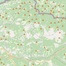
Grožnjan kartē
Datu avoti un metodoloģija
Mūsu laika prognozes tiek nodrošinātas ar profesionāla laika datu pakalpojumu sniedzēja palīdzību, kas apkopo datus no valsts meteoroloģiskajiem dienestiem, satelītu novērojumiem, radaru tīkliem un vairāk nekā 80 000 meteoroloģisko staciju visā pasaulē. Prognožu dati tiek atjaunināti vairākas reizes dienā. Mēs pārveidojam neapstrādātus datus skaidros kopsavilkumos — vēja ātrums m/s, spiediens mmHg — lai jūs varētu plānot savu dienu ar pārliecību.