Orų prognozė 5 dienoms Toronto 17-07-2026
Orų prognozė Toronto liepos 17 d., penktadienis 17.07.2026: mažai debesuota, temperatūra nuo 20 °C iki 26 °C.
Kritulių tikimybė 17%. Vėjas iki 3.19 m/s (gūsiai 4.67 m/s). Oro drėgmė 39–62%, atmosferos slėgis 761–764 mm Hg, UV indeksas iki 5.1.
Oro perspėjimai
Slėpti perspėjimusyellow warning - air quality - in effect
air quality
Smoke is causing or expected to cause poor air quality and reduced visibility.
Smoke from forest fires in northwestern Ontario is causing poor air quality to much of southern Ontario. Poor air quality may persist into Thursday for some areas.
###
As smoke levels increase, health risks increase. Limit time outdoors. Consider reducing or rescheduling outdoor sports, activities and events.
You may experience mild and common symptoms such as eye, nose and throat irritation, headaches or a mild cough. More serious but less common symptoms include wheezing, chest pains or severe cough. If you think you are having a medical emergency, seek immediate medical assistance.
People more likely to be impacted by wildfire smoke, including people aged 65 and older, pregnant people, infants and young children, people with an existing illness or chronic health condition, and people who work outdoors, should reduce or reschedule strenuous activities outdoors and seek medical attention if experiencing symptoms.
For further information visit the website https://www.airqualityontario.com/ or contact the Ontario Ministry of the Environment, Conservation and Parks at 416-314-6666.
Visit http://www.airhealth.ca for information on how to reduce your health risk and your personal contribution to pollution levels, as well as for current and forecast AQHI values.
Please continue to monitor alerts and forecasts issued by Environment Canada.
When indoors, keep windows and doors closed as much as possible. When there is an extreme heat event occurring with poor air quality, prioritize keeping cool.
Protect your indoor air from wildfire smoke. Actions can include using the highest quality air filter that your ventilation system can handle and/or a certified portable air cleaner that can filter fine particles.
If you must spend time outdoors, a well-constructed, well-fitting and properly worn respirator type mask (such as a NIOSH-certified N95 or equivalent respirator) can reduce your exposure to the fine particles in the smoke. Even though exposure may be reduced, there can still be risks to health.
Check in on others who are in your care or live nearby who may be more likely to be impacted by wildfire smoke.
Always follow guidance from local authorities.
Learn more at https://www.canada.ca/wildfire-smoke.
orange warning - air quality - in effect
air quality
Smoke from wildfires in northwestern Ontario is causing very poor air quality and reduced visibility. Conditions may improve Friday morning.
###
During heavy smoke conditions, everyone’s health is at risk regardless of their age or health status.
Limit time outdoors. Reschedule or cancel outdoor sports, activities and events.
You may experience mild and common symptoms such as eye, nose and throat irritation, headaches or a mild cough. More serious but less common symptoms include wheezing, chest pains or severe cough. If you think you are having a medical emergency, seek immediate medical assistance.
People more likely to be impacted by wildfire smoke, including people aged 65 and older, pregnant people, infants and young children, people with an existing illness or chronic health condition, and people who work outdoors, should avoid strenuous activities outdoors and seek medical attention if experiencing symptoms.
For further information visit the website https://www.airqualityontario.com/ or contact the Ontario Ministry of the Environment, Conservation and Parks at 416-314-6666.
Visit http://www.airhealth.ca for information on how to reduce your health risk and your personal contribution to pollution levels, as well as for current and forecast AQHI values.
Please continue to monitor alerts and forecasts issued by Environment Canada.
When indoors, keep windows and doors closed as much as possible. When there is an extreme heat event occurring with poor air quality, prioritize keeping cool.
Protect your indoor air from wildfire smoke. Actions can include using the highest quality air filter that your ventilation system can handle and/or a certified portable air cleaner that can filter fine particles.
If you must spend time outdoors, limit the time as much as possible. A well-constructed, well-fitting and properly worn respirator type mask (such as a NIOSH-certified N95 or equivalent respirator) can reduce your exposure to the fine particles in the smoke. Even though exposure may be reduced, there can still be risks to health.
Check in on others who are in your care or live nearby who may be more likely to be impacted by wildfire smoke.
Always follow guidance from local authorities.
Learn more at https://www.canada.ca/wildfire-smoke.
orange warning - air quality - in effect
air quality
###
During heavy smoke conditions, everyone’s health is at risk regardless of their age or health status.
Limit time outdoors. Reschedule or cancel outdoor sports, activities and events.
You may experience mild and common symptoms such as eye, nose and throat irritation, headaches or a mild cough. More serious but less common symptoms include wheezing, chest pains or severe cough. If you think you are having a medical emergency, seek immediate medical assistance.
People more likely to be impacted by wildfire smoke, including people aged 65 and older, pregnant people, infants and young children, people with an existing illness or chronic health condition, and people who work outdoors, should avoid strenuous activities outdoors and seek medical attention if experiencing symptoms.
For further information visit the website https://www.airqualityontario.com/ or contact the Ontario Ministry of the Environment, Conservation and Parks at 416-314-6666.
Visit http://www.airhealth.ca for information on how to reduce your health risk and your personal contribution to pollution levels, as well as for current and forecast AQHI values.
Please continue to monitor alerts and forecasts issued by Environment Canada.
When indoors, keep windows and doors closed as much as possible. When there is an extreme heat event occurring with poor air quality, prioritize keeping cool.
Protect your indoor air from wildfire smoke. Actions can include using the highest quality air filter that your ventilation system can handle and/or a certified portable air cleaner that can filter fine particles.
If you must spend time outdoors, limit the time as much as possible. A well-constructed, well-fitting and properly worn respirator type mask (such as a NIOSH-certified N95 or equivalent respirator) can reduce your exposure to the fine particles in the smoke. Even though exposure may be reduced, there can still be risks to health.
Check in on others who are in your care or live nearby who may be more likely to be impacted by wildfire smoke.
Always follow guidance from local authorities.
Learn more at https://www.canada.ca/wildfire-smoke.
Saulėtekis 05:51
Saulėlydis 20:55
Saulėlydis 20:55
Jauno mėnulio pjautuvas15% apšvietimo
Mėnulio patekėjimas 09:31 · Mėnulio nusileidimas 22:51
Mėnulio patekėjimas 09:31 · Mėnulio nusileidimas 22:51
Diagrama
LentelėPrognozė nuo 20 °C iki 26 °C ir krituliai
Debesuotumas ir kritulių tikimybė
Vėjo greitis ir kryptis
Oro drėgmė
Atmosferos slėgis
Ultravioletinis indeksas
Oro kokybė ir žiedadulkės
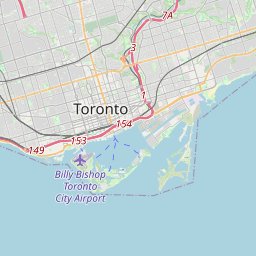
Toronto žemėlapyje
Duomenų šaltiniai ir metodologija
Mūsų orų prognozės yra paremtos profesionaliu orų duomenų tiekėju, kuris apibendrina duomenis iš nacionalinių meteorologijos tarnybų, palydovinių stebėjimų, radarų tinklų ir daugiau nei 80 000 meteorologinių stočių visame pasaulyje. Prognozių duomenys atnaujinami kelis kartus per dieną. Neapdorotus duomenis paverčiame aiškiomis santraukomis – vėjo greitis m/s, slėgis mm Hg – kad galėtumėte planuoti savo dieną su pasitikėjimu.