Orų prognozė 5 dienoms San Diego 01-08-2026

Orų prognozė San Diego rugpjūčio 1 d., šeštadienis 01.08.2026: saulėta, temperatūra nuo 24 °C iki 28 °C.

Kritulių tikimybė 5%. Vėjas iki 3.81 m/s (gūsiai 4.36 m/s). Oro drėgmė 53–67%, atmosferos slėgis 757–759 mm Hg, UV indeksas iki 7.

Oro perspėjimai

Slėpti perspėjimus
Minor07-27 13:3607-27 21:45Versti su Google
Coastal Flood Advisory issued July 27 at 1:36PM PDT until August 1 at 3:00AM PDT by NWS San Diego CA

Coastal Flood Advisory

* WHAT...For the Beach Hazards Statement, 3-6 feet with sets to 7 feet expected. For the Coastal Flood Advisory, minor coastal flooding expected. For the High Surf Advisory, large breaking waves of 5-8 feet with sets up to 9 feet on south-southwest facing beaches and 3-6 feet on west-facing beaches. * WHERE...San Diego County Coastal Areas and Orange County Coastal Areas. * WHEN...For the Beach Hazards Statement, through Wednesday afternoon. For the Coastal Flood Advisory, from 5 PM Wednesday to 3 AM PDT Saturday. For the High Surf Advisory, from 5 PM Wednesday to 5 PM PDT Saturday. * IMPACTS...Flooding of lots, parks, and roads with only isolated road closures expected. Dangerous swimming and surfing conditions and localized beach erosion. Breaking waves can sweep people off jetties and docks, and into dangerous seas. * ADDITIONAL DETAILS...A long period southerly swell of 3 feet at 17 seconds continues through Wednesday. A higher amplitude swell associated with Hurricane Genevieve of around 5 feet at 14 seconds builds late Wednesday into Thursday. Swell and associated surf look to subside late Saturday into Sunday. Also, the following are the evening high tides for La Jolla: Wednesday: 6.11 ft at 9:36 PM PDT Thursday: 5.96 ft at 10:08 PM PDT Friday: 5.65 ft at 10:41 PM PDT Note, tides have been chronically underpredicted this summer, with observed tides at La Jolla generally 0.3-0.4 ft higher than these predictions.
Inexperienced swimmers should remain out of the water due to dangerous surf conditions.
Minor07-27 13:3607-27 21:45Versti su Google
High Surf Advisory issued July 27 at 1:36PM PDT until August 1 at 5:00PM PDT by NWS San Diego CA

High Surf Advisory

* WHAT...For the Beach Hazards Statement, 3-6 feet with sets to 7 feet expected. For the Coastal Flood Advisory, minor coastal flooding expected. For the High Surf Advisory, large breaking waves of 5-8 feet with sets up to 9 feet on south-southwest facing beaches and 3-6 feet on west-facing beaches. * WHERE...San Diego County Coastal Areas and Orange County Coastal Areas. * WHEN...For the Beach Hazards Statement, through Wednesday afternoon. For the Coastal Flood Advisory, from 5 PM Wednesday to 3 AM PDT Saturday. For the High Surf Advisory, from 5 PM Wednesday to 5 PM PDT Saturday. * IMPACTS...Flooding of lots, parks, and roads with only isolated road closures expected. Dangerous swimming and surfing conditions and localized beach erosion. Breaking waves can sweep people off jetties and docks, and into dangerous seas. * ADDITIONAL DETAILS...A long period southerly swell of 3 feet at 17 seconds continues through Wednesday. A higher amplitude swell associated with Hurricane Genevieve of around 5 feet at 14 seconds builds late Wednesday into Thursday. Swell and associated surf look to subside late Saturday into Sunday. Also, the following are the evening high tides for La Jolla: Wednesday: 6.11 ft at 9:36 PM PDT Thursday: 5.96 ft at 10:08 PM PDT Friday: 5.65 ft at 10:41 PM PDT Note, tides have been chronically underpredicted this summer, with observed tides at La Jolla generally 0.3-0.4 ft higher than these predictions.
Inexperienced swimmers should remain out of the water due to dangerous surf conditions.
Moderate07-27 13:3607-27 21:45Versti su Google
Beach Hazards Statement issued July 27 at 1:36PM PDT until July 29 at 5:00PM PDT by NWS San Diego CA

Beach Hazards Statement

* WHAT...For the Beach Hazards Statement, 3-6 feet with sets to 7 feet expected. For the Coastal Flood Advisory, minor coastal flooding expected. For the High Surf Advisory, large breaking waves of 5-8 feet with sets up to 9 feet on south-southwest facing beaches and 3-6 feet on west-facing beaches. * WHERE...San Diego County Coastal Areas and Orange County Coastal Areas. * WHEN...For the Beach Hazards Statement, through Wednesday afternoon. For the Coastal Flood Advisory, from 5 PM Wednesday to 3 AM PDT Saturday. For the High Surf Advisory, from 5 PM Wednesday to 5 PM PDT Saturday. * IMPACTS...Flooding of lots, parks, and roads with only isolated road closures expected. Dangerous swimming and surfing conditions and localized beach erosion. Breaking waves can sweep people off jetties and docks, and into dangerous seas. * ADDITIONAL DETAILS...A long period southerly swell of 3 feet at 17 seconds continues through Wednesday. A higher amplitude swell associated with Hurricane Genevieve of around 5 feet at 14 seconds builds late Wednesday into Thursday. Swell and associated surf look to subside late Saturday into Sunday. Also, the following are the evening high tides for La Jolla: Wednesday: 6.11 ft at 9:36 PM PDT Thursday: 5.96 ft at 10:08 PM PDT Friday: 5.65 ft at 10:41 PM PDT Note, tides have been chronically underpredicted this summer, with observed tides at La Jolla generally 0.3-0.4 ft higher than these predictions.
Inexperienced swimmers should remain out of the water due to dangerous surf conditions.
Minor07-27 21:1107-28 13:15Versti su Google
High Surf Advisory issued July 27 at 9:11PM PDT until August 1 at 5:00PM PDT by NWS San Diego CA

High Surf Advisory

* WHAT...For the Beach Hazards Statement, 3-6 feet with sets to 7 feet expected. For the Coastal Flood Advisory, minor coastal flooding expected. For the High Surf Advisory, large breaking waves of 5-8 feet with sets up to 9 feet on south-southwest facing beaches and 3-6 feet on west-facing beaches. * WHERE...San Diego County Coastal Areas and Orange County Coastal Areas. * WHEN...For the Beach Hazards Statement, through Wednesday afternoon. For the Coastal Flood Advisory, from 5 PM Wednesday to 3 AM PDT Saturday. For the High Surf Advisory, from 5 PM Wednesday to 5 PM PDT Saturday. * IMPACTS...Flooding of lots, parks, and roads with only isolated road closures expected. Dangerous swimming and surfing conditions and localized beach erosion. Breaking waves can sweep people off jetties and docks, and into dangerous seas. * ADDITIONAL DETAILS...A long period southerly swell of 3 feet at 17 seconds continues through Wednesday. A higher amplitude swell associated with Hurricane Genevieve of around 5 feet at 14 seconds builds late Wednesday into Thursday. Swell and associated surf look to subside late Saturday into Sunday.
If travel is required, allow extra time as some roads may be closed. Do not drive around barricades or through water of unknown depth. Take the necessary actions to protect flood-prone property. Inexperienced swimmers should remain out of the water due to dangerous surf conditions. Remain out of the water to avoid hazardous swimming conditions.
Moderate07-27 21:1107-28 13:15Versti su Google
Beach Hazards Statement issued July 27 at 9:11PM PDT until July 29 at 5:00PM PDT by NWS San Diego CA

Beach Hazards Statement

* WHAT...For the Beach Hazards Statement, 3-6 feet with sets to 7 feet expected. For the Coastal Flood Advisory, minor coastal flooding expected. For the High Surf Advisory, large breaking waves of 5-8 feet with sets up to 9 feet on south-southwest facing beaches and 3-6 feet on west-facing beaches. * WHERE...San Diego County Coastal Areas and Orange County Coastal Areas. * WHEN...For the Beach Hazards Statement, through Wednesday afternoon. For the Coastal Flood Advisory, from 5 PM Wednesday to 3 AM PDT Saturday. For the High Surf Advisory, from 5 PM Wednesday to 5 PM PDT Saturday. * IMPACTS...Flooding of lots, parks, and roads with only isolated road closures expected. Dangerous swimming and surfing conditions and localized beach erosion. Breaking waves can sweep people off jetties and docks, and into dangerous seas. * ADDITIONAL DETAILS...A long period southerly swell of 3 feet at 17 seconds continues through Wednesday. A higher amplitude swell associated with Hurricane Genevieve of around 5 feet at 14 seconds builds late Wednesday into Thursday. Swell and associated surf look to subside late Saturday into Sunday.
If travel is required, allow extra time as some roads may be closed. Do not drive around barricades or through water of unknown depth. Take the necessary actions to protect flood-prone property. Inexperienced swimmers should remain out of the water due to dangerous surf conditions. Remain out of the water to avoid hazardous swimming conditions.
5 dienų glaustai — spustelėkite dieną, kad ją atidarytumėte
Saulėtekis 06:02
Saulėlydis 19:47
Delčia83% apšvietimo
Mėnulio patekėjimas 21:37 · Mėnulio nusileidimas 09:01
Diagrama
Lentelė
2026-08-01, št

Prognozė nuo 24 °C iki 28 °C ir krituliai

Temperatūra & Krituliai
Laikas00:0001:0002:0003:0004:0005:0006:0007:0008:0009:0010:0011:0012:0013:0014:0015:0016:0017:0018:0019:0020:0021:0022:0023:00
Temperatūra (°C)252525242424242525262728282828282828272625252525
Krituliai (mm/val.)000000000000000000000000

Debesuotumas ir kritulių tikimybė

Debesuotumas & Lietaus tikimybė
Laikas00:0001:0002:0003:0004:0005:0006:0007:0008:0009:0010:0011:0012:0013:0014:0015:0016:0017:0018:0019:0020:0021:0022:0023:00
Debesuotumas (%)001020011100000511161273579
Lietaus tikimybė (%)444455544332222233344555

Vėjo greitis ir kryptis

Vėjas & Vėjo gūsis
Laikas00:0001:0002:0003:0004:0005:0006:0007:0008:0009:0010:0011:0012:0013:0014:0015:0016:0017:0018:0019:0020:0021:0022:0023:00
Vėjas (m/s)22.112.1122.192.392.312.192.112.52.893.313.53.613.813.613.53.313.112.892.692.311.811.39
Vėjo gūsis (m/s)2.863.033.283.063.283.783.393.112.783.113.53.8644.194.364.1943.813.613.53.312.812.391.89
Vėjo kryptis (°)VŠV 298°VŠV 296°ŠV 308°VŠV 300°VŠV 296°ŠV 308°VŠV 302°VŠV 297°VŠV 291°VŠV 285°V 279°V 274°V 270°V 267°V 264°V 266°V 268°V 270°V 262°VPV 255°VPV 247°V 260°V 273°VŠV 286°

Oro drėgmė

Drėgmė
Laikas00:0001:0002:0003:0004:0005:0006:0007:0008:0009:0010:0011:0012:0013:0014:0015:0016:0017:0018:0019:0020:0021:0022:0023:00
Drėgmė (%)626364656667666564615854545353535353576064656667

Atmosferos slėgis

Slėgis
Laikas00:0001:0002:0003:0004:0005:0006:0007:0008:0009:0010:0011:0012:0013:0014:0015:0016:0017:0018:0019:0020:0021:0022:0023:00
Slėgis (mm Hg)759759758758758758758758759759759758758758758758758757757758758758758758

Ultravioletinis indeksas

UV indeksas
Laikas00:0001:0002:0003:0004:0005:0006:0007:0008:0009:0010:0011:0012:0013:0014:0015:0016:0017:0018:0019:0020:0021:0022:0023:00
UV indeksas000000067777777777770000
2026-08-01, št

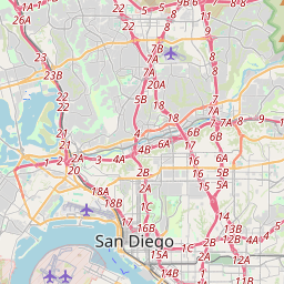
San Diego žemėlapyje

Duomenų šaltiniai ir metodologija

Mūsų orų prognozės yra paremtos profesionaliu orų duomenų tiekėju, kuris apibendrina duomenis iš nacionalinių meteorologijos tarnybų, palydovinių stebėjimų, radarų tinklų ir daugiau nei 80 000 meteorologinių stočių visame pasaulyje. Prognozių duomenys atnaujinami kelis kartus per dieną. Neapdorotus duomenis paverčiame aiškiomis santraukomis – vėjo greitis m/s, slėgis mm Hg – kad galėtumėte planuoti savo dieną su pasitikėjimu.