
Orų prognozė 5 dienoms Los Angeles 2026-11-16
 20°
Orų prognozė — Los Angeles, rytoj, 2026-11-16: galimas trumpalaikis lietus, temperatūra nuo 16 °C iki 20 °C.
Kritulių tikimybė 34%. Vėjas iki 2.39 m/s (gūsiai 4.92 m/s). Oro drėgmė 63–79%, atmosferos slėgis 761–764 mm Hg, UV indeksas iki 2.7.
Oro perspėjimai
Coastal Flood Advisory issued November 14 at 4:02AM PST until November 14 at 4:00PM PST by NWS Los Angeles/Oxnard CA
Coastal Flood Advisory
* WHAT...For the High Surf Advisory, large breaking waves of 5
to 8 feet Friday, increasing to 8 to 12 feet Saturday. Surf
heights are expected to decrease to 5 to 9 feet Sunday through
Tuesday. Dangerous rip currents expected. For the Coastal
Flood Advisory, minor to moderate coastal flooding expected.
* WHERE...Malibu Coast and Los Angeles County Beaches. Surf will
we highest for west-northwest facing beaches.
* WHEN...For the High Surf Advisory, until 3 PM PST Tuesday. For
the Coastal Flood Advisory, from 4 AM to 4 PM PST Saturday.
* IMPACTS...Moderate flooding of sea water is likely over some
vulnerable low-lying coastal areas that are normally dry,
especially around the time of high tide, including over beach
parking lots, bike paths, and harbor walkways. Moderate to
significant beach erosion is likely. Isolated damage is
unlikely but possible. There is an increased risk for ocean
drowning. Rip currents can pull swimmers and surfers out to
sea. Large breaking waves can cause injury, wash people off
beaches and rocks, and capsize small boats near shore.
* ADDITIONAL DETAILS...A series of significant west-
northwesterly swells are expected to produce large surf into
next week with highest surf and greatest impacts likely
peaking Saturday and potentially again Monday. Minor to
moderate coastal flooding impacts are possible, especially
when largest surf overlaps with peak high tides. Some of these
impacts may be moderate to significant beach erosion and
shallow flooding of normally dry beaches and walkways.
High Surf Advisory issued November 14 at 4:02AM PST until November 17 at 3:00PM PST by NWS Los Angeles/Oxnard CA
High Surf Advisory
* WHAT...For the High Surf Advisory, large breaking waves of 5
to 8 feet Friday, increasing to 8 to 12 feet Saturday. Surf
heights are expected to decrease to 5 to 9 feet Sunday through
Tuesday. Dangerous rip currents expected. For the Coastal
Flood Advisory, minor to moderate coastal flooding expected.
* WHERE...Malibu Coast and Los Angeles County Beaches. Surf will
we highest for west-northwest facing beaches.
* WHEN...For the High Surf Advisory, until 3 PM PST Tuesday. For
the Coastal Flood Advisory, from 4 AM to 4 PM PST Saturday.
* IMPACTS...Moderate flooding of sea water is likely over some
vulnerable low-lying coastal areas that are normally dry,
especially around the time of high tide, including over beach
parking lots, bike paths, and harbor walkways. Moderate to
significant beach erosion is likely. Isolated damage is
unlikely but possible. There is an increased risk for ocean
drowning. Rip currents can pull swimmers and surfers out to
sea. Large breaking waves can cause injury, wash people off
beaches and rocks, and capsize small boats near shore.
* ADDITIONAL DETAILS...A series of significant west-
northwesterly swells are expected to produce large surf into
next week with highest surf and greatest impacts likely
peaking Saturday and potentially again Monday. Minor to
moderate coastal flooding impacts are possible, especially
when largest surf overlaps with peak high tides. Some of these
impacts may be moderate to significant beach erosion and
shallow flooding of normally dry beaches and walkways.
High Surf Advisory issued November 14 at 6:02PM PST until November 17 at 3:00PM PST by NWS Los Angeles/Oxnard CA
High Surf Advisory
* WHAT...For the High Surf Advisory, large breaking waves of 5
to 8 feet Friday, increasing to 8 to 12 feet Saturday. Surf
heights are expected to decrease to 5 to 9 feet Sunday through
Tuesday. Dangerous rip currents expected. For the Coastal
Flood Advisory, minor to moderate coastal flooding expected.
* WHERE...Malibu Coast and Los Angeles County Beaches. Surf will
we highest for west-northwest facing beaches.
* WHEN...For the High Surf Advisory, until 3 PM PST Tuesday. For
the Coastal Flood Advisory, from 4 AM to 4 PM PST Saturday.
* IMPACTS...Moderate flooding of sea water is likely over some
vulnerable low-lying coastal areas that are normally dry,
especially around the time of high tide, including over beach
parking lots, bike paths, and harbor walkways. Moderate to
significant beach erosion is likely. Isolated damage is
unlikely but possible. There is an increased risk for ocean
drowning. Rip currents can pull swimmers and surfers out to
sea. Large breaking waves can cause injury, wash people off
beaches and rocks, and capsize small boats near shore.
* ADDITIONAL DETAILS...A series of significant west-
northwesterly swells are expected to produce large surf into
next week with highest surf and greatest impacts likely
peaking Saturday and potentially again Monday. Minor to
moderate coastal flooding impacts are possible, especially
when largest surf overlaps with peak high tides. Some of these
impacts may be moderate to significant beach erosion and
shallow flooding of normally dry beaches and walkways.
High Surf Advisory issued November 14 at 8:26PM PST until November 17 at 3:00PM PST by NWS Los Angeles/Oxnard CA
High Surf Advisory
* WHAT...For the High Surf Advisory, breaking waves of 8 to 12
feet lowering to 5 to 9 feet Sunday through Tuesday. Dangerous
rip currents expected. For the Coastal Flood Advisory, minor to
moderate coastal flooding expected.
* WHERE...Malibu Coast and Los Angeles County Beaches. Surf will
we highest for west-northwest facing beaches.
* WHEN...For the High Surf Advisory, until 3 PM PST Tuesday. For
the Coastal Flood Advisory, from 4 AM to 4 PM PST Saturday.
* IMPACTS...Moderate flooding of sea water is likely over some
vulnerable low-lying coastal areas that are normally dry,
especially around the time of high tide, including over beach
parking lots, bike paths, and harbor walkways. Moderate to
significant beach erosion is likely. Isolated damage is
unlikely but possible. There is an increased risk for ocean
drowning. Rip currents can pull swimmers and surfers out to
sea. Large breaking waves can cause injury, wash people off
beaches and rocks, and capsize small boats near shore.
* ADDITIONAL DETAILS...A series of significant west-
northwesterly swells are expected to produce large surf into
next week with highest surf and greatest impacts likely
peaking Saturday and potentially again Monday. Minor to
moderate coastal flooding impacts are possible, especially
when largest surf overlaps with peak high tides. Some of these
impacts may be moderate to significant beach erosion and
shallow flooding of normally dry beaches and walkways.
5 dienų glaustai — spustelėkite dieną, kad ją atidarytumėte
Saulėtekis 06:26
Saulėlydis 16:48
Saulėlydis 16:48
Pirmasis ketvirtis52% apšvietimo
Mėnulio patekėjimas 12:27 · Mėnulio nusileidimas 23:31
Mėnulio patekėjimas 12:27 · Mėnulio nusileidimas 23:31
Diagrama
LentelėPrognozė nuo 16 °C iki 20 °C ir krituliai
Debesuotumas ir kritulių tikimybė
Vėjo greitis ir kryptis
Oro drėgmė
Atmosferos slėgis
Ultravioletinis indeksas
Oro kokybė ir žiedadulkės
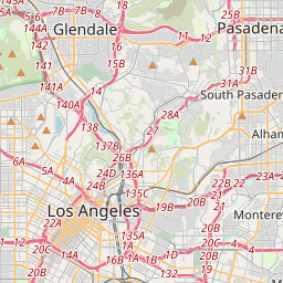
Los Angeles žemėlapyje
Duomenų šaltiniai ir metodologija
Mūsų orų prognozės yra paremtos profesionaliu orų duomenų tiekėju, kuris apibendrina duomenis iš nacionalinių meteorologijos tarnybų, palydovinių stebėjimų, radarų tinklų ir daugiau nei 80 000 meteorologinių stočių visame pasaulyje. Prognozių duomenys atnaujinami kelis kartus per dieną. Neapdorotus duomenis paverčiame aiškiomis santraukomis – vėjo greitis m/s, slėgis mm Hg – kad galėtumėte planuoti savo dieną su pasitikėjimu.