Orų prognozė 5 dienoms Limbach-Oberfrohna 17-08-2026

Orų prognozė Limbach-Oberfrohna šiandien 17.08.2026: pustomas sniegas, temperatūra nuo -2 °C iki 1 °C.

Kritulių tikimybė 94%. Vėjas iki 16.69 m/s (gūsiai 22.53 m/s). Oro drėgmė 68–99%, atmosferos slėgis 740–743 mm Hg, UV indeksas iki 2.7.

Oro perspėjimai

Slėpti perspėjimus
Moderate08-16 11:0208-18 17:00Versti su Google
Moderate Fire Impact
Risk of fires due to prolonged drought. Possible occurrence of severe fire with subsequent damage. Possible damage to ecosystems, property, forestry, agriculture, etc. Risk of human injury. Deterioration of air quality causing respiratory problems and other health issues.
Do not light fires outdoors, do not burn grass, do not smoke or discard cigarette butts on the ground. Do not use portable stoves or other open flame sources. Follow local bans issued due to drought and fire risk. Stay alert when using agricultural machinery and near railway tracks where sparks from wheels and brakes can ignite vegetation.
Moderate08-16 11:0208-18 17:00Versti su Google
Moderate Fire Impact
Risk of fires due to prolonged drought. Possible occurrence of severe fire with subsequent damage. Possible damage to ecosystems, property, forestry, agriculture, etc. Risk of human injury. Deterioration of air quality causing respiratory problems and other health issues.
Do not light fires outdoors, do not burn grass, do not smoke or discard cigarette butts on the ground. Do not use portable stoves or other open flame sources. Follow local bans issued due to drought and fire risk. Stay alert when using agricultural machinery and near railway tracks where sparks from wheels and brakes can ignite vegetation.
Moderate08-16 11:0208-18 17:00Versti su Google
Moderate Fire Impact
Risk of fires due to prolonged drought. Possible occurrence of severe fire with subsequent damage. Possible damage to ecosystems, property, forestry, agriculture, etc. Risk of human injury. Deterioration of air quality causing respiratory problems and other health issues.
Do not light fires outdoors, do not burn grass, do not smoke or discard cigarette butts on the ground. Do not use portable stoves or other open flame sources. Follow local bans issued due to drought and fire risk. Stay alert when using agricultural machinery and near railway tracks where sparks from wheels and brakes can ignite vegetation.
Moderate08-16 11:0208-17 20:59Versti su Google
Moderate Thunderstorm Impact
Risk of severe thunderstorms. Possible local property damage and complications, especially in the energy industry and transport. Potential for local flooding, especially of low-lying areas. Local wind damage to roofs, fences, soft shelters and trees. Local power outages. Some travel delays. Driving conditions difficult. Possible crop damage from small hail. Risk of fire caused by lightning strike. Risk of injury from flying or falling objects, and lightning strikes.
Beware of lightning strikes and flying or falling objects (especially branches). Seek shelter in a building equipped with lightning protection. Outdoors, take cover in dense forest or low vegetation; avoid water bodies, hilltops, metal structures, isolated trees, and rock overhangs. When driving reduce speed. Observe weather warnings, weather radar (www.chmi.cz or mobile apps) and local flood risk https://produkty.chmi.cz/ffi.
Moderate08-16 11:0208-17 20:59Versti su Google
Moderate Thunderstorm Impact
Risk of severe thunderstorms. Possible local property damage and complications, especially in the energy industry and transport. Potential for local flooding, especially of low-lying areas. Local wind damage to roofs, fences, soft shelters and trees. Local power outages. Some travel delays. Driving conditions difficult. Possible crop damage from small hail. Risk of fire caused by lightning strike. Risk of injury from flying or falling objects, and lightning strikes.
Beware of lightning strikes and flying or falling objects (especially branches). Seek shelter in a building equipped with lightning protection. Outdoors, take cover in dense forest or low vegetation; avoid water bodies, hilltops, metal structures, isolated trees, and rock overhangs. When driving reduce speed. Observe weather warnings, weather radar (www.chmi.cz or mobile apps) and local flood risk https://produkty.chmi.cz/ffi.
5 dienų glaustai — spustelėkite dieną, kad ją atidarytumėte
Saulėtekis 05:59
Saulėlydis 20:26
Jauno mėnulio pjautuvas27% apšvietimo
Mėnulio patekėjimas 12:02 · Mėnulio nusileidimas 21:47
Diagrama
Lentelė
2026-08-17, pr

Prognozė nuo -2 °C iki 1 °C ir krituliai

Temperatūra & Krituliai
Laikas00:0001:0002:0003:0004:0005:0006:0007:0008:0009:0010:0011:0012:0013:0014:0015:0016:0017:0018:0019:0020:0021:0022:0023:00
Temperatūra (°C)00010-1-2-2-1-1-1-1-1-1-1-1-1-1-2-2-2-2-2-2
Krituliai (mm/val.)0.0700.050.010.014.112.410.0600.020.0200.0300.030.040.040.050.040.090.070.130.090.07

Debesuotumas ir kritulių tikimybė

Debesuotumas & Lietaus tikimybė
Laikas00:0001:0002:0003:0004:0005:0006:0007:0008:0009:0010:0011:0012:0013:0014:0015:0016:0017:0018:0019:0020:0021:0022:0023:00
Debesuotumas (%)8633891001001001001001001001008993100100901001007510010010083100
Lietaus tikimybė (%)321229253694863524253121241825252829243631403232

Vėjo greitis ir kryptis

Vėjas & Vėjo gūsis
Laikas00:0001:0002:0003:0004:0005:0006:0007:0008:0009:0010:0011:0012:0013:0014:0015:0016:0017:0018:0019:0020:0021:0022:0023:00
Vėjas (m/s)15.8115.611616.6916.6112.617.318.117.697.319.318.899.1910.6111.3912.1912.8912.3912.512.8112.8113.1913.6114.19
Vėjo gūsis (m/s)20.3320.521.522.5322.2219.2211.8110.9211.7210.5311.3911.7213.1413.8315.0617.4218.031717.4217.3917.1417.2218.4218.89
Vėjo kryptis (°)ŠV 319°ŠV 319°ŠV 322°ŠV 323°ŠV 321°ŠV 321°VPV 247°V 267°V 273°V 275°V 259°VPV 252°V 269°V 273°V 276°V 278°V 279°V 278°V 279°V 280°V 280°V 281°V 278°V 276°

Oro drėgmė

Drėgmė
Laikas00:0001:0002:0003:0004:0005:0006:0007:0008:0009:0010:0011:0012:0013:0014:0015:0016:0017:0018:0019:0020:0021:0022:0023:00
Drėgmė (%)787877798999908078787977706868707273737372747272

Atmosferos slėgis

Slėgis
Laikas00:0001:0002:0003:0004:0005:0006:0007:0008:0009:0010:0011:0012:0013:0014:0015:0016:0017:0018:0019:0020:0021:0022:0023:00
Slėgis (mm Hg)743743742741740740740740740740740741741742741742742742742743743743743743

Ultravioletinis indeksas

UV indeksas
Laikas00:0001:0002:0003:0004:0005:0006:0007:0008:0009:0010:0011:0012:0013:0014:0015:0016:0017:0018:0019:0020:0021:0022:0023:00
UV indeksas00000000.20.51.11.82.32.62.22.70.60.40.200.10000

Oro kokybė ir žiedadulkės

Oro kokybė
Laikas00:0001:0002:0003:0004:0005:0006:0007:0008:0009:0010:0011:0012:0013:0014:0015:0016:0017:0018:0019:0020:0021:0022:0023:00
PM2.5 (µg/m³)6.76.46.576.56.16.15.34.95.75.95.66.876.765.65.24.74.84.84.954.4
PM10 (µg/m³)8.78.999.89.78.375.95.877.79.39.99.79.39.79.58.37.67.57.67.47.36.2
Ozonas (O₃) (µg/m³)655952454442596559576465686970707274747269615755
NO₂ (µg/m³)7.38.27.26.35.54.94.15.76.66.85.34.94.95.354.53.44.65.55.65.96.76.76.9
SO₂ (µg/m³)0.70.60.50.40.30.30.20.31.13.12.92.82.72.92.72.31.92.52.42.22.42.41.91.6
CO (µg/m³)167169149145140135133138143140141136139141140141140141142138138139133135
2026-08-17, pr

Dažni klausimai apie 5 dienų orų prognozę Limbach-Oberfrohna

Koks oras bus Limbach-Oberfrohna artimiausias 5 dienas?
Artimiausias 5 dienas Limbach-Oberfrohna temperatūra svyruos maždaug nuo -2 iki 5 °C. Išsamią kiekvienos iš 5 dienų valandinę prognozę rasite grafikuose viršuje.
Kuriomis iš artimiausių 5 dienų Limbach-Oberfrohna lis?
Kritulių tikimybė Limbach-Oberfrohna artimiausias 5 dienas siekia 94%. Viršuje esančiame 5 dienų kritulių grafike matysite, kuriomis dienomis ir valandomis lis.
Kiek tiksli 5 dienų orų prognozė Limbach-Oberfrohna?
5 dienų prognozė gana patikima: pirmos 2–3 dienos paprastai labai tikslios, 4–5 dienos gali būti tikslinamos. Duomenys atnaujinami kelis kartus per dieną, todėl prieš svarbius planus užsukite dar kartą.
Kuri iš artimiausių 5 dienų Limbach-Oberfrohna bus šilčiausia, o kuri vėsiausia?
Artimiausias 5 dienas temperatūra Limbach-Oberfrohna svyruoja maždaug nuo -2 iki 5 °C. Šilčiausią ir vėsiausią dieną patogu palyginti temperatūros grafike viršuje.
Ar Limbach-Oberfrohna artimiausias 5 dienas bus vėjuota?
Artimiausias 5 dienas vėjas Limbach-Oberfrohna sustiprėja iki 19 m/s. Vėjuočiausios dienos gerai matomos vėjo grafike viršuje.
Kuri savaitės diena Limbach-Oberfrohna geriausiai tinka pasivaikščiojimui ar kelionei?
Pasivaikščiojimui ar kelionei rinkitės dienas su mažiausia kritulių tikimybe (iki 94%) ir silpnu vėju – jas lengva palyginti 5 dienų grafikuose viršuje.
Kaip geriausiai naudotis Limbach-Oberfrohna 5 dienų prognoze?
Pirmos 2–3 dienos pakankamai patikimos tvirtiems sprendimams, o 4–5 dienos yra orientyras, kuris tikslėja artėjant. Prognozė atnaujinama kelis kartus per dieną, todėl prieš svarbius planus patikrinkite dar kartą.

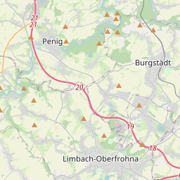
Limbach-Oberfrohna žemėlapyje

Duomenų šaltiniai ir metodologija

Mūsų orų prognozės yra paremtos profesionaliu orų duomenų tiekėju, kuris apibendrina duomenis iš nacionalinių meteorologijos tarnybų, palydovinių stebėjimų, radarų tinklų ir daugiau nei 80 000 meteorologinių stočių visame pasaulyje. Prognozių duomenys atnaujinami kelis kartus per dieną. Neapdorotus duomenis paverčiame aiškiomis santraukomis – vėjo greitis m/s, slėgis mm Hg – kad galėtumėte planuoti savo dieną su pasitikėjimu.