Prévisions météo à 5 jours Surry Hills 10 nov. 2026

20°13° · Ensoleillé

Prévisions météo Surry Hills demain 10 nov. 2026 : ensoleillé, température de 13 °C à 20 °C.

Probabilité de précipitations 21%. Vent jusqu'à 8.69 m/s (rafales 12.69 m/s). Humidité de l'air 54–80%, pression atmosphérique 760–764 mm Hg, indice UV jusqu'à 10.1.

Alertes météo

Moderate9 nov., 00:00 — 10 nov., 00:00Traduire avec Google
Hazardous Surf Warning for Byron Coast: Point Danger to Wooli, Coffs Coast: Wooli to Smoky Cape, Macquarie Coast: Smoky Cape to Seal Rocks, Hunter Coast: Seal Rocks to Broken Bay, Sydney Coast: Broken Bay to Port Hacking, Illawarra Coast: Port Hacking to Ulladulla, Batemans Coast: Ulladulla to Montague Island and Eden Coast: Montague Island to Gabo Island for 09 November

Large Coastal Surf

NSW Police Force, Marine Area Command advise that: People should consider staying out of the water and avoid walking near surf-exposed areas. Rock fishers should avoid coastal rock platforms exposed to the ocean and seek a safe location that is sheltered from the surf. Boaters planning to cross shallow water and ocean bars should consider changing or delaying their voyage. Boaters already on the water should carry the appropriate safety equipment and wear a lifejacket. Boaters should remember to log on with their local Marine Rescue radio base, via VHF Radio or the Marine Rescue APP, and consider their safety management plan.
Moderate9 nov., 00:00 — 10 nov., 00:00Traduire avec Google
Hazardous Surf Warning for Byron Coast: Point Danger to Wooli, Coffs Coast: Wooli to Smoky Cape, Macquarie Coast: Smoky Cape to Seal Rocks, Hunter Coast: Seal Rocks to Broken Bay, Sydney Coast: Broken Bay to Port Hacking, Illawarra Coast: Port Hacking to Ulladulla, Batemans Coast: Ulladulla to Montague Island and Eden Coast: Montague Island to Gabo Island for 09 November

Large Coastal Surf

NSW Police Force, Marine Area Command advise that: People should consider staying out of the water and avoid walking near surf-exposed areas. Rock fishers should avoid coastal rock platforms exposed to the ocean and seek a safe location that is sheltered from the surf. Boaters planning to cross shallow water and ocean bars should consider changing or delaying their voyage. Boaters already on the water should carry the appropriate safety equipment and wear a lifejacket. Boaters should remember to log on with their local Marine Rescue radio base, via VHF Radio or the Marine Rescue APP, and consider their safety management plan.
Moderate9 nov., 00:00 — 10 nov., 00:00Traduire avec Google
Hazardous Surf Warning for Byron Coast: Point Danger to Wooli, Coffs Coast: Wooli to Smoky Cape, Macquarie Coast: Smoky Cape to Seal Rocks, Hunter Coast: Seal Rocks to Broken Bay, Sydney Coast: Broken Bay to Port Hacking, Illawarra Coast: Port Hacking to Ulladulla, Batemans Coast: Ulladulla to Montague Island and Eden Coast: Montague Island to Gabo Island for 09 November

Large Coastal Surf

NSW Police Force, Marine Area Command advise that: People should consider staying out of the water and avoid walking near surf-exposed areas. Rock fishers should avoid coastal rock platforms exposed to the ocean and seek a safe location that is sheltered from the surf. Boaters planning to cross shallow water and ocean bars should consider changing or delaying their voyage. Boaters already on the water should carry the appropriate safety equipment and wear a lifejacket. Boaters should remember to log on with their local Marine Rescue radio base, via VHF Radio or the Marine Rescue APP, and consider their safety management plan.
Moderate9 nov., 00:00 — 10 nov., 00:00Traduire avec Google
Strong Wind Warning for coastal waters between Point Danger and Montague Island and for Sydney Enclosed Waters for 09 November

Wind

Moderate9 nov., 00:00 — 10 nov., 00:00Traduire avec Google
Strong Wind Warning for coastal waters between Point Danger and Montague Island and for Sydney Enclosed Waters for 09 November

Wind

Les 5 jours en un coup d'œil — appuyez sur un jour pour l'ouvrir
Lever du soleil 05:46
Coucher du soleil 19:31
Nouvelle Lune3% illuminé
Lever de la lune 05:54 · Coucher de la lune 20:50
Graphique
Tableau

Prévisions de 13 °C à 20 °C et précipitations

Température & Précipitations
Heure00:0001:0002:0003:0004:0005:0006:0007:0008:0009:0010:0011:0012:0013:0014:0015:0016:0017:0018:0019:0020:0021:0022:0023:00
Température (°C)171614151413131315151719181719191920191919191919
Précipitations (mm/h)000000000000000000000000

Couverture nuageuse et probabilité de précipitations

Couverture nuageuse & Risque de pluie
Heure00:0001:0002:0003:0004:0005:0006:0007:0008:0009:0010:0011:0012:0013:0014:0015:0016:0017:0018:0019:0020:0021:0022:0023:00
Couverture nuageuse (%)1007438951000562520035054100100429210049
Risque de pluie (%)1511111769666933354559181811182114

Vitesse et direction du vent

Vent & Rafale de vent
Heure00:0001:0002:0003:0004:0005:0006:0007:0008:0009:0010:0011:0012:0013:0014:0015:0016:0017:0018:0019:0020:0021:0022:0023:00
Vent (m/s)4.113.693.53.613.3933.113.893.112.892.392.395.117.617.198.698.196.698.196.694.695.694.693.31
Rafale de vent (m/s)4.423.924.836.618.394.286.117.894.613.533.614.258.1110.619.3912.698.339.949.197.817.067.116.725.97
Direction du vent (°)SSO 205°SO 229°OSO 250°OSO 249°OSO 254°O 268°ONO 284°ONO 294°ONO 290°NO 311°N 352°NE 45°ENE 69°ENE 62°NE 56°NE 56°ENE 61°ENE 57°NE 53°NE 55°NE 50°NNE 32°NNE 24°NNE 18°

Humidité de l'air

Humidité
Heure00:0001:0002:0003:0004:0005:0006:0007:0008:0009:0010:0011:0012:0013:0014:0015:0016:0017:0018:0019:0020:0021:0022:0023:00
Humidité (%)616475687080727270625654606762676766697074737580

Pression atmosphérique

Pression
Heure00:0001:0002:0003:0004:0005:0006:0007:0008:0009:0010:0011:0012:0013:0014:0015:0016:0017:0018:0019:0020:0021:0022:0023:00
Pression (mm Hg)764764764763763764764764764764764763762761761760760761760761762762762763

Indice ultraviolet

Indice UV
Heure00:0001:0002:0003:0004:0005:0006:0007:0008:0009:0010:0011:0012:0013:0014:0015:0016:0017:0018:0019:0020:0021:0022:0023:00
Indice UV00000000.31.22.95.37.89.510.19.37.44.92.60.90.20000

Qualité de l'air et pollen

Qualité de l'air
Heure00:0001:0002:0003:0004:0005:0006:0007:0008:0009:0010:0011:0012:0013:0014:0015:0016:0017:0018:0019:0020:0021:0022:0023:00
PM2.5 (µg/m³)12.712.612.512.211.811.712.413.813.39.71011.112.313.214.31617.317.617.417.51818.418.316.2
PM10 (µg/m³)15.71514.413.713.212.913.715.215.913.213.414.916.517.919.622.224.124.624.324.224.62524.821
Ozone (O₃) (µg/m³)1916141199121826374961728187868277747066605246
NO₂ (µg/m³)21.923.72526.327.326.723.819.415.311.98.86.55.45.15.56.78.710.813.115.517.719.721.522.7
SO₂ (µg/m³)4.355.76.26.67.28.39.610.19.27.66.46.16.279.21213.713.211.59.88.46.95.9
CO (µg/m³)878693114143168189206208184144111938174727578818588888795

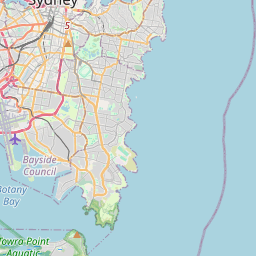
Surry Hills sur la carte

Sources de données et méthodologie

Nos prévisions météo sont alimentées par un fournisseur professionnel de données météorologiques qui agrège les données des services météorologiques nationaux, des observations satellites, des réseaux radar et de plus de 80 000 stations météorologiques dans le monde. Les données de prévision sont mises à jour plusieurs fois par jour. Nous convertissons les données brutes en résumés clairs — vitesse du vent en m/s, pression en mm Hg — afin que vous puissiez planifier votre journée en toute confiance.