Prévisions météo à 5 jours Salinas 18 nov. 2026

14°9° · Pluie modérée

Prévisions météo Salinas demain 18 nov. 2026 : pluie modérée, température de 9 °C à 14 °C.

Probabilité de précipitations 90%. Vent jusqu'à 6.69 m/s (rafales 14.61 m/s). Humidité de l'air 79–94%, pression atmosphérique 758–764 mm Hg, indice UV jusqu'à 0.3.

Alertes météo

Severe17 nov., 11:48 — 18 nov., 05:15Traduire avec Google
Flash Flood Watch issued November 17 at 11:48AM PST until November 19 at 4:00AM PST by NWS San Francisco CA

Flash Flood Watch

* WHAT...Flash flooding and debris flows caused by excessive rainfall are possible over the Plaskett and Timber burn areas. * WHERE...For the Timber Scar, portions of CA Highway 1 and the Los Padres National Forecast from Andrew Molera State Park to Partington Ridge including the town of Big Sur. For the Plaskett Scar, areas near CA Highway 1 mile marker 17 to mile marker 11 including Los Burros Road. * WHEN...From early Wednesday morning to early Thursday morning. * IMPACTS...Heavy rainfall over the Timber and Plaskett burn areas is expected during the watch period. Residents near the Timber burn area should prepare for potential debris flow moving through the drainages within Lafler, Castro, and Graves Canyons, as well as drainages between Grimes and Castro Canyons. Residents near the Plaskett burn area should prepare for potential debris flow moving through the Alder, Plaskett, and Prewitt Creeks. Be sure to stay up to date with information from local authorities. Heavy rainfall could trigger flash flooding of low-lying areas, roadway flooding, and debris flows in and near recent wildfire burn scars. * ADDITIONAL DETAILS... - National Weather Service Meteorologists are forecasting heavy rainfall over the Timber and Plaskett burn areas, which may lead to flash flooding and debris flows. - Some locations that may experience flash flooding include... Big Sur, Plaskett, and Pfeiffer Big Sur State Park - http://www.weather.gov/safety/flood
Minor17 nov., 14:29 — 17 nov., 22:30Traduire avec Google
Small Craft Advisory issued November 17 at 2:29PM PST until November 18 at 3:00AM PST by NWS San Francisco CA

Small Craft Advisory

* WHAT...For the Small Craft Advisory, south winds 10 to 20 kt with gusts up to 30 kt expected. For the Gale Warning, south winds 20 to 30 kt with gusts up to 45 kt expected. * WHERE...Monterey Bay. * WHEN...For the Small Craft Advisory, from 9 PM this evening to 3 AM PST Wednesday. For the Gale Warning, from 3 AM to 3 PM PST Wednesday. * IMPACTS...Strong winds will cause hazardous seas which could capsize or damage vessels and reduce visibility.
Moderate17 nov., 14:29 — 17 nov., 22:30Traduire avec Google
Gale Warning issued November 17 at 2:29PM PST until November 18 at 3:00PM PST by NWS San Francisco CA

Gale Warning

* WHAT...For the Small Craft Advisory, south winds 10 to 20 kt with gusts up to 30 kt expected. For the Gale Warning, south winds 20 to 30 kt with gusts up to 45 kt expected. * WHERE...Monterey Bay. * WHEN...For the Small Craft Advisory, from 9 PM this evening to 3 AM PST Wednesday. For the Gale Warning, from 3 AM to 3 PM PST Wednesday. * IMPACTS...Strong winds will cause hazardous seas which could capsize or damage vessels and reduce visibility.
Les 5 jours en un coup d'œil — appuyez sur un jour pour l'ouvrir
Lever du soleil 06:47
Coucher du soleil 16:55
Gibbeuse Croissante73% illuminé
Lever de la lune 13:33 · Coucher de la lune 00:39
Graphique
Tableau

Prévisions de 9 °C à 14 °C et précipitations

Température & Précipitations
Heure00:0001:0002:0003:0004:0005:0006:0007:0008:0009:0010:0011:0012:0013:0014:0015:0016:0017:0018:0019:0020:0021:0022:0023:00
Température (°C)999999101011121313141414141413131313121212
Précipitations (mm/h)000000.090.180.260.871.72.633.765.756.373.381.82.454.820.850.170.220.150.240.53

Couverture nuageuse et probabilité de précipitations

Couverture nuageuse & Risque de pluie
Heure00:0001:0002:0003:0004:0005:0006:0007:0008:0009:0010:0011:0012:0013:0014:0015:0016:0017:0018:0019:0020:0021:0022:0023:00
Couverture nuageuse (%)4588939597989910010010010010010010010010010088756281885877
Risque de pluie (%)152223232332444866758285899085788388663740373456

Vitesse et direction du vent

Vent & Rafale de vent
Heure00:0001:0002:0003:0004:0005:0006:0007:0008:0009:0010:0011:0012:0013:0014:0015:0016:0017:0018:0019:0020:0021:0022:0023:00
Vent (m/s)3.193.614.114.314.8954.8154.614.554.815.616.696.194.813.53.543.694.54.394.54.61
Rafale de vent (m/s)5.256.117.227.679.069.429.229.429.429.6411.1111.6713.0614.6112.8910.478.947.676.946.587.928.318.789
Direction du vent (°)SE 129°SE 124°ESE 123°ESE 123°ESE 122°SE 124°SE 126°SE 126°SE 134°SE 144°SSE 156°S 172°S 176°S 184°S 190°S 184°SSO 192°SO 227°SO 225°SO 228°SO 222°SO 214°SSO 203°SSO 199°

Humidité de l'air

Humidité
Heure00:0001:0002:0003:0004:0005:0006:0007:0008:0009:0010:0011:0012:0013:0014:0015:0016:0017:0018:0019:0020:0021:0022:0023:00
Humidité (%)828180797981818182848787909089909294949187868789

Pression atmosphérique

Pression
Heure00:0001:0002:0003:0004:0005:0006:0007:0008:0009:0010:0011:0012:0013:0014:0015:0016:0017:0018:0019:0020:0021:0022:0023:00
Pression (mm Hg)764764764763762761761761761761761760759758758758758758758758758758758758

Indice ultraviolet

Indice UV
Heure00:0001:0002:0003:0004:0005:0006:0007:0008:0009:0010:0011:0012:0013:0014:0015:0016:0017:0018:0019:0020:0021:0022:0023:00
Indice UV000000000.10.20.30.30.30.20.20.20.10000000

Qualité de l'air et pollen

Qualité de l'air
Heure00:0001:0002:0003:0004:0005:0006:0007:0008:0009:0010:0011:0012:0013:0014:0015:0016:0017:0018:0019:0020:0021:0022:0023:00
PM2.5 (µg/m³)9.47.65.74.43.53.23.43.43.54.54.54.65.25.45.64.63.63.84.75.46.98.59.59
PM10 (µg/m³)10.48.46.45.14.24.24.64.74.96.96.87.188.38.77.15.45.46.77.89.91213.412.7
Ozone (O₃) (µg/m³)232531394651566065717578797978767369645955514848
NO₂ (µg/m³)21.517.9149.76.55.14.74.33.52.621.61.51.51.722.84.25.97.79.711.712.511
SO₂ (µg/m³)0.70.50.40.40.40.40.30.30.30.30.30.20.20.10.10.10.10.20.40.50.60.70.70.6
CO (µg/m³)139133143161171165152141138137136133129126124124126134146153153149143135

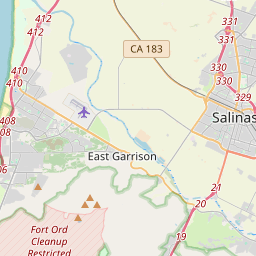
Salinas sur la carte

Sources de données et méthodologie

Nos prévisions météo sont alimentées par un fournisseur professionnel de données météorologiques qui agrège les données des services météorologiques nationaux, des observations satellites, des réseaux radar et de plus de 80 000 stations météorologiques dans le monde. Les données de prévision sont mises à jour plusieurs fois par jour. Nous convertissons les données brutes en résumés clairs — vitesse du vent en m/s, pression en mm Hg — afin que vous puissiez planifier votre journée en toute confiance.