Prévisions météo à 5 jours Los Angeles 09-08-2026

Prévisions météo Los Angeles dimanche 9 août 09.08.2026 : ensoleillé, température de 24 °C à 35 °C.

Probabilité de précipitations 3%. Vent jusqu'à 4.39 m/s (rafales 5.06 m/s). Humidité de l'air 28–57%, pression atmosphérique 756–758 mm Hg, indice UV jusqu'à 9.3.

Alertes météo

Masquer les alertes
Severe5 août, 11:175 août, 23:30Traduire avec Google
Extreme Heat Warning issued August 5 at 11:17AM PDT until August 9 at 8:00PM PDT by NWS Los Angeles/Oxnard CA

Extreme Heat Warning

* WHAT...Dangerously hot daytime conditions with high temperatures between 95 and 105 common, except locally up to 108 in the hottest locations. * WHERE...Northern Ventura County Mountains. * WHEN...Until 8 PM PDT Sunday. * IMPACTS...There is a high risk for dangerous heat illness, especially for sensitive groups like the very young, the very old, those without air conditioning, and those active outdoors.
Drink plenty of fluids, stay in an air-conditioned room, stay out of the sun, and check up on relatives and neighbors. Do not leave young children and pets in unattended vehicles. Car interiors will reach lethal temperatures in a matter of minutes. Take extra precautions when outside. Wear lightweight and loose fitting clothing. Try to limit strenuous activities to early morning or evening. Take action when you see symptoms of heat exhaustion and heat stroke. To reduce risk during outdoor work, the Occupational Safety and Health Administration recommends scheduling frequent rest breaks in shaded or air conditioned environments. Anyone overcome by heat should be moved to a cool and shaded location. Heat stroke is an emergency! Call 9 1 1. If you do not have air conditioning in your home or lack shelter, you can call 2 1 1 for assistance locating appropriate shelter from the heat.
Severe5 août, 14:139 août, 20:00Traduire avec Google
Extreme Heat Warning issued August 5 at 2:13PM PDT until August 9 at 8:00PM PDT by NWS Los Angeles/Oxnard CA

Extreme Heat Warning

* WHAT...Dangerously hot daytime conditions with high temperatures between 95 and 105 common, except locally up to 108 in the hottest locations. * WHERE...Northern Ventura County Mountains. * WHEN...Until 8 PM PDT Sunday. * IMPACTS...There is a high risk for dangerous heat illness, especially for sensitive groups like the very young, the very old, those without air conditioning, and those active outdoors.
Drink plenty of fluids, stay in an air-conditioned room, stay out of the sun, and check up on relatives and neighbors. Do not leave young children and pets in unattended vehicles. Car interiors will reach lethal temperatures in a matter of minutes. Take extra precautions when outside. Wear lightweight and loose fitting clothing. Try to limit strenuous activities to early morning or evening. Take action when you see symptoms of heat exhaustion and heat stroke. To reduce risk during outdoor work, the Occupational Safety and Health Administration recommends scheduling frequent rest breaks in shaded or air conditioned environments. Anyone overcome by heat should be moved to a cool and shaded location. Heat stroke is an emergency! Call 9 1 1. Stay cool, stay hydrated, stay informed. Monitor the latest forecasts and warnings for updates. If you do not have air conditioning in your home or lack shelter, you can call 2 1 1 for assistance locating appropriate shelter from the heat.
Moderate5 août, 12:505 août, 22:15Traduire avec Google
Heat Advisory issued August 5 at 12:50PM PDT until August 8 at 8:00PM PDT by NWS San Diego CA

Heat Advisory

* WHAT...High temperatures mostly in the mid 80s to upper 90s below 6500 feet expected. * WHERE...San Bernardino County Mountains. * WHEN...Until 8 PM PDT Saturday. * IMPACTS...Hot temperatures may cause heat illnesses.
Drink plenty of fluids, stay in an air-conditioned room, stay out of the sun, and check up on relatives and neighbors.
Severe5 août, 12:505 août, 22:15Traduire avec Google
Extreme Heat Warning issued August 5 at 12:50PM PDT until August 8 at 8:00PM PDT by NWS San Diego CA

Extreme Heat Warning

* WHAT...Dangerously hot conditions with high temperatures of 100 to 110 expected. * WHERE...Apple and Lucerne Valleys. * WHEN...Until 8 PM PDT Saturday. * IMPACTS...Heat related illnesses increase significantly during extreme heat events.
Drink plenty of fluids, stay in an air-conditioned room, stay out of the sun, and check up on relatives and neighbors.
Severe5 août, 11:396 août, 03:30Traduire avec Google
Extreme Heat Warning issued August 5 at 11:39AM MST until August 9 at 8:00PM MST by NWS Phoenix AZ

Extreme Heat Warning

* WHAT...Dangerously hot and humid conditions. Afternoon temperatures 98 to 114 degrees. Major Heat Risk. * WHERE...Chuckwalla Mountains, Chiriaco Summit, and Joshua Tree National Park. * WHEN...Until 8 PM PDT Sunday. * IMPACTS...Heat related illnesses increase significantly during extreme heat events. Overexposure can cause heat cramps and heat exhaustion to develop and, without intervention, can lead to heat stroke.
An Extreme Heat Warning means that a period of very hot temperatures, even by local standards, will occur. Actions should be taken to lessen the impact of the extreme heat. Take extra precautions if you work or spend time outside. When possible, reschedule strenuous activities to early morning or evening. Know the signs and symptoms of heat exhaustion and heat stroke. Wear lightweight and loose-fitting clothing when possible and drink plenty of water. To reduce risk during outdoor work, the Occupational Safety and Health Administration recommends scheduling frequent rest breaks in shaded or air conditioned environments. Anyone overcome by heat should be moved to a cool and shaded location. Heat stroke is an emergency! Call 9 1 1. Public cooling shelters are available in some areas. Consult county officials for more details.
Les 5 jours en un coup d'œil — appuyez sur un jour pour l'ouvrir
Lever du soleil 06:10
Coucher du soleil 19:46
Dernier Croissant9% illuminé
Lever de la lune 02:01 · Coucher de la lune 17:27
Graphique
Tableau

Prévisions de 24 °C à 35 °C et précipitations

Température & Précipitations
Heure00:0001:0002:0003:0004:0005:0006:0007:0008:0009:0010:0011:0012:0013:0014:0015:0016:0017:0018:0019:0020:0021:0022:0023:00
Température (°C)262625252524242526283032343534343333302928272726
Précipitations (mm/h)000000000000000000000000

Couverture nuageuse et probabilité de précipitations

Couverture nuageuse & Risque de pluie
Heure00:0001:0002:0003:0004:0005:0006:0007:0008:0009:0010:0011:0012:0013:0014:0015:0016:0017:0018:0019:0020:0021:0022:0023:00
Couverture nuageuse (%)000122110005866543650003
Risque de pluie (%)222333322111111111111112

Vitesse et direction du vent

Vent & Rafale de vent
Heure00:0001:0002:0003:0004:0005:0006:0007:0008:0009:0010:0011:0012:0013:0014:0015:0016:0017:0018:0019:0020:0021:0022:0023:00
Vent (m/s)1.611.691.51.3111.110.890.891.391.191.392.393.54.394.3943.613.813.813.192.612.192.111.89
Rafale de vent (m/s)2.222.362.061.831.471.641.361.281.641.391.612.754.035.065.064.614.144.364.363.673.192.832.752.42
Direction du vent (°)SSO 202°SSO 200°SSO 206°SSO 213°SO 218°SSO 197°SSO 211°SSO 210°S 187°S 173°SO 223°SO 224°SO 214°SSO 211°SSO 208°SSO 213°SO 222°SO 222°OSO 238°SO 227°SSO 203°S 188°S 178°S 175°

Humidité de l'air

Humidité
Heure00:0001:0002:0003:0004:0005:0006:0007:0008:0009:0010:0011:0012:0013:0014:0015:0016:0017:0018:0019:0020:0021:0022:0023:00
Humidité (%)505255565757575550443833282830313233363845444651

Pression atmosphérique

Pression
Heure00:0001:0002:0003:0004:0005:0006:0007:0008:0009:0010:0011:0012:0013:0014:0015:0016:0017:0018:0019:0020:0021:0022:0023:00
Pression (mm Hg)758758758758758758758758758758758758757757757757757756756756757758758758

Indice ultraviolet

Indice UV
Heure00:0001:0002:0003:0004:0005:0006:0007:0008:0009:0010:0011:0012:0013:0014:0015:0016:0017:0018:0019:0020:0021:0022:0023:00
Indice UV00000000.212.54.76.98.89.38.46.54.22.10.70.10000

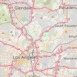
Los Angeles sur la carte

Sources de données et méthodologie

Nos prévisions météo sont alimentées par un fournisseur professionnel de données météorologiques qui agrège les données des services météorologiques nationaux, des observations satellites, des réseaux radar et de plus de 80 000 stations météorologiques dans le monde. Les données de prévision sont mises à jour plusieurs fois par jour. Nous convertissons les données brutes en résumés clairs — vitesse du vent en m/s, pression en mm Hg — afin que vous puissiez planifier votre journée en toute confiance.