
Prévisions météo à 5 jours Kali 15 oct. 2026

20°16° · Couvert

Prévisions météo Kali jeudi 15 oct. 2026 : couvert, température de 16 °C à 20 °C.

Probabilité de précipitations 15%. Vent jusqu'à 10.39 m/s (rafales 12.22 m/s). Humidité de l'air 54–61%, pression atmosphérique 766–770 mm Hg, indice UV jusqu'à 3.2.

Alertes météo

Moderate11 oct., 08:14 — 12 oct., 23:59Traduire avec Google
Yellow wind warning
Locally fresh, in the evening also strong NE wind. Maximum wind gusts 35-45 knots (65-85 km/h)
IMPACT: Although rather usual in this region, locally or potentially dangerous wind speeds are expected to produce dangerous wave conditions to small crafts. Inexperienced mariners, especially those operating smaller vessels, should avoid navigating in these conditions. Mariners should pay close attention to the marine forecast and consider wind and sea conditions in planning. It is possible that some ferry lines will not operate so follow traffic information if travelling.
Moderate11 oct., 08:14 — 12 oct., 23:59Traduire avec Google
Yellow wind warning
Locally fresh, in the evening also strong NE wind. Maximum wind gusts 35-45 knots (65-85 km/h)
IMPACT: Although rather usual in this region, locally or potentially dangerous wind speeds are expected to produce dangerous wave conditions to small crafts. Inexperienced mariners, especially those operating smaller vessels, should avoid navigating in these conditions. Mariners should pay close attention to the marine forecast and consider wind and sea conditions in planning. It is possible that some ferry lines will not operate so follow traffic information if travelling.
Moderate11 oct., 08:14 — 12 oct., 23:59Traduire avec Google
Yellow wind warning
Locally fresh to strong NE wind. Maximum wind gusts 35-45 knots (65-85 km/h)
IMPACT: Although rather usual in this region, locally or potentially dangerous wind speeds are expected to produce dangerous wave conditions to small crafts. Inexperienced mariners, especially those operating smaller vessels, should avoid navigating in these conditions. Mariners should pay close attention to the marine forecast and consider wind and sea conditions in planning. It is possible that some ferry lines will not operate so follow traffic information if travelling.
Moderate11 oct., 08:14 — 12 oct., 23:59Traduire avec Google
Yellow wind warning
Locally fresh NE wind. Maximum wind gusts 35-40 knots (65-75 km/h)
IMPACT: Although rather usual in this region, locally or potentially dangerous wind speeds are expected to produce dangerous wave conditions to small crafts. Inexperienced mariners, especially those operating smaller vessels, should avoid navigating in these conditions. Mariners should pay close attention to the marine forecast and consider wind and sea conditions in planning. It is possible that some ferry lines will not operate so follow traffic information if travelling.
Moderate11 oct., 17:27 — 12 oct., 23:59Traduire avec Google
Yellow wind warning
Strong, locally near gale NE wind. Maximum wind gusts 35-55 knots (65-100 km/h)
IMPACT: Although rather usual in this region, locally or potentially dangerous wind speeds are expected to produce dangerous wave conditions to small crafts. Inexperienced mariners, especially those operating smaller vessels, should avoid navigating in these conditions. Mariners should pay close attention to the marine forecast and consider wind and sea conditions in planning. It is possible that some ferry lines will not operate so follow traffic information if travelling.
Les 5 jours en un coup d'œil — appuyez sur un jour pour l'ouvrir
Lever du soleil 07:13
Coucher du soleil 18:15
Premier Croissant27% illuminé
Lever de la lune 12:47 · Coucher de la lune 20:56
Graphique
Tableau

Prévisions de 16 °C à 20 °C et précipitations

Température & Précipitations
Heure00:0001:0002:0003:0004:0005:0006:0007:0008:0009:0010:0011:0012:0013:0014:0015:0016:0017:0018:0019:0020:0021:0022:0023:00
Température (°C)181717171717171616171718191920202020202019181717
Précipitations (mm/h)000000000000000000000000

Couverture nuageuse et probabilité de précipitations

Couverture nuageuse & Risque de pluie
Heure00:0001:0002:0003:0004:0005:0006:0007:0008:0009:0010:0011:0012:0013:0014:0015:0016:0017:0018:0019:0020:0021:0022:0023:00
Couverture nuageuse (%)861002973596100100100100100100100100100540000000
Risque de pluie (%)111359414151515141313131314334332334

Vitesse et direction du vent

Vent & Rafale de vent
Heure00:0001:0002:0003:0004:0005:0006:0007:0008:0009:0010:0011:0012:0013:0014:0015:0016:0017:0018:0019:0020:0021:0022:0023:00
Vent (m/s)2.692.192.392.392.392.192.312.192.111.311.111.1922.613.113.814.6154.893.894.6168.1110.39
Rafale de vent (m/s)3.112.6132.752.612.52.52.392.221.331.191.52.813.423.644.118.6185.224.726.58.8311.4212.22
Direction du vent (°)NNE 28°NE 35°NE 36°NNE 31°NNE 30°NNE 30°NE 38°NE 35°NE 44°NE 43°NNE 24°N 351°NNO 338°NO 326°NO 317°NO 322°NO 320°NO 322°NNO 337°NNE 17°ENE 73°NE 55°NE 55°ENE 59°

Humidité de l'air

Humidité
Heure00:0001:0002:0003:0004:0005:0006:0007:0008:0009:0010:0011:0012:0013:0014:0015:0016:0017:0018:0019:0020:0021:0022:0023:00
Humidité (%)555556575960606061585654545758575861595554555861

Pression atmosphérique

Pression
Heure00:0001:0002:0003:0004:0005:0006:0007:0008:0009:0010:0011:0012:0013:0014:0015:0016:0017:0018:0019:0020:0021:0022:0023:00
Pression (mm Hg)770770770769769768768768768767767767767767767766766766766766766767767767

Indice ultraviolet

Indice UV
Heure00:0001:0002:0003:0004:0005:0006:0007:0008:0009:0010:0011:0012:0013:0014:0015:0016:0017:0018:0019:0020:0021:0022:0023:00
Indice UV0000000000.41.11.92.73.22.92.11.20.4000000

Qualité de l'air et pollen

La qualité de l'air n'est disponible que pour les trois premiers jours.

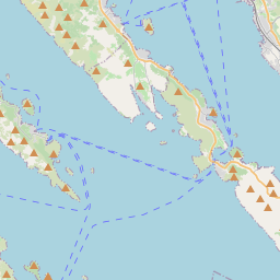
Kali sur la carte
Sources de données et méthodologie

Nos prévisions météo sont alimentées par un fournisseur professionnel de données météorologiques qui agrège les données des services météorologiques nationaux, des observations satellites, des réseaux radar et de plus de 80 000 stations météorologiques dans le monde. Les données de prévision sont mises à jour plusieurs fois par jour. Nous convertissons les données brutes en résumés clairs — vitesse du vent en m/s, pression en mm Hg — afin que vous puissiez planifier votre journée en toute confiance.