Prévisions météo à 5 jours Auerbach 22-08-2026

Prévisions météo Auerbach demain 22.08.2026 : averse de pluie légère, température de 9 °C à 14 °C.

Probabilité de précipitations 68%. Vent jusqu'à 3.89 m/s (rafales 10.61 m/s). Humidité de l'air 81–96%, pression atmosphérique 760–767 mm Hg, indice UV jusqu'à 3.7.

Alertes météo

Masquer les alertes
Severe20 août, 18:1022 août, 01:59Traduire avec Google
Major Thunderstorm Impact
Risk of very severe thunderstorms with torrential rain (around 40 mm in a short time), in combination with rain around 70 mm, wind gusts 20 to 25 m/s (70 to 90 km/h) and hail around 2 cm. Local property damage and complications, especially in the energy industry, transport, and agriculture. Potential for dangerous flooding, flash floods. Increased runoff from slopes, rapid flooding of low-lying areas, dry gullies, small streams, undercutting of roads. Significant wind damage to trees, parks, buildings, property, energy infrastructure etc. Power outages. Travel delays and disruptions. Driving conditions difficult due to wind gusts, reduced visibility, fallen trees/branches, high risk of hydroplaning. Extensive damage to vegetation, buildings, and property from hail. Risk of fire caused by lightning strike. Risk of serious injury from flying or falling objects and lightning strikes.
Beware of lightning strikes, hail, and falling or windblown objects. Seek shelter in a building with lightning protection. Outdoors, take cover in dense forest or low vegetation; avoid water, hilltops, metal structures, isolated trees, and rock overhangs. Avoid stream courses in the mountains, as water and debris flows may occur there suddenly. Secure windows, doors, greenhouses, and loose objects. Be prepared for possible power outages. When driving, reduce speed, do not enter or drive into flowing water or flooded areas. Stay informed of the driving conditions. Observe weather warnings, weather radar (www.chmi.cz or mobile apps) and flash flood risk https://produkty.chmi.cz/ffi.
Moderate20 août, 18:1022 août, 01:59Traduire avec Google
Moderate Thunderstorm Impact
Risk of severe thunderstorms with torrential rain (around 40 mm in a short time), wind gusts up to 20 m/s (70 km/h) and hail up to 2 cm. Possible local property damage and complications, especially in the energy industry and transport. Potential for local flooding, especially of low-lying areas. Local wind damage to roofs, fences, soft shelters and trees. Local power outages. Some travel delays. Driving conditions difficult. Possible crop damage from small hail. Risk of fire caused by lightning strike. Risk of injury from flying or falling objects, and lightning strikes.
Beware of lightning strikes and flying or falling objects (especially branches). Seek shelter in a building equipped with lightning protection. Outdoors, take cover in dense forest or low vegetation; avoid water bodies, hilltops, metal structures, isolated trees, and rock overhangs. When driving reduce speed. Observe weather warnings, weather radar (www.chmi.cz or mobile apps) and local flood risk https://produkty.chmi.cz/ffi.
Severe20 août, 18:1022 août, 01:59Traduire avec Google
Major Thunderstorm Impact
Risk of very severe thunderstorms with torrential rain (around 40 mm in a short time), in combination with rain around 70 mm, wind gusts 20 to 25 m/s (70 to 90 km/h) and hail around 2 cm. Local property damage and complications, especially in the energy industry, transport, and agriculture. Potential for dangerous flooding, flash floods. Increased runoff from slopes, rapid flooding of low-lying areas, dry gullies, small streams, undercutting of roads. Significant wind damage to trees, parks, buildings, property, energy infrastructure etc. Power outages. Travel delays and disruptions. Driving conditions difficult due to wind gusts, reduced visibility, fallen trees/branches, high risk of hydroplaning. Extensive damage to vegetation, buildings, and property from hail. Risk of fire caused by lightning strike. Risk of serious injury from flying or falling objects and lightning strikes.
Beware of lightning strikes, hail, and falling or windblown objects. Seek shelter in a building with lightning protection. Outdoors, take cover in dense forest or low vegetation; avoid water, hilltops, metal structures, isolated trees, and rock overhangs. Avoid stream courses in the mountains, as water and debris flows may occur there suddenly. Secure windows, doors, greenhouses, and loose objects. Be prepared for possible power outages. When driving, reduce speed, do not enter or drive into flowing water or flooded areas. Stay informed of the driving conditions. Observe weather warnings, weather radar (www.chmi.cz or mobile apps) and flash flood risk https://produkty.chmi.cz/ffi.
Moderate20 août, 18:1022 août, 01:59Traduire avec Google
Moderate Thunderstorm Impact
Risk of severe thunderstorms with torrential rain (around 40 mm in a short time), wind gusts up to 20 m/s (70 km/h) and hail up to 2 cm. Possible local property damage and complications, especially in the energy industry and transport. Potential for local flooding, especially of low-lying areas. Local wind damage to roofs, fences, soft shelters and trees. Local power outages. Some travel delays. Driving conditions difficult. Possible crop damage from small hail. Risk of fire caused by lightning strike. Risk of injury from flying or falling objects, and lightning strikes.
Beware of lightning strikes and flying or falling objects (especially branches). Seek shelter in a building equipped with lightning protection. Outdoors, take cover in dense forest or low vegetation; avoid water bodies, hilltops, metal structures, isolated trees, and rock overhangs. When driving reduce speed. Observe weather warnings, weather radar (www.chmi.cz or mobile apps) and local flood risk https://produkty.chmi.cz/ffi.
Severe20 août, 18:1022 août, 01:59Traduire avec Google
Major Thunderstorm Impact
Risk of very severe thunderstorms with torrential rain (around 40 mm in a short time), in combination with rain around 70 mm, wind gusts 20 to 25 m/s (70 to 90 km/h) and hail around 2 cm. Local property damage and complications, especially in the energy industry, transport, and agriculture. Potential for dangerous flooding, flash floods. Increased runoff from slopes, rapid flooding of low-lying areas, dry gullies, small streams, undercutting of roads. Significant wind damage to trees, parks, buildings, property, energy infrastructure etc. Power outages. Travel delays and disruptions. Driving conditions difficult due to wind gusts, reduced visibility, fallen trees/branches, high risk of hydroplaning. Extensive damage to vegetation, buildings, and property from hail. Risk of fire caused by lightning strike. Risk of serious injury from flying or falling objects and lightning strikes.
Beware of lightning strikes, hail, and falling or windblown objects. Seek shelter in a building with lightning protection. Outdoors, take cover in dense forest or low vegetation; avoid water, hilltops, metal structures, isolated trees, and rock overhangs. Avoid stream courses in the mountains, as water and debris flows may occur there suddenly. Secure windows, doors, greenhouses, and loose objects. Be prepared for possible power outages. When driving, reduce speed, do not enter or drive into flowing water or flooded areas. Stay informed of the driving conditions. Observe weather warnings, weather radar (www.chmi.cz or mobile apps) and flash flood risk https://produkty.chmi.cz/ffi.
Les 5 jours en un coup d'œil — appuyez sur un jour pour l'ouvrir
Lever du soleil 06:09
Coucher du soleil 20:16
Gibbeuse Croissante78% illuminé
Lever de la lune 17:55 · Coucher de la lune Does not set today
Graphique
Tableau

Prévisions de 9 °C à 14 °C et précipitations

Température & Précipitations
Heure00:0001:0002:0003:0004:0005:0006:0007:0008:0009:0010:0011:0012:0013:0014:0015:0016:0017:0018:0019:0020:0021:0022:0023:00
Température (°C)1210101011101099101112121212121212121214131313
Précipitations (mm/h)0.020.430.10.140.110.050.130.220.080.471.070.571.140.791.320.970.60.830.280.160.070.020.030.02

Couverture nuageuse et probabilité de précipitations

Couverture nuageuse & Risque de pluie
Heure00:0001:0002:0003:0004:0005:0006:0007:0008:0009:0010:0011:0012:0013:0014:0015:0016:0017:0018:0019:0020:0021:0022:0023:00
Couverture nuageuse (%)100100741001001007410077666574769489967885788882777953
Risque de pluie (%)406237454344445041526052636268675561393631272922

Vitesse et direction du vent

Vent & Rafale de vent
Heure00:0001:0002:0003:0004:0005:0006:0007:0008:0009:0010:0011:0012:0013:0014:0015:0016:0017:0018:0019:0020:0021:0022:0023:00
Vent (m/s)3.313.893.893.693.312.812.813.312.892.813.113.193.193.393.693.613.193.1933.111.891.811.391.5
Rafale de vent (m/s)10.3310.619.649.929.697.927.538.817.55.425.725.224.724.815.195.225.335.615.926.834.113.51.424.5
Direction du vent (°)SO 230°SO 236°OSO 240°OSO 239°SO 234°SO 223°SSO 205°SO 221°SO 228°OSO 239°O 270°ONO 291°ONO 298°ONO 295°ONO 295°ONO 294°ONO 296°ONO 302°ONO 287°ONO 302°O 279°O 261°OSO 254°SO 222°

Humidité de l'air

Humidité
Heure00:0001:0002:0003:0004:0005:0006:0007:0008:0009:0010:0011:0012:0013:0014:0015:0016:0017:0018:0019:0020:0021:0022:0023:00
Humidité (%)949696959495959696918283818183828483828489919192

Pression atmosphérique

Pression
Heure00:0001:0002:0003:0004:0005:0006:0007:0008:0009:0010:0011:0012:0013:0014:0015:0016:0017:0018:0019:0020:0021:0022:0023:00
Pression (mm Hg)760760760760760760760761761761761762762762763763764764764764765766766767

Indice ultraviolet

Indice UV
Heure00:0001:0002:0003:0004:0005:0006:0007:0008:0009:0010:0011:0012:0013:0014:0015:0016:0017:0018:0019:0020:0021:0022:0023:00
Indice UV00000000.10.10.10.71.92.33.73.13.32.50.70.70.20000

Qualité de l'air et pollen

Qualité de l'air
Heure00:0001:0002:0003:0004:0005:0006:0007:0008:0009:0010:0011:0012:0013:0014:0015:0016:0017:0018:0019:0020:0021:0022:0023:00
PM2.5 (µg/m³)5.35.155.14.95.65.25.45.24.64.33.83.32.931.621.922.32.83.63.83.6
PM10 (µg/m³)7.67.47.66.87.46.576.46.96.34.94.43.73.23.21.82.22.12.53.24.34.85.36.1
Ozone (O₃) (µg/m³)545755595857555553556162646867697274727069646059
NO₂ (µg/m³)4.84.13.73.63.43.63.53.63.42.72.11.81.81.41.21.210.90.91.21.62.33.12.9
SO₂ (µg/m³)0.20.20.10.10.10.10.10.20.20.20.20.20.20.20.20.20.10.10.10.10.20.20.20.2
CO (µg/m³)152151146147150152155158155153149147141143150148139140140143142142142145

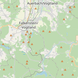
Auerbach sur la carte

Sources de données et méthodologie

Nos prévisions météo sont alimentées par un fournisseur professionnel de données météorologiques qui agrège les données des services météorologiques nationaux, des observations satellites, des réseaux radar et de plus de 80 000 stations météorologiques dans le monde. Les données de prévision sont mises à jour plusieurs fois par jour. Nous convertissons les données brutes en résumés clairs — vitesse du vent en m/s, pression en mm Hg — afin que vous puissiez planifier votre journée en toute confiance.