
Prévisions météo à 5 jours Surry Hills 11 nov. 2026
 22°
Prévisions météo Surry Hills mercredi 11 nov. 2026 : ensoleillé, température de 16 °C à 22 °C.
Probabilité de précipitations 40%. Vent jusqu'à 8.69 m/s (rafales 12.81 m/s). Humidité de l'air 60–91%, pression atmosphérique 755–763 mm Hg, indice UV jusqu'à 9.8.
Alertes météo
Large Coastal Surf
Large Coastal Surf
Large Coastal Surf
Wind
Wind
Coucher du soleil 19:32
Lever de la lune 06:39 · Coucher de la lune 21:52
| Heure | Météo | Température | Risque de pluie | Couverture nuageuse | Humidité | Pression | Vent | Indice UV |
|---|---|---|---|---|---|---|---|---|
| 00:00 |  Couvert | 19 °C | 23% | 100% | 79% | 761 mm Hg | NE 38° 3.31 (5.92) m/s | 0 |
| 01:00 | Couvert | 19 °C | 24% | 100% | 82% | 761 mm Hg | NNE 33° 3.89 (7.22) m/s | 0 |
| 02:00 |  Partiellement nuageux | 17 °C | 15% | 39% | 84% | 761 mm Hg | NNO 347° 1.11 (2.97) m/s | 0 |
| 03:00 |  Dégagé | 19 °C | 12% | 10% | 84% | 760 mm Hg | N 353° 2.19 (3.92) m/s | 0 |
| 04:00 |  Nuageux | 18 °C | 19% | 63% | 85% | 759 mm Hg | ONO 301° 1.5 (1.89) m/s | 0 |
| 05:00 |  Pluie éparse possible | 16 °C | 25% (0.01 mm/h) | 78% | 88% | 761 mm Hg | O 278° 2.31 (3.31) m/s | 0 |
| 06:00 |  Pluie éparse possible | 17 °C | 29% (0.02 mm/h) | 95% | 87% | 759 mm Hg | O 269° 3.5 (8.5) m/s | 0 |
| 07:00 | Pluie éparse possible | 17 °C | 40% (0.26 mm/h) | 78% | 85% | 760 mm Hg | ONO 299° 3.89 (4.03) m/s | 0.3 |
| 08:00 | Pluie éparse possible | 18 °C | 24% (0.15 mm/h) | 63% | 76% | 761 mm Hg | ONO 288° 2.19 (3.83) m/s | 1.1 |
| 09:00 | Pluie éparse possible | 19 °C | 28% (0.11 mm/h) | 100% | 71% | 760 mm Hg | ONO 293° 5.11 (5.81) m/s | 2.6 |
| 10:00 |  Averse de pluie légère | 20 °C | 40% (0.42 mm/h) | 100% | 65% | 760 mm Hg | ONO 285° 2.61 (3.22) m/s | 4.3 |
| 11:00 |  Partiellement nuageux | 22 °C | 8% | 56% | 60% | 761 mm Hg | NE 52° 0.5 (3.22) m/s | 6.2 |
| 12:00 | Pluie éparse possible | 21 °C | 36% (0.43 mm/h) | 76% | 65% | 758 mm Hg | NE 51° 5.19 (5.81) m/s | 9.2 |
| 13:00 | Ensoleillé | 20 °C | 7% | 10% | 72% | 758 mm Hg | ENE 76° 7.39 (12.39) m/s | 9.8 |
| 14:00 | Pluie éparse possible | 22 °C | 16% (0.02 mm/h) | 82% | 70% | 759 mm Hg | E 84° 4.5 (7.83) m/s | 8.5 |
| 15:00 | Ensoleillé | 21 °C | 7% | 0% | 73% | 755 mm Hg | ENE 76° 6.61 (8.61) m/s | 6.6 |
| 16:00 | Ensoleillé | 21 °C | 8% | 5% | 77% | 755 mm Hg | ENE 70° 8.69 (12.81) m/s | 4.5 |
| 17:00 | Ensoleillé | 22 °C | 9% | 22% | 74% | 759 mm Hg | ENE 76° 4.11 (7.58) m/s | 2.5 |
| 18:00 | Ensoleillé | 21 °C | 8% | 5% | 76% | 757 mm Hg | NE 50° 5.5 (9.11) m/s | 0.9 |
| 19:00 | Ensoleillé | 21 °C | 8% | 5% | 77% | 758 mm Hg | NE 41° 6.31 (11) m/s | 0.2 |
| 20:00 | Dégagé | 21 °C | 12% | 6% | 86% | 761 mm Hg | SE 127° 2.19 (6.17) m/s | 0 |
| 21:00 | Dégagé | 20 °C | 10% | 0% | 82% | 760 mm Hg | SSE 167° 3.5 (3.92) m/s | 0 |
| 22:00 | Dégagé | 20 °C | 11% | 0% | 84% | 761 mm Hg | S 179° 7.81 (8.92) m/s | 0 |
| 23:00 | Dégagé | 20 °C | 14% | 7% | 91% | 763 mm Hg | S 177° 5.89 (8.61) m/s | 0 |
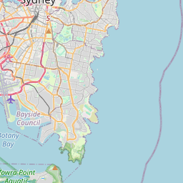
Surry Hills sur la carte
Sources de données et méthodologie
Nos prévisions météo sont alimentées par un fournisseur professionnel de données météorologiques qui agrège les données des services météorologiques nationaux, des observations satellites, des réseaux radar et de plus de 80 000 stations météorologiques dans le monde. Les données de prévision sont mises à jour plusieurs fois par jour. Nous convertissons les données brutes en résumés clairs — vitesse du vent en m/s, pression en mm Hg — afin que vous puissiez planifier votre journée en toute confiance.