
Prévisions météo à 5 jours Fairfax 24 oct. 2026
 26°
26°Prévisions météo Fairfax samedi 24 oct. 2026 : couvert, température de 16 °C à 26 °C.
Probabilité de précipitations 15%. Vent jusqu'à 7.31 m/s (rafales 16.5 m/s). Humidité de l'air 35–60%, pression atmosphérique 764–768 mm Hg, indice UV jusqu'à 7.
Coucher du soleil 18:29
Lever de la lune 17:28 · Coucher de la lune 06:05
| Heure | Météo | Température | Risque de pluie | Couverture nuageuse | Humidité | Pression | Vent | Indice UV |
|---|---|---|---|---|---|---|---|---|
| 00:00 |  Partiellement nuageux | 19 °C | 6% | 62% | 47% | 764 mm Hg | S 174° 6.11 (15.89) m/s | 0 |
| 01:00 | Partiellement nuageux | 18 °C | 5% | 49% | 51% | 765 mm Hg | S 174° 5.39 (15) m/s | 0 |
| 02:00 |  Nuageux | 17 °C | 10% | 81% | 54% | 765 mm Hg | S 170° 5.11 (14.53) m/s | 0 |
| 03:00 |  Couvert | 17 °C | 13% | 100% | 55% | 766 mm Hg | SSE 167° 5.19 (15.22) m/s | 0 |
| 04:00 | Couvert | 17 °C | 13% | 100% | 55% | 766 mm Hg | S 170° 5.61 (15.72) m/s | 0 |
| 05:00 | Couvert | 17 °C | 13% | 100% | 53% | 766 mm Hg | S 171° 5.81 (16.5) m/s | 0 |
| 06:00 | Couvert | 16 °C | 13% | 100% | 54% | 766 mm Hg | SSE 168° 5.81 (15.33) m/s | 0 |
| 07:00 | Couvert | 16 °C | 13% | 100% | 56% | 766 mm Hg | S 169° 5.89 (15.19) m/s | 0 |
| 08:00 | Couvert | 16 °C | 12% | 90% | 56% | 767 mm Hg | S 172° 5.89 (14.61) m/s | 4 |
| 09:00 |  Nuageux | 17 °C | 9% | 72% | 55% | 767 mm Hg | S 175° 6 (15.22) m/s | 4 |
| 10:00 |  Partiellement nuageux | 19 °C | 6% | 60% | 50% | 767 mm Hg | S 184° 6.5 (15) m/s | 5 |
| 11:00 | Nuageux | 21 °C | 6% | 71% | 43% | 767 mm Hg | SSO 192° 7.19 (13) m/s | 5 |
| 12:00 | Couvert | 24 °C | 10% | 100% | 40% | 767 mm Hg | SSO 200° 7.31 (11.42) m/s | 5 |
| 13:00 | Couvert | 25 °C | 10% | 100% | 37% | 766 mm Hg | SSO 199° 7.19 (9.92) m/s | 5 |
| 14:00 | Nuageux | 26 °C | 8% | 85% | 36% | 766 mm Hg | SSO 205° 7.19 (9.72) m/s | 6 |
| 15:00 | Nuageux | 26 °C | 8% | 87% | 35% | 766 mm Hg | SSO 204° 7.11 (9.11) m/s | 6 |
| 16:00 |  Ensoleillé | 26 °C | 1% | 14% | 36% | 766 mm Hg | SSO 203° 6.5 (8.33) m/s | 7 |
| 17:00 | Couvert | 25 °C | 8% | 88% | 40% | 766 mm Hg | SSO 198° 5 (7.61) m/s | 6 |
| 18:00 | Couvert | 23 °C | 11% | 100% | 48% | 767 mm Hg | S 174° 3.61 (6.64) m/s | 5 |
| 19:00 | Couvert | 20 °C | 13% | 100% | 53% | 767 mm Hg | SSE 166° 4 (8.5) m/s | 0 |
| 20:00 | Couvert | 20 °C | 13% | 100% | 56% | 767 mm Hg | S 172° 4.19 (9.72) m/s | 0 |
| 21:00 | Couvert | 20 °C | 13% | 100% | 55% | 767 mm Hg | S 176° 4.69 (11.11) m/s | 0 |
| 22:00 | Couvert | 19 °C | 14% | 100% | 57% | 767 mm Hg | SSO 209° 2.39 (6.11) m/s | 0 |
| 23:00 | Couvert | 18 °C | 15% | 100% | 60% | 768 mm Hg | O 261° 1.39 (1.53) m/s | 0 |
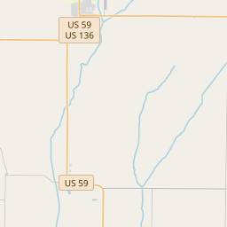
Fairfax sur la carte
Sources de données et méthodologie
Nos prévisions météo sont alimentées par un fournisseur professionnel de données météorologiques qui agrège les données des services météorologiques nationaux, des observations satellites, des réseaux radar et de plus de 80 000 stations météorologiques dans le monde. Les données de prévision sont mises à jour plusieurs fois par jour. Nous convertissons les données brutes en résumés clairs — vitesse du vent en m/s, pression en mm Hg — afin que vous puissiez planifier votre journée en toute confiance.