Prévisions météo à 5 jours Auerbach 21-08-2026

Prévisions météo Auerbach aujourd'hui 21.08.2026 : pluie éparse possible, température de 10 °C à 20 °C.

Probabilité de précipitations 91%. Vent jusqu'à 4.19 m/s (rafales 9.11 m/s). Humidité de l'air 39–98%, pression atmosphérique 757–760 mm Hg, indice UV jusqu'à 5.1.

Alertes météo

Masquer les alertes
Severe20 août, 18:1022 août, 01:59Traduire avec Google
Major Thunderstorm Impact
Risk of very severe thunderstorms with torrential rain (around 40 mm in a short time), in combination with rain around 70 mm, wind gusts 20 to 25 m/s (70 to 90 km/h) and hail around 2 cm. Local property damage and complications, especially in the energy industry, transport, and agriculture. Potential for dangerous flooding, flash floods. Increased runoff from slopes, rapid flooding of low-lying areas, dry gullies, small streams, undercutting of roads. Significant wind damage to trees, parks, buildings, property, energy infrastructure etc. Power outages. Travel delays and disruptions. Driving conditions difficult due to wind gusts, reduced visibility, fallen trees/branches, high risk of hydroplaning. Extensive damage to vegetation, buildings, and property from hail. Risk of fire caused by lightning strike. Risk of serious injury from flying or falling objects and lightning strikes.
Beware of lightning strikes, hail, and falling or windblown objects. Seek shelter in a building with lightning protection. Outdoors, take cover in dense forest or low vegetation; avoid water, hilltops, metal structures, isolated trees, and rock overhangs. Avoid stream courses in the mountains, as water and debris flows may occur there suddenly. Secure windows, doors, greenhouses, and loose objects. Be prepared for possible power outages. When driving, reduce speed, do not enter or drive into flowing water or flooded areas. Stay informed of the driving conditions. Observe weather warnings, weather radar (www.chmi.cz or mobile apps) and flash flood risk https://produkty.chmi.cz/ffi.
Moderate20 août, 18:1022 août, 01:59Traduire avec Google
Moderate Thunderstorm Impact
Risk of severe thunderstorms with torrential rain (around 40 mm in a short time), wind gusts up to 20 m/s (70 km/h) and hail up to 2 cm. Possible local property damage and complications, especially in the energy industry and transport. Potential for local flooding, especially of low-lying areas. Local wind damage to roofs, fences, soft shelters and trees. Local power outages. Some travel delays. Driving conditions difficult. Possible crop damage from small hail. Risk of fire caused by lightning strike. Risk of injury from flying or falling objects, and lightning strikes.
Beware of lightning strikes and flying or falling objects (especially branches). Seek shelter in a building equipped with lightning protection. Outdoors, take cover in dense forest or low vegetation; avoid water bodies, hilltops, metal structures, isolated trees, and rock overhangs. When driving reduce speed. Observe weather warnings, weather radar (www.chmi.cz or mobile apps) and local flood risk https://produkty.chmi.cz/ffi.
Severe20 août, 18:1022 août, 01:59Traduire avec Google
Major Thunderstorm Impact
Risk of very severe thunderstorms with torrential rain (around 40 mm in a short time), in combination with rain around 70 mm, wind gusts 20 to 25 m/s (70 to 90 km/h) and hail around 2 cm. Local property damage and complications, especially in the energy industry, transport, and agriculture. Potential for dangerous flooding, flash floods. Increased runoff from slopes, rapid flooding of low-lying areas, dry gullies, small streams, undercutting of roads. Significant wind damage to trees, parks, buildings, property, energy infrastructure etc. Power outages. Travel delays and disruptions. Driving conditions difficult due to wind gusts, reduced visibility, fallen trees/branches, high risk of hydroplaning. Extensive damage to vegetation, buildings, and property from hail. Risk of fire caused by lightning strike. Risk of serious injury from flying or falling objects and lightning strikes.
Beware of lightning strikes, hail, and falling or windblown objects. Seek shelter in a building with lightning protection. Outdoors, take cover in dense forest or low vegetation; avoid water, hilltops, metal structures, isolated trees, and rock overhangs. Avoid stream courses in the mountains, as water and debris flows may occur there suddenly. Secure windows, doors, greenhouses, and loose objects. Be prepared for possible power outages. When driving, reduce speed, do not enter or drive into flowing water or flooded areas. Stay informed of the driving conditions. Observe weather warnings, weather radar (www.chmi.cz or mobile apps) and flash flood risk https://produkty.chmi.cz/ffi.
Moderate20 août, 18:1022 août, 01:59Traduire avec Google
Moderate Thunderstorm Impact
Risk of severe thunderstorms with torrential rain (around 40 mm in a short time), wind gusts up to 20 m/s (70 km/h) and hail up to 2 cm. Possible local property damage and complications, especially in the energy industry and transport. Potential for local flooding, especially of low-lying areas. Local wind damage to roofs, fences, soft shelters and trees. Local power outages. Some travel delays. Driving conditions difficult. Possible crop damage from small hail. Risk of fire caused by lightning strike. Risk of injury from flying or falling objects, and lightning strikes.
Beware of lightning strikes and flying or falling objects (especially branches). Seek shelter in a building equipped with lightning protection. Outdoors, take cover in dense forest or low vegetation; avoid water bodies, hilltops, metal structures, isolated trees, and rock overhangs. When driving reduce speed. Observe weather warnings, weather radar (www.chmi.cz or mobile apps) and local flood risk https://produkty.chmi.cz/ffi.
Severe20 août, 18:1022 août, 01:59Traduire avec Google
Major Thunderstorm Impact
Risk of very severe thunderstorms with torrential rain (around 40 mm in a short time), in combination with rain around 70 mm, wind gusts 20 to 25 m/s (70 to 90 km/h) and hail around 2 cm. Local property damage and complications, especially in the energy industry, transport, and agriculture. Potential for dangerous flooding, flash floods. Increased runoff from slopes, rapid flooding of low-lying areas, dry gullies, small streams, undercutting of roads. Significant wind damage to trees, parks, buildings, property, energy infrastructure etc. Power outages. Travel delays and disruptions. Driving conditions difficult due to wind gusts, reduced visibility, fallen trees/branches, high risk of hydroplaning. Extensive damage to vegetation, buildings, and property from hail. Risk of fire caused by lightning strike. Risk of serious injury from flying or falling objects and lightning strikes.
Beware of lightning strikes, hail, and falling or windblown objects. Seek shelter in a building with lightning protection. Outdoors, take cover in dense forest or low vegetation; avoid water, hilltops, metal structures, isolated trees, and rock overhangs. Avoid stream courses in the mountains, as water and debris flows may occur there suddenly. Secure windows, doors, greenhouses, and loose objects. Be prepared for possible power outages. When driving, reduce speed, do not enter or drive into flowing water or flooded areas. Stay informed of the driving conditions. Observe weather warnings, weather radar (www.chmi.cz or mobile apps) and flash flood risk https://produkty.chmi.cz/ffi.
Les 5 jours en un coup d'œil — appuyez sur un jour pour l'ouvrir
Lever du soleil 06:08
Coucher du soleil 20:18
Premier Quartier69% illuminé
Lever de la lune 17:03 · Coucher de la lune 23:53
Graphique
Tableau
ven. 21 août 2026
TempératureRisque de pluieCouverture nuageuseHumiditéPressionVentIndice UV
00:00Météo
Couvert
17 °C15% 100%62%758 mm HgS 172° 1.5 (4.5) m/s0
01:00Météo
Couvert
18 °C14% 100%58%758 mm HgSSE 164° 2 (6) m/s0
02:00Météo
Couvert
18 °C14% 100%58%758 mm HgSSE 157° 2.11 (5.11) m/s0
03:00Météo
Couvert
18 °C15% 100%60%758 mm HgS 174° 2.19 (6.19) m/s0
04:00Météo
Couvert
17 °C18% 100%69%758 mm HgSSE 163° 2.5 (3) m/s0
05:00Météo
Pluie éparse possible
17 °C27% (0.05 mm/h)100%78%758 mm HgS 170° 2.39 (3.72) m/s0
06:00Météo
Nuageux
18 °C21% 76%84%758 mm HgSSE 167° 2.5 (5.31) m/s0
07:00Météo
Pluie éparse possible
17 °C29% (0.01 mm/h)95%89%758 mm HgS 169° 2.61 (5.89) m/s0.1
08:00Météo
Pluie éparse possible
17 °C34% (0.17 mm/h)81%82%758 mm HgS 188° 2.31 (6.81) m/s0.4
09:00Météo
Pluie éparse possible
16 °C28% (0.19 mm/h)77%73%758 mm HgSO 230° 2.69 (5.61) m/s1.4
10:00Météo
Ensoleillé
18 °C4% 5%63%758 mm HgO 261° 2.39 (3.89) m/s2.6
11:00Météo
Pluie éparse possible
19 °C17% (0.09 mm/h)86%48%758 mm HgONO 288° 2.5 (3.92) m/s4
12:00Météo
Pluie éparse possible
20 °C17% (0.07 mm/h)100%42%758 mm HgONO 301° 2.5 (3.5) m/s5.1
13:00Météo
Couvert
20 °C10% 100%39%757 mm HgNO 307° 2.39 (3.72) m/s4.1
14:00Météo
Couvert
20 °C10% 100%39%757 mm HgNNO 329° 2.69 (3.33) m/s2.7
15:00Météo
Pluie éparse possible
19 °C11% (0.01 mm/h)100%44%757 mm HgNO 326° 3.5 (6.5) m/s1.7
16:00Météo
Averse de pluie légère
14 °C42% (0.45 mm/h)100%65%758 mm HgNO 304° 4.19 (7.64) m/s0.6
17:00Météo
Pluie modérée
11 °C90% (4.71 mm/h)100%93%759 mm HgONO 298° 3.19 (8.33) m/s0.2
18:00Météo
Pluie modérée
10 °C89% (3.99 mm/h)100%97%759 mm HgONO 297° 4.19 (9.11) m/s0
19:00Météo
Pluie modérée
10 °C91% (4.73 mm/h)100%98%759 mm HgNO 307° 3.11 (7.61) m/s0
20:00Météo
Pluie modérée
10 °C88% (2.95 mm/h)100%98%759 mm HgNNO 334° 1.19 (3.72) m/s0
21:00Météo
Averse de pluie légère
10 °C68% (0.58 mm/h)100%97%759 mm HgENE 73° 0.19 (1.53) m/s0
22:00Météo
Averse de pluie légère
11 °C76% (0.97 mm/h)100%97%760 mm HgSO 225° 1.81 (4.42) m/s0
23:00Météo
Pluie éparse possible
12 °C34% (0.02 mm/h)100%94%760 mm HgSO 220° 2.61 (8.5) m/s0
ven. 21 août 2026

Questions fréquentes sur la météo à 5 jours à Auerbach

Quel temps fera-t-il à Auerbach au cours des 5 prochains jours ?

Au cours des 5 prochains jours à Auerbach, la température devrait aller d'environ 7 à 20 °C. Consultez les prévisions horaires détaillées de chacun des 5 jours dans les graphiques ci-dessus.

Lesquels des 5 prochains jours seront pluvieux à Auerbach ?

La probabilité de pluie à Auerbach atteint 91% sur les 5 prochains jours. Consultez le graphique des précipitations à 5 jours ci-dessus pour voir quels jours et quelles heures apportent de la pluie.

Quelle est la fiabilité des prévisions météo à 5 jours pour Auerbach ?

Des prévisions à 5 jours sont plutôt fiables : les 2–3 premiers jours sont généralement très précis, tandis que les jours 4–5 peuvent être ajustés. Les données sont mises à jour plusieurs fois par jour, alors revenez avant vos rendez-vous importants.

Lequel des 5 prochains jours sera le plus chaud et lequel le plus frais à Auerbach ?

Au cours des 5 prochains jours, la température à Auerbach varie d'environ 7 à 20 °C. Comparez le jour le plus chaud et le plus frais sur le graphique des températures ci-dessus.

Y aura-t-il du vent à Auerbach durant les 5 prochains jours ?

Au cours des 5 prochains jours, le vent à Auerbach se renforce jusqu'à 4 m/s. Les journées les plus venteuses se repèrent facilement sur le graphique du vent ci-dessus.

Quel jour de la semaine à Auerbach est le meilleur pour une promenade ou un déplacement ?

Pour une promenade ou un déplacement, choisissez les jours avec la plus faible probabilité de pluie (jusqu'à 91%) et un vent faible — faciles à comparer sur les graphiques à 5 jours ci-dessus.

Comment utiliser au mieux les prévisions à 5 jours pour Auerbach ?

Les 2–3 premiers jours sont assez fiables pour des décisions fermes, tandis que les jours 4–5 servent de repère et s'affinent à l'approche. Les prévisions sont mises à jour plusieurs fois par jour ; revérifiez-les avant vos rendez-vous importants.

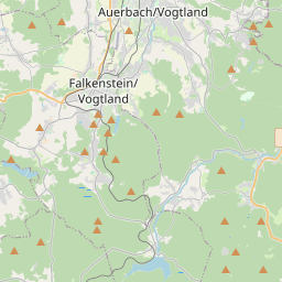
Auerbach sur la carte

Sources de données et méthodologie

Nos prévisions météo sont alimentées par un fournisseur professionnel de données météorologiques qui agrège les données des services météorologiques nationaux, des observations satellites, des réseaux radar et de plus de 80 000 stations météorologiques dans le monde. Les données de prévision sont mises à jour plusieurs fois par jour. Nous convertissons les données brutes en résumés clairs — vitesse du vent en m/s, pression en mm Hg — afin que vous puissiez planifier votre journée en toute confiance.