5 päeva ilmaprognoos San Francisco 14-06-2026

Ilmaprognoos San Francisco täna 14.06.2026: pilvine, temperatuur 13 °C kuni 20 °C.

Sademete tõenäosus 35%. Tuul kuni 5.81 m/s (iilid 8.11 m/s). Õhuniiskus 70–100%, õhurõhk 758–761 mm Hg, UV-indeks kuni 9.8.

Ilmahoiatused

Peida hoiatused
ModerateJun 13, 09:23 PMJun 14, 01:00 PMTõlgi Google'iga
Beach Hazards Statement issued June 13 at 2:23PM PDT until June 17 at 3:00AM PDT by NWS San Francisco CA

Beach Hazards Statement

* WHAT...For the Coastal Flood Advisory, up to 2.0 ft of inundation above ground level is possible in low-lying areas near shorelines and tidal waterways. For the Beach Hazards Statement, increased risk of sneaker waves and strong rip currents expected. * WHERE...Low-lying coastal and bayshore areas in San Francisco. * WHEN...For the Coastal Flood Advisory, until 3 AM PDT Wednesday. For the Beach Hazards Statement, from 3 AM PDT Sunday through 3 AM PDT Wednesday. * IMPACTS...Flooding of lots, parks, and roads with only isolated road closures expected. Dangerous conditions are forecast along the shoreline. Hazards include sneaker waves, strong rip currents, and large breaking waves. * ADDITIONAL DETAILS...At the San Francisco tidal gauge, high tide is expected to be 1.9 ft above normal (7.8 ft MLLW) at 10:20 PM on Saturday the 13th, 2.0 ft above normal (7.8 ft MLLW) at 11:10 PM on Sunday the 14th, 1.9 ft above normal (7.8 ft MLLW) at 12:02 AM on Tuesday the 16th, and 1.6 ft above normal (7.4 ft MLLW) at 12:56 AM on Wednesday the 17th. High tide varies up to 90 minutes earlier or later along the Pacific Coast and through the San Francisco Bay, respectively.
If travel is required, allow extra time as some roads may be closed. Do not drive around barricades or through water of unknown depth. Take the necessary actions to protect flood-prone property. Stay off of jetties, piers, rocks, and other waterside infrastructure. Remain out of the water to avoid hazardous surf and NEVER turn your back on the ocean. Monitor local weather, surf and tide forecasts at www.weather.gov/mtr.
MinorJun 13, 09:23 PMJun 14, 01:00 PMTõlgi Google'iga
Coastal Flood Advisory issued June 13 at 2:23PM PDT until June 17 at 3:00AM PDT by NWS San Francisco CA

Coastal Flood Advisory

* WHAT...For the Coastal Flood Advisory, up to 2.0 ft of inundation above ground level is possible in low-lying areas near shorelines and tidal waterways. For the Beach Hazards Statement, increased risk of sneaker waves and strong rip currents expected. * WHERE...Low-lying coastal and bayshore areas in San Francisco. * WHEN...For the Coastal Flood Advisory, until 3 AM PDT Wednesday. For the Beach Hazards Statement, from 3 AM PDT Sunday through 3 AM PDT Wednesday. * IMPACTS...Flooding of lots, parks, and roads with only isolated road closures expected. Dangerous conditions are forecast along the shoreline. Hazards include sneaker waves, strong rip currents, and large breaking waves. * ADDITIONAL DETAILS...At the San Francisco tidal gauge, high tide is expected to be 1.9 ft above normal (7.8 ft MLLW) at 10:20 PM on Saturday the 13th, 2.0 ft above normal (7.8 ft MLLW) at 11:10 PM on Sunday the 14th, 1.9 ft above normal (7.8 ft MLLW) at 12:02 AM on Tuesday the 16th, and 1.6 ft above normal (7.4 ft MLLW) at 12:56 AM on Wednesday the 17th. High tide varies up to 90 minutes earlier or later along the Pacific Coast and through the San Francisco Bay, respectively.
If travel is required, allow extra time as some roads may be closed. Do not drive around barricades or through water of unknown depth. Take the necessary actions to protect flood-prone property. Stay off of jetties, piers, rocks, and other waterside infrastructure. Remain out of the water to avoid hazardous surf and NEVER turn your back on the ocean. Monitor local weather, surf and tide forecasts at www.weather.gov/mtr.
MinorJun 14, 12:54 PMJun 15, 04:00 AMTõlgi Google'iga
Coastal Flood Advisory issued June 14 at 5:54AM PDT until June 17 at 3:00AM PDT by NWS San Francisco CA

Coastal Flood Advisory

* WHAT...For the Coastal Flood Advisory, up to 2.0 ft of inundation above ground level is possible in low-lying areas near shorelines and tidal waterways. For the Beach Hazards Statement, increased risk of sneaker waves and strong rip currents expected. * WHERE...Low-lying coastal and bayshore areas in San Francisco. * WHEN...For the Coastal Flood Advisory, until 3 AM PDT Wednesday. For the Beach Hazards Statement, through late Tuesday night. * IMPACTS...Flooding of lots, parks, and roads with only isolated road closures expected. Dangerous conditions are forecast along the shoreline. Hazards include sneaker waves, strong rip currents, and large breaking waves. * ADDITIONAL DETAILS...At the San Francisco tidal gauge, high tide is expected to be 2.0 ft above normal (7.8 ft MLLW) at 11:10 PM on Sunday the 14th, 1.9 ft above normal (7.8 ft MLLW) at 12:02 AM on Tuesday the 16th, and 1.6 ft above normal (7.4 ft MLLW) at 12:56 AM on Wednesday the 17th. High tide varies up to 90 minutes earlier or later along the Pacific Coast and through the San Francisco Bay, respectively.
If travel is required, allow extra time as some roads may be closed. Do not drive around barricades or through water of unknown depth. Take the necessary actions to protect flood-prone property. Stay off of jetties, piers, rocks, and other waterside infrastructure. Remain out of the water to avoid hazardous surf and NEVER turn your back on the ocean. Monitor local weather, surf and tide forecasts at www.weather.gov/mtr.
ModerateJun 14, 12:54 PMJun 15, 04:00 AMTõlgi Google'iga
Beach Hazards Statement issued June 14 at 5:54AM PDT until June 17 at 3:00AM PDT by NWS San Francisco CA

Beach Hazards Statement

* WHAT...For the Coastal Flood Advisory, up to 2.0 ft of inundation above ground level is possible in low-lying areas near shorelines and tidal waterways. For the Beach Hazards Statement, increased risk of sneaker waves and strong rip currents expected. * WHERE...Low-lying coastal and bayshore areas in San Francisco. * WHEN...For the Coastal Flood Advisory, until 3 AM PDT Wednesday. For the Beach Hazards Statement, through late Tuesday night. * IMPACTS...Flooding of lots, parks, and roads with only isolated road closures expected. Dangerous conditions are forecast along the shoreline. Hazards include sneaker waves, strong rip currents, and large breaking waves. * ADDITIONAL DETAILS...At the San Francisco tidal gauge, high tide is expected to be 2.0 ft above normal (7.8 ft MLLW) at 11:10 PM on Sunday the 14th, 1.9 ft above normal (7.8 ft MLLW) at 12:02 AM on Tuesday the 16th, and 1.6 ft above normal (7.4 ft MLLW) at 12:56 AM on Wednesday the 17th. High tide varies up to 90 minutes earlier or later along the Pacific Coast and through the San Francisco Bay, respectively.
If travel is required, allow extra time as some roads may be closed. Do not drive around barricades or through water of unknown depth. Take the necessary actions to protect flood-prone property. Stay off of jetties, piers, rocks, and other waterside infrastructure. Remain out of the water to avoid hazardous surf and NEVER turn your back on the ocean. Monitor local weather, surf and tide forecasts at www.weather.gov/mtr.
MinorJun 13, 09:23 PMJun 14, 01:00 PMTõlgi Google'iga
Coastal Flood Advisory issued June 13 at 2:23PM PDT until June 16 at 3:00AM PDT by NWS San Francisco CA

Coastal Flood Advisory

* WHAT...For the Coastal Flood Advisory, up to 2.0 ft of inundation above ground level is possible in low-lying areas near shorelines and tidal waterways. For the Beach Hazards Statement, increased risk of sneaker waves and strong rip currents expected. * WHERE...Pacific Coast Beaches. * WHEN...For the Coastal Flood Advisory, from 7 PM PDT Saturday to 3 AM PDT Tuesday. For the Beach Hazards Statement, from 3 AM PDT Sunday through 3 AM PDT Wednesday. * IMPACTS...High tide flooding of lots, parks, and roads with only isolated road closures expected. Dangerous swimming and surfing conditions and localized beach erosion can be expected. Sneaker waves can sweep across the shoreline without warning, pulling people into the sea from rocks, jetties and beaches. * ADDITIONAL DETAILS...At the San Francisco tidal gauge, high tide is expected to be 1.9 ft above normal (7.8 ft MLLW) at 10:20 PM on Saturday the 13th, 2.0 ft above normal (7.8 ft MLLW) at 11:10 PM on Sunday the 14th, 1.9 ft above normal (7.8 ft MLLW) at 12:02 AM on Tuesday the 16th. High tide varies up to 90 minutes earlier or later along the Pacific Coast and through the San Francisco Bay, respectively.
If travel is required, allow extra time as some roads may be closed. Do not drive around barricades or through water of unknown depth. Take the necessary actions to protect flood-prone property. Stay off of jetties, piers, rocks, and other waterside infrastructure. Remain out of the water to avoid hazardous surf and NEVER turn your back on the ocean. Monitor local weather, surf and tide forecasts at www.weather.gov/mtr.
Päikesetõus 05:47
Päikeseloojang 20:32
Noorkuu0% valgustatud
Kuutõus 04:40 · Kuuloojang 20:30
Graafik
Tabel
P, 14. juuni 2026

Prognoos 13 °C kuni 20 °C ja sademed

Temperatuur & Sademed
Aeg00:0001:0002:0003:0004:0005:0006:0007:0008:0009:0010:0011:0012:0013:0014:0015:0016:0017:0018:0019:0020:0021:0022:0023:00
Temperatuur (°C)141414141414131314151719181920191917161514151515
Sademed (mm/h)000000000000000000000000

Pilvisus ja sademete tõenäosus

Pilvisus & Vihma tõenäosus
Aeg00:0001:0002:0003:0004:0005:0006:0007:0008:0009:0010:0011:0012:0013:0014:0015:0016:0017:0018:0019:0020:0021:0022:0023:00
Pilvisus (%)10010010010082839310010090455015151514214683949710022
Vihma tõenäosus (%)3535353529293235342918121010991117252932321212

Tuulekiirus ja -suund

Tuul & Tuuleiil
Aeg00:0001:0002:0003:0004:0005:0006:0007:0008:0009:0010:0011:0012:0013:0014:0015:0016:0017:0018:0019:0020:0021:0022:0023:00
Tuul (m/s)2.192.612.692.692.52.52.392.112.112.192.893.614.114.815.315.615.815.55.194.814.1132.52.5
Tuuleiil (m/s)4.114.814.284.223.923.893.693.032.862.923.834.675.286.256.927.478.117.947.727.336.535.034.254.36
Tuule suund (°)WSW 243°WSW 252°WSW 254°WSW 258°WSW 255°WSW 250°WSW 250°WSW 250°WSW 242°WSW 246°WSW 252°WSW 256°W 261°W 260°WSW 258°WSW 258°WSW 257°WSW 255°WSW 254°WSW 256°W 260°W 259°WSW 255°WSW 251°

Õhuniiskus

Niiskus
Aeg00:0001:0002:0003:0004:0005:0006:0007:0008:0009:0010:0011:0012:0013:0014:0015:0016:0017:0018:0019:0020:0021:0022:0023:00
Niiskus (%)10010099100969696100100938970807877778085909296988687

Õhurõhk

Rõhk
Aeg00:0001:0002:0003:0004:0005:0006:0007:0008:0009:0010:0011:0012:0013:0014:0015:0016:0017:0018:0019:0020:0021:0022:0023:00
Rõhk (mm Hg)758758759759759760760761761761761761761761761761760760760760761761761761

Ultraviolettkiirguse indeks

UV-indeks
Aeg00:0001:0002:0003:0004:0005:0006:0007:0008:0009:0010:0011:0012:0013:0014:0015:0016:0017:0018:0019:0020:0021:0022:0023:00
UV-indeks00000000.31.12.74.97.199.89.47.95.73.41.60.50000

Õhukvaliteet ja õietolm

Õhukvaliteet
Aeg00:0001:0002:0003:0004:0005:0006:0007:0008:0009:0010:0011:0012:0013:0014:0015:0016:0017:0018:0019:0020:0021:0022:0023:00
PM2.5 (µg/m³)13.713.51312.511.911.511.21111.21212.51313.213.313.312.912.412.312.412.612.712.913.213.5
PM10 (µg/m³)20.319.819.118.317.517.116.816.516.617.918.719.519.820.120.219.618.818.718.719.119.319.419.720.1
Osoon (O₃) (µg/m³)575859595858575657606468707273737169666259575555
NO₂ (µg/m³)10.69.48.47.87.47.27.47.87.97.46.65.854.13.53.23.23.85.78.310.211.111.310.9
SO₂ (µg/m³)1.41.51.51.51.41.41.41.41.41.41.51.51.51.41.41.31.31.21.11.11.11.11.21.3
CO (µg/m³)10210099989898991011031041041041031011009999100103106108107105103
P, 14. juuni 2026

Korduma kippuvad küsimused ilma kohta linnas San Francisco

Täna on San Francisco temperatuur vahemikus 13 °C kuni 20 °C, tuul kuni 5.81 m/s. Vaadake üksikasjalikku tunnikaupa prognoosi ülalpool lisateabe saamiseks.

Sademete tõenäosus linnas San Francisco on täna 35%. Vaadake ülalpool täielikku mitmepäevast prognoosi, et näha vihma tõenäosust igaks järgnevaks päevaks.

Tuulekiirus linnas San Francisco ulatub täna kuni 5.81 m/s iilide kuni 8.11 m/s. Vaadake ülalpool üksikasjalikku tuulegraafikut tunnikaupa tuuleandmete saamiseks.

Õhuniiskus linnas San Francisco on täna vahemikus 70% kuni 100%. Vaadake ülalpool niiskuse graafikut tunnikaupa üksikasjade saamiseks.

UV-indeks linnas San Francisco ulatub täna kuni 9.8. Vaadake ülalpool UV-indeksi graafikut tunnikaupa väärtuste saamiseks kogu päeva jooksul.

Õhurõhk linnas San Francisco on täna vahemikus 758 kuni 761 mm Hg. Vaadake ülalpool rõhugraafikut tunnikaupa näitude saamiseks.

Pilvisus linnas San Francisco ulatub täna kuni 100%. Vaadake ülalpool pilvisuse graafikut tunnikaupa üksikasjade saamiseks kogu päeva jooksul.

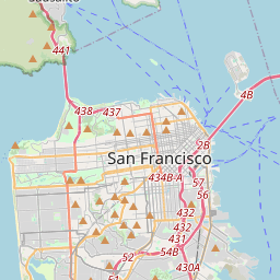
San Francisco kaardil

Andmeallikad ja metoodika

Meie ilmaprognoosid põhinevad professionaalsel ilmaandmete pakkujal, mis koondab andmeid riiklikelt ilmateenistustelt, satelliidivaatlustelt, radarivõrkudelt ja enam kui 80 000 ilmajaamalt üle maailma. Prognoosiandmeid uuendatakse mitu korda päevas. Me teisendame toorandmed selgeteks kokkuvõteteks – tuulekiirus m/s-des, rõhk mmHg-des – et saaksite oma päeva enesekindlalt planeerida.