
5 päeva ilmaprognoos Los Angeles 8. nov 2026
 30°
Ilmaprognoos — Los Angeles, pühapäev, 8. nov 2026: päikesepaisteline, temperatuur 18 °C kuni 30 °C.
Sademete tõenäosus 1%. Tuul kuni 2.89 m/s (iilid 6.81 m/s). Õhuniiskus 9–34%, õhurõhk 761–764 mm Hg, UV-indeks kuni 4.3.
Ilmahoiatused
Red Flag Warning issued November 5 at 1:36PM PST until November 7 at 6:00PM PST by NWS Los Angeles/Oxnard CA
Red Flag Warning
...RISK FOR RAPID FIRE GROWTH AND EXTREME FIRE BEHAVIOR WITH ANY
NEW FIRE STARTS, ESPECIALLY LATE FRIDAY NIGHT THROUGH SATURDAY...
.Weak to moderate Santa Ana winds will be on the increase,
peaking on Saturday. During the peak, gusts of 30 to 45 mph will
be common in the typical wind-prone areas of Los Angeles and
Ventura Counties. Meanwhile, the air will warm and dry, with
minimum humidities in the 8 to 20 percent range common by
Saturday. Fuels remain critically dry despite some minor greenup
from recent rains. There is a high risk for fast-moving fires
where the plants are driest and the winds are strongest, which
this targeted Red Flag Warning addresses.
The National Weather Service in Los Angeles/Oxnard has issued a
Red Flag Warning for wind and low relative humidity, which is in
effect from 2 AM to 6 PM PST Saturday.
* AFFECTED AREA...Santa Clarita Valley, Santa Monica Mountains
Recreational Area, Santa Susana Mountains and Western San
Gabriel Mountains.
* TIMING...From 2 AM to 6 PM PST Saturday.
* WINDS...Periods of northeast 20 to 30 mph with gusts to 45 mph.
Isolated gusts of 45 to 55 mph possible.
* RELATIVE HUMIDITY...Minimums of 8 to 20 percent. Poor overnight
recoveries.
* IMPACTS...If fire ignition occurs, conditions are favorable
for extreme fire behavior which would threaten life and
property.
Beach Hazards Statement issued November 5 at 2:56PM PST until November 10 at 12:00PM PST by NWS Los Angeles/Oxnard CA
Beach Hazards Statement
* WHAT...Dangerous rip currents and breaking waves due to elevated
surf up to 4 to 6 feet expected.
* WHERE...Catalina and Santa Barbara Islands, Santa Barbara County
South Coast, Malibu Coast and Los Angeles County Beaches.
* WHEN...From late tonight through Tuesday morning.
* IMPACTS...There is an increased risk of ocean drowning. Rip
currents can pull swimmers and surfers out to sea. Waves can
wash people off beaches and rocks, and capsize small boats
nearshore. Pooling of sea water is possible around high tide at
beach and harbor areas that is uncommon with normal tidal
ranges. Enhanced beach erosion is also possible.
* ADDITIONAL DETAILS...High tides of 7.2 to 7.6 feet (MLLW) are
expected each morning. Surf and coastal flooding impacts peak on
Monday, when it is possible that a Coastal Flood Advisory is
need.
5 päeva ühe pilguga — puuduta päeva, et see avada
Päikesetõus 06:19
Päikeseloojang 16:54
Päikeseloojang 16:54
Noorkuu0% valgustatud
Kuutõus 05:52 · Kuuloojang 16:20
Kuutõus 05:52 · Kuuloojang 16:20
Graafik
TabelPrognoos 18 °C kuni 30 °C ja sademed
Pilvisus ja sademete tõenäosus
Tuulekiirus ja -suund
Õhuniiskus
Õhurõhk
Ultraviolettkiirguse indeks
Õhukvaliteet ja õietolm
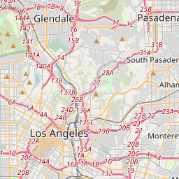
Los Angeles kaardil
Andmeallikad ja metoodika
Meie ilmaprognoosid põhinevad professionaalsel ilmaandmete pakkujal, mis koondab andmeid riiklikelt ilmateenistustelt, satelliidivaatlustelt, radarivõrkudelt ja enam kui 80 000 ilmajaamalt üle maailma. Prognoosiandmeid uuendatakse mitu korda päevas. Me teisendame toorandmed selgeteks kokkuvõteteks – tuulekiirus m/s-des, rõhk mmHg-des – et saaksite oma päeva enesekindlalt planeerida.